
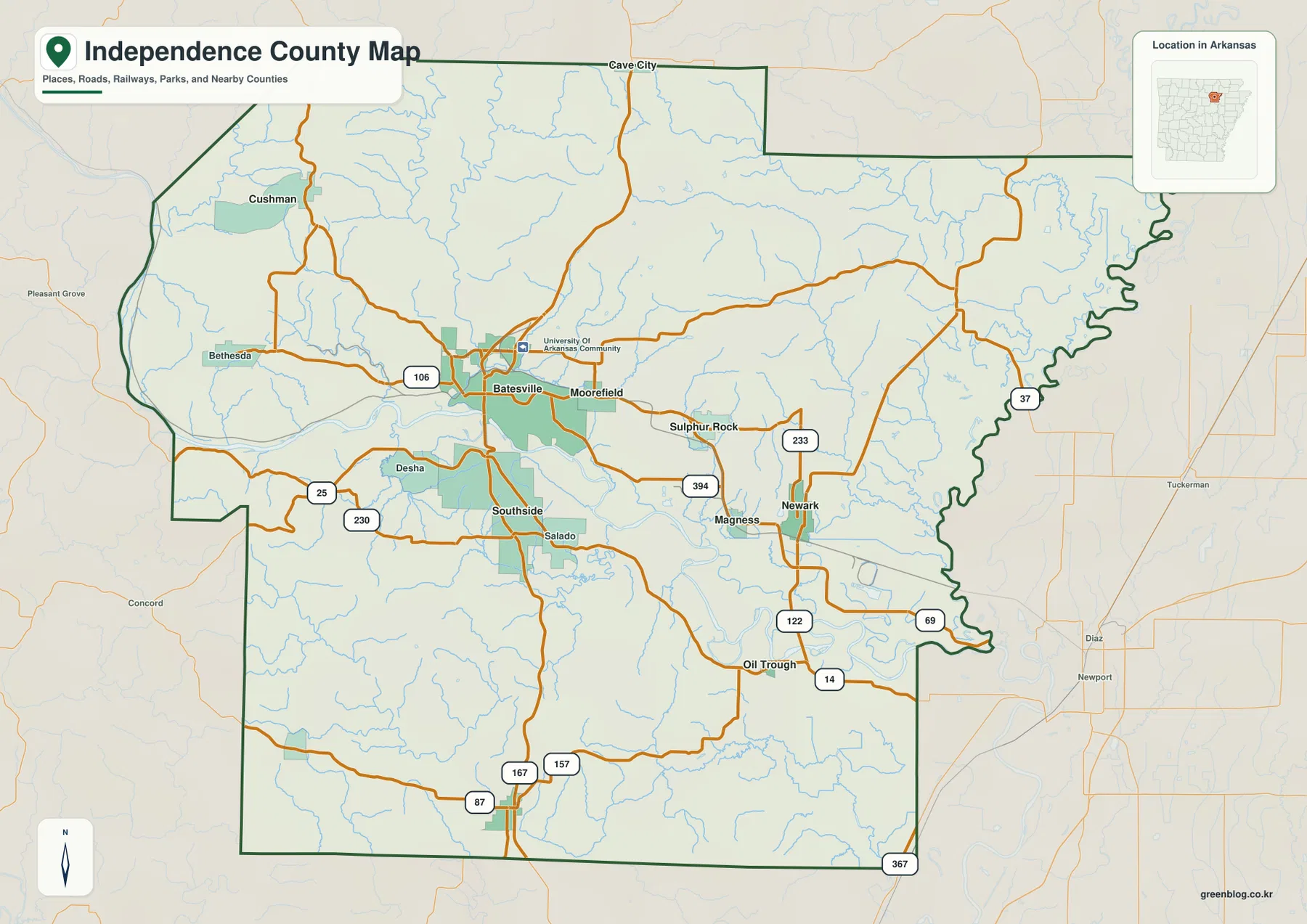
Independence County Map – Batesville, White River Valley, and Rolling Uplands in Arkansas
Independence County in north-central Arkansas is organized around the White River valley, with Batesville forming the strongest road and settlement
Independence County in north-central Arkansas is organized around the White River valley, with Batesville forming the strongest road and settlement
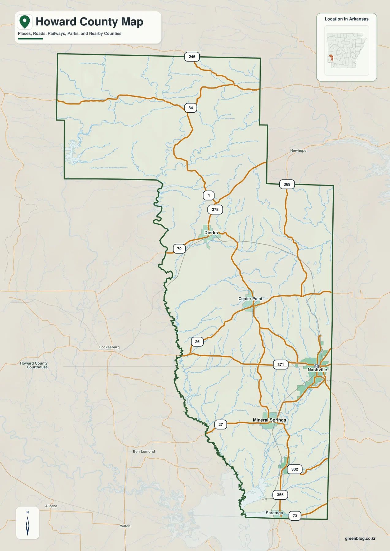
Howard County in southwestern Arkansas has a long north-to-south shape, with Nashville forming the main road hub in the lower
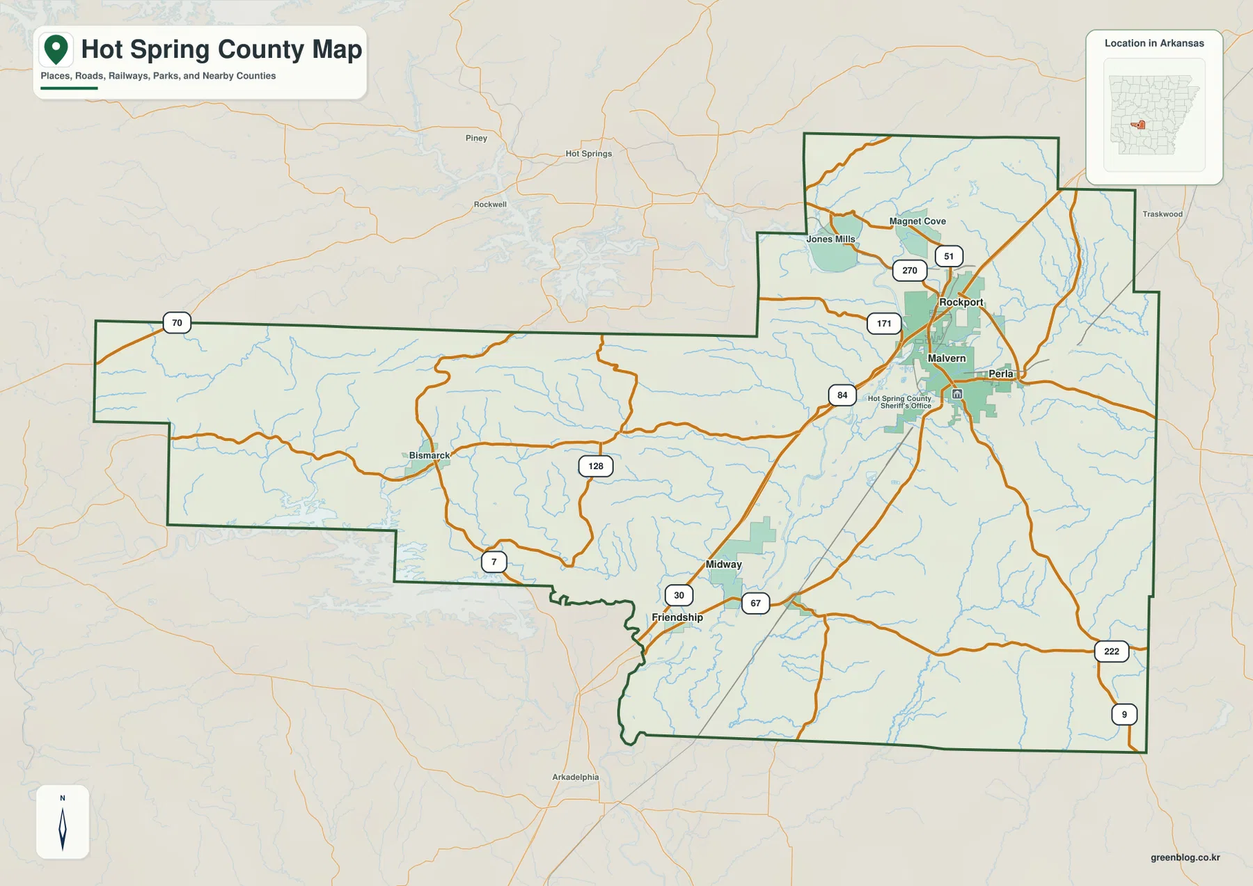
Hot Spring County lies in south-central Arkansas, where Malvern, Rockport, and Perla form a compact cluster in the northeastern part
Hot Spring County Map – Malvern River Corridor and Rugged Western Uplands Read More »
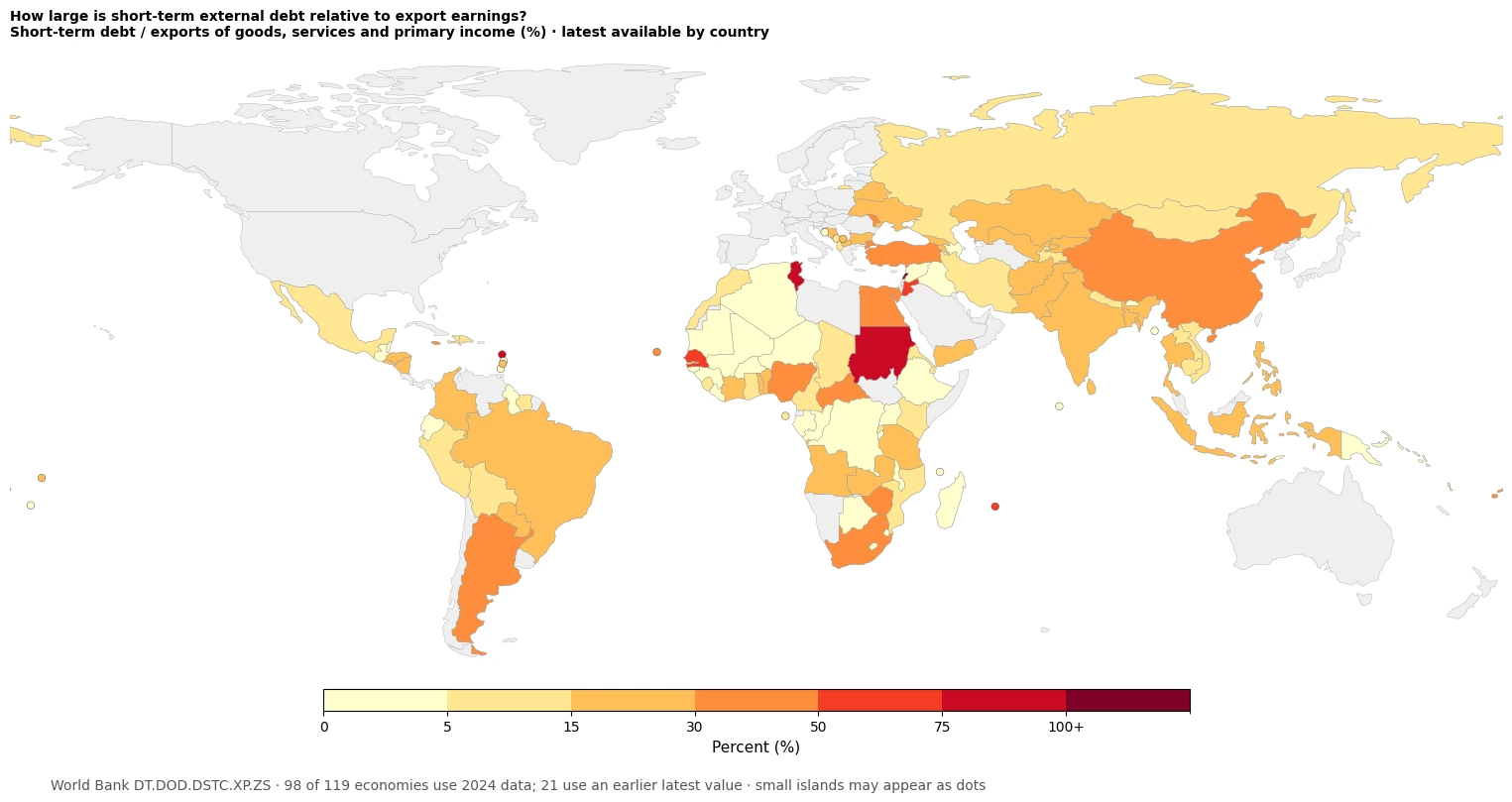
A large amount of external debt does not mean the same thing in every economy. Absolute debt stocks are difficult
Short-Term External Debt vs Exports: Global Country Map Read More »
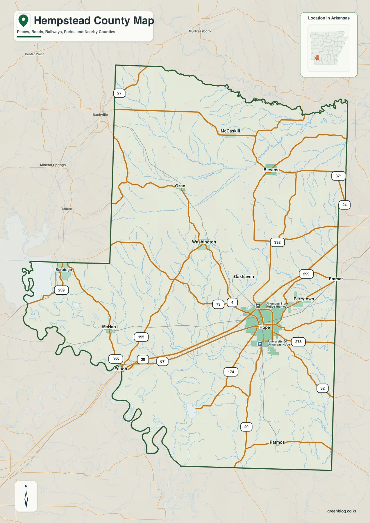
Hempstead County lies in southwestern Arkansas, where Hope forms the strongest road and settlement center on the supplied maps and
Hempstead County Map from Hope to the Little River — Roads, Creeks, and Rolling Uplands Read More »
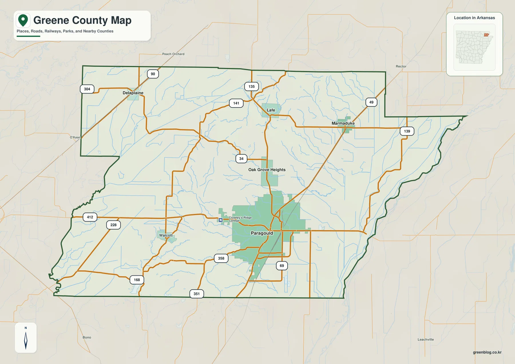
Greene County occupies a distinctive part of northeastern Arkansas where Paragould sits on Crowley’s Ridge between two broad river lowlands.
Greene County Arkansas Map – Paragould on Crowley’s Ridge Between Two River Lowlands Read More »
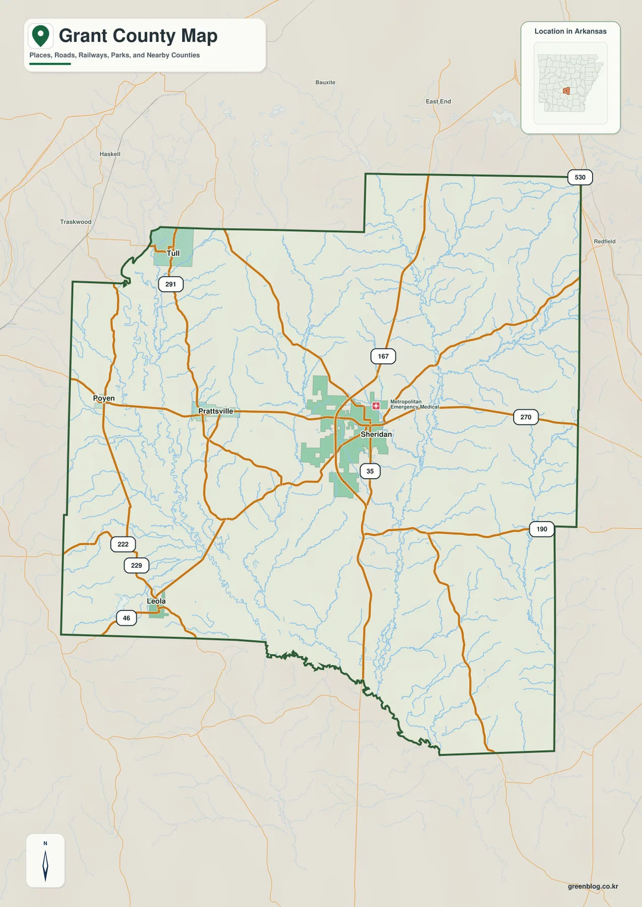
Grant County lies in central Arkansas, where Sheridan anchors the road network while the Saline River winds along the western
Sheridan and the Saline River on the Grant County Arkansas Map Read More »
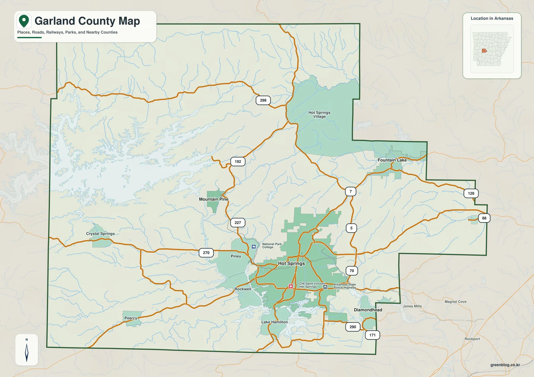
Garland County sits in the Ouachita Mountains of west-central Arkansas, where Hot Springs forms the main urban center among long
Garland County Map of Hot Springs, Lake Ouachita, and the Ouachita Highlands Read More »
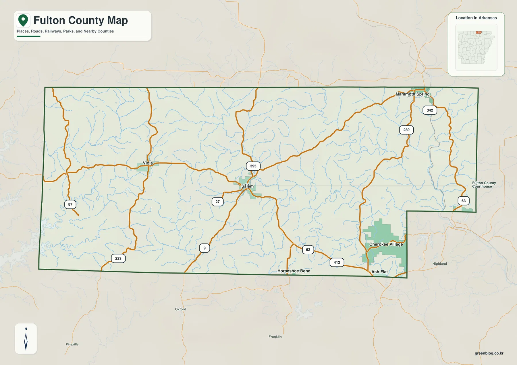
Fulton County occupies the north-central edge of Arkansas, where the Ozark hills reach the Missouri state line and a dense
Fulton County Arkansas Map – Salem Roads, Mammoth Spring, and the Spring River Valley Read More »