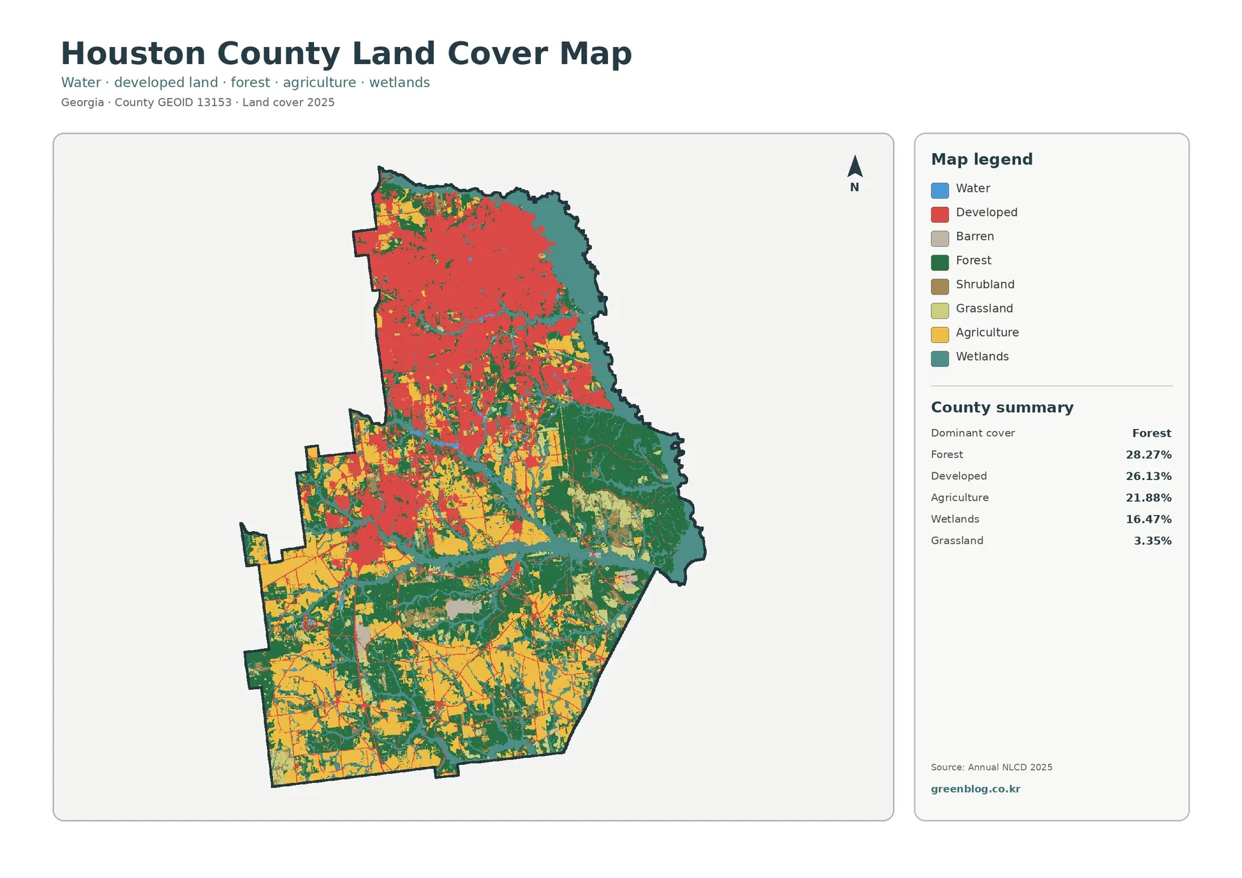
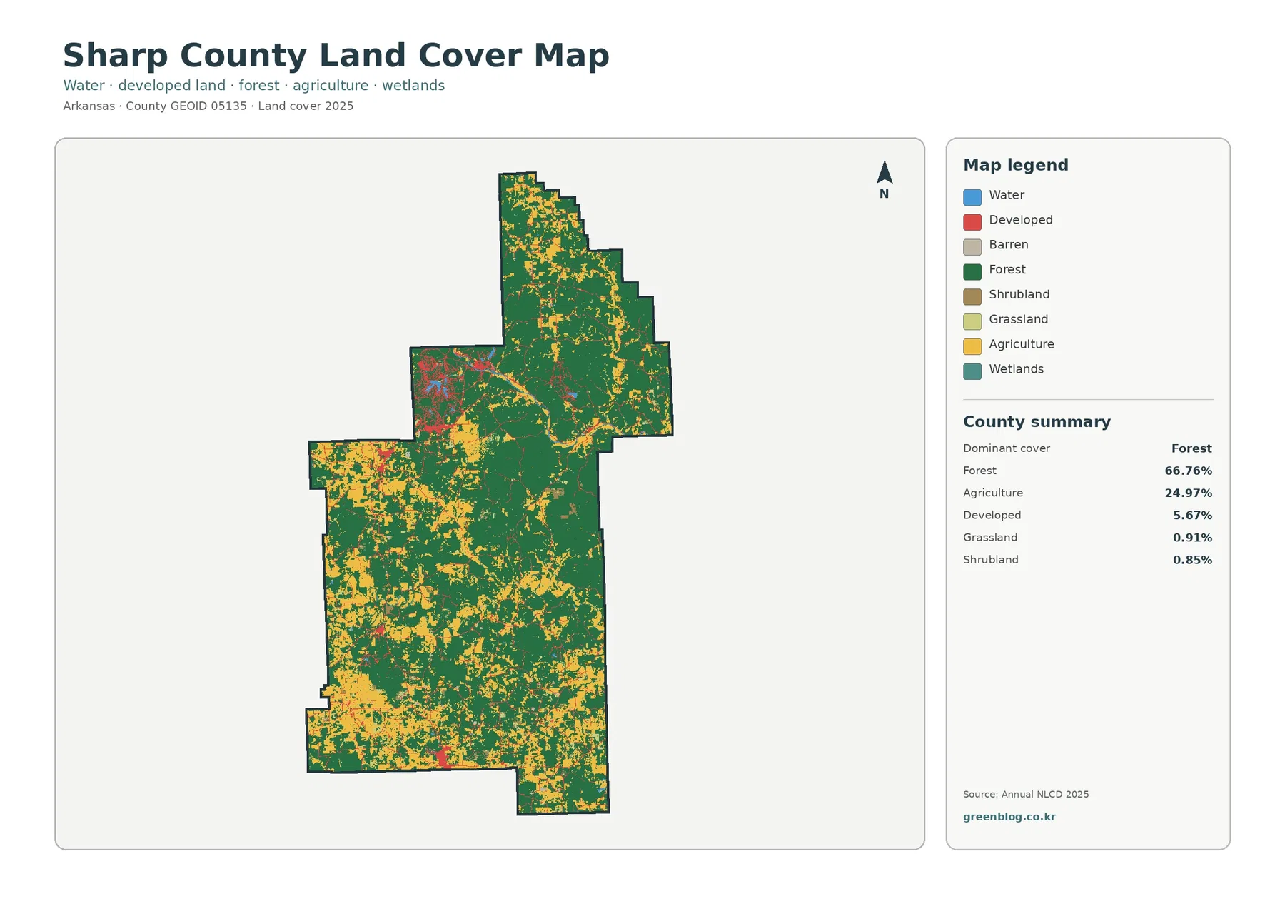
Somerset County occupies the low southern end of Maryland’s Eastern Shore, where the inland Princess Anne corridor contrasts with Crisfield, Deal Island, Smith Island, and the broad waters of Tangier Sound. U.S. 13 runs through the eastern interior, MD 413 reaches Crisfield, and MD 363 heads toward Chance and Deal Island. Much of the western and southern county is shaped by marshes, tidal creeks, sounds, and islands rather than continuous dry land. This page explains the settlements, roads, rivers, coastal waters, and elevation differences visible on the supplied maps, and matching high-resolution JPG files are available together in a downloadable ZIP archive.
The Maryland State Archives identifies Princess Anne as the county seat and lists only two incorporated municipalities in Somerset County: Crisfield and Princess Anne. It also describes the county as bounded by Wicomico County to the north, Worcester County to the east, Chesapeake Bay to the south, and Tangier Sound to the west. Those boundaries fit the map closely and explain why the western half is so deeply indented by water and marsh.
Table of Contents
Princess Anne and U.S. 13 anchor the inland side of the county
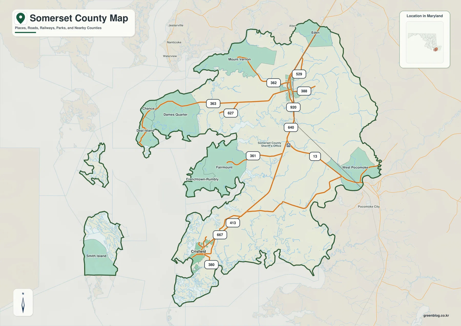
Princess Anne provides the clearest inland reference in the north-central to northeastern part of Somerset County. U.S. 13 runs north-south through this side, connecting the Eden direction in the north with West Pocomoke and the Worcester County side farther south. MD 362, MD 388, MD 529, MD 640, and MD 920 add local connections around the Princess Anne area.
Mount Vernon lies northwest of Princess Anne, while Chance and Deal Island occupy the much wetter western side. MD 363 crosses toward that coast with Dames Quarter along the way. Compared with the U.S. 13 corridor, the west contains fewer major roads and many more small creeks, marshes, and irregular shorelines.
West Pocomoke appears near the eastern boundary, with Pocomoke City labeled just outside the county as a regional reference. The eastern landmass is more continuous than the shoreline to the west, although small tributaries still divide the flat terrain. This east-west contrast is one of the easiest ways to understand Somerset County’s shape.
The map is intended for geographic orientation, not live navigation. Construction, closures, flooding, and weather-related road conditions are not shown. Current Maryland transportation information and a navigation service should be used for actual travel, especially in low coastal areas where water can affect local access.
Crisfield and MD 413 lead into the county’s marshy southwestern coast
Crisfield is the strongest city label in the southwest. MD 413 connects it with the inland road network, while MD 667 and MD 380 provide local references nearby. Fairmount and Frenchtown-Rumbly lie to the north, across a broad lowland crossed by many small waterways.
Janes Island State Park sits just outside Crisfield. Maryland DNR describes a mainland park area and an island section containing more than 2,900 acres of saltmarsh, over 30 miles of water trails, and isolated beaches on the Tangier Sound side. That official park setting gives useful real-world context to the highly dissected marsh and water landscape around Crisfield.
Little Annemessex River, Tangier Sound, and Pocomoke Sound surround much of the Crisfield side. Roads therefore follow narrow strips of higher land and cannot simply cross the wetland in a straight line. Places that appear close on a countywide map may require a longer route around creeks and marshes.
Deal Island, Chance, and Dames Quarter provide additional western references, while Smith Island appears as a separate island farther out in the Chesapeake-Tangier Sound landscape. These place names are important geographically, but they do not all represent the same type of administrative unit, so the road map and municipal list should not be treated as identical.
The City Index reduces the county to its two incorporated municipalities
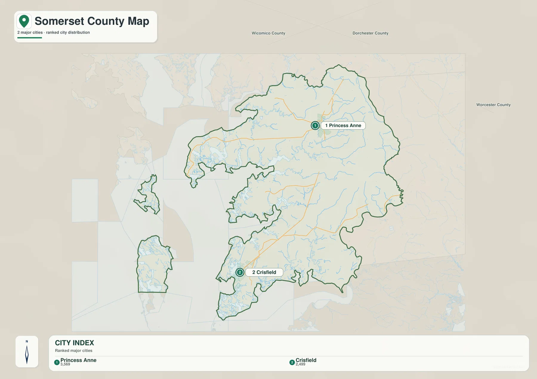
The City Index ranks Princess Anne and Crisfield. It prints the values 3,569 for Princess Anne and 2,499 for Crisfield. Because the graphic does not state a reference year or statistical definition, these figures should not be presented as current population counts. Current values should come from the latest U.S. Census Bureau or municipal data.
The location contrast is more useful than the ranking itself. Princess Anne sits in the northeastern interior, while Crisfield lies on the southwestern coast. Large lowlands and creek systems separate the two, so they function as distinct geographic anchors rather than one continuous urban corridor.
In this county, the two-place City Index aligns directly with the official municipal system. Maryland State Archives lists Crisfield and Princess Anne as Somerset County’s two municipalities. Important communities and islands such as Deal Island, Smith Island, Mount Vernon, and Fairmount remain important map references even though they are outside that two-municipality list.
No connector line or mileage value is printed between the two markers. The City Index should not be used to calculate driving distance from Princess Anne to Crisfield. Use it for relative position, then rely on the general road map and current routing information for actual travel.
Manokin and Annemessex rivers divide the lowland before opening into Tangier Sound
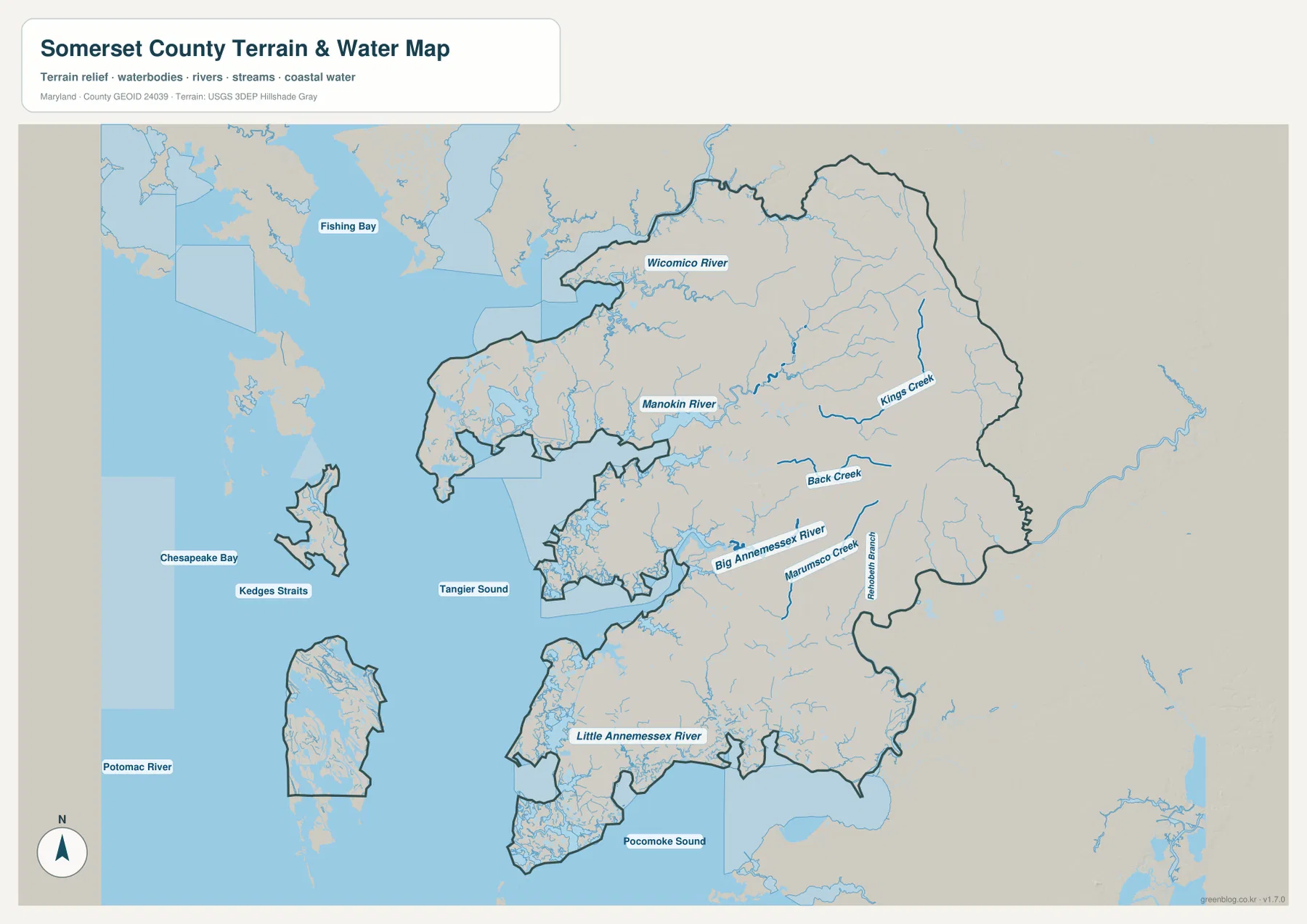
Chesapeake Bay and Tangier Sound dominate the western water landscape. Fishing Bay appears farther northwest, and Kedges Straits separates island and coastal features west of the mainland. The shoreline is deeply indented, with numerous coves, tidal creeks, and marsh channels breaking up what would otherwise look like a simple western boundary.
Wicomico River appears near the northern county boundary, while Manokin River runs west of the Princess Anne side. Kings Creek and Back Creek are strong inland labels farther east. These streams divide the flat agricultural interior into many smaller drainage areas and create lower corridors that are also visible on the elevation map.
Big Annemessex River is prominent in the central-southern county, with Marumsco Creek and Pocomoke Branch nearby. Little Annemessex River lies around the Crisfield side, and Pocomoke Sound opens to the south. Comparing the water and road views makes it clear why routes around Crisfield and Fairmount respond so strongly to creek and marsh geometry.
The terrain-water graphic is a geographic reference, not a flood map, depth chart, tidal forecast, navigation chart, or legal water-boundary product. Somerset County’s islands and marshes are especially sensitive to changing water conditions, so boating, flood, and safety decisions require current NOAA, FEMA, USGS, Maryland, and local information.
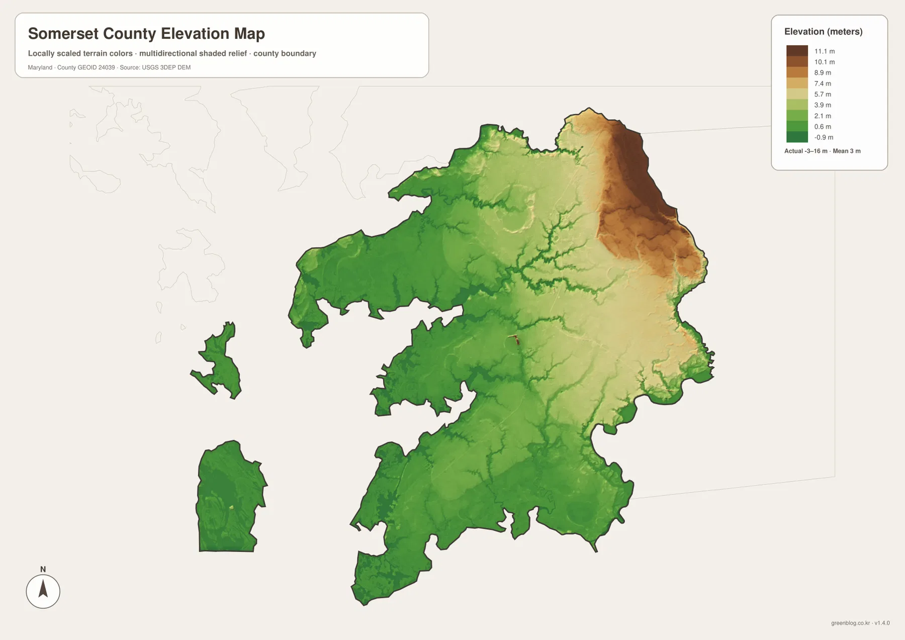
A mean elevation of only 3 meters emphasizes the extremely low coastal setting
The elevation graphic reports an actual data range from -3 to 16 meters and a mean elevation of 3 meters. Somerset County is therefore extremely low by Maryland standards. Most of the map remains green, while the relatively higher tan and brown terrain is concentrated in the northeastern interior.
The Princess Anne-Eden side contains the clearest higher ground within the county. Small creek valleys cut through it as lower green channels, and elevation gradually drops westward and southward. Even the county’s highest map colors represent gentle coastal-plain relief rather than hills or mountains.
Deal Island, Crisfield, Smith Island, and the Tangier Sound side are overwhelmingly low. Manokin and Annemessex drainage corridors also appear as low strips across the mainland. The close match between the water and elevation maps reflects how small height differences can have a large influence on marsh, drainage, and shoreline patterns in such a flat landscape.
The -3 to 16 meter range is the overall data range printed on the supplied elevation map, not an exact property or road elevation. Flood exposure depends on tides, storms, rainfall, drainage, local topography, and protection measures as well as height. Surveying and engineering require authoritative USGS or professional elevation data, while flood decisions should use current FEMA and local information.
Use the inland road corridor for Princess Anne and the coastal maps for Crisfield and the islands
The general county map is the best starting point for Princess Anne, Mount Vernon, West Pocomoke, U.S. 13, and MD 362. Crisfield, Deal Island, Chance, MD 413, and MD 363 are easier to understand as part of the western coastal network. The two-place City Index is useful for the incorporated municipalities, while the water map provides the detail needed to distinguish Manokin River, the Annemessex rivers, Tangier Sound, and Pocomoke Sound.
Janes Island State Park is a particularly useful local example of Somerset County’s coastal environment. Maryland DNR describes more than 2,900 acres of saltmarsh and over 30 miles of water trails on the island portion near Crisfield. That landscape closely matches the very low elevation, dense tidal channels, and irregular shoreline visible on the supplied maps.
The downloadable originals are JPG files measuring 3638 × 2572 pixels each. They work well in landscape documents and can be enlarged around Princess Anne, Crisfield, Deal Island, Manokin River, or other areas for classroom material, presentations, and personal reference. Enlargement does not add live traffic, parcel boundaries, flood zones, water depth, tidal conditions, or survey-grade elevation, so specialized decisions should always use current official data.
Frequently Asked Questions
What is the county seat of Somerset County, Maryland?
Princess Anne is the county seat. The Maryland State Archives identifies Princess Anne as the county seat, and the general map places it along the inland U.S. 13 corridor with several state roads nearby.
Are Princess Anne and Crisfield the only incorporated municipalities in Somerset County?
Yes. The current Maryland State Archives municipal list identifies Crisfield and Princess Anne as Somerset County’s two municipalities. Other important places such as Deal Island, Smith Island, Mount Vernon, and Fairmount are separate geographic communities or island names rather than additional incorporated municipalities.
Can the 3-meter mean elevation be used to judge flood risk?
No. The mean and the -3 to 16 meter range describe the supplied elevation dataset, not flood probability at a specific site. Tides, storms, rainfall, drainage, and detailed topography all matter, so current FEMA and local flood information should be used for decisions.
Map File Information
The ZIP archive contains high-resolution JPG maps of Somerset County matching the map themes described on this page.
- Included Files: county and major roads map, City Index map, terrain and water map, elevation map
- Printable Size: 3638 × 2572 pixels each
- File Type: JPG
Related Maps
Sources and References
- Maryland State Archives – Somerset County
- Maryland State Archives – Somerset County Municipalities
- Maryland DNR – Janes Island State Park
- U.S. Census Bureau – TIGER/Line Shapefiles
- USGS – National Hydrography
- USGS – 3D Elevation Program
Green Map creates custom-edited map images using open geographic data sources such as geoBoundaries, Natural Earth, OpenStreetMap, and government open data. These maps are edited visual materials, not raw data files, and are provided for education, documents, presentations, and graphic reference.