A Printable Taoyuan City Map is useful when you need more than a simple location reference on a Taiwan map. Taoyuan City sits in northwestern Taiwan, close to New Taipei City and connected to the Taiwan Strait on the west. It also borders Hsinchu County to the south and includes a mix of urban districts, coastal areas, airport-related zones, industrial areas, and mountain communities. Because of this varied layout, a district boundary map is often much easier to use than a general city location image.
This printable map collection includes three versions: a color district map, a black and white labeled map, and a blank outline map. The files are prepared in JPG format and designed for A3-size printing, making them useful for classroom handouts, travel planning materials, presentation slides, blog graphics, regional comparison projects, and editable infographic work.
Taoyuan is also one of Taiwan’s most important gateway cities because Taiwan Taoyuan International Airport is located within the city. For travel content, logistics references, regional explanation pages, or Taiwan city comparison materials, the district layout matters. Districts such as Taoyuan, Zhongli, Pingzhen, Bade, Luzhu, Guishan, Dayuan, Yangmei, Longtan, Guanyin, Xinwu, Daxi, and Fuxing each have different spatial roles across the city. A clear map helps readers understand how the compact urban districts, coastal districts, airport area, and mountain-side district relate to one another.
During the map preparation process, extra attention was given to label spacing around the denser urban districts. Areas such as Taoyuan, Zhongli, Pingzhen, and Bade sit close together, so labels and boundary lines need to remain readable when printed or inserted into a document. Fuxing District, by contrast, covers a much wider mountain area, so the overall layout was balanced to keep both compact and larger districts visually clear.
Table of Contents
Printable Taoyuan City Map Overview
This map set is designed for users who need a clean administrative reference rather than a road map. It focuses on district boundaries and district names, which makes it suitable for educational, editorial, and visual design purposes.
The collection includes:
- Color map for quick district comparison
- Black and white map for printing and documents
- Outline map for editing, coloring, and custom annotations
- JPG image format
- A3-size printable layout
Because Taoyuan City includes dense city districts, coastal districts, and a large mountain district, the three map versions serve different purposes. The color version helps readers separate districts quickly, the black and white version works well in printed materials, and the outline version gives designers or teachers a clean base for custom map work.
Color Taoyuan City Map for Visual Comparison
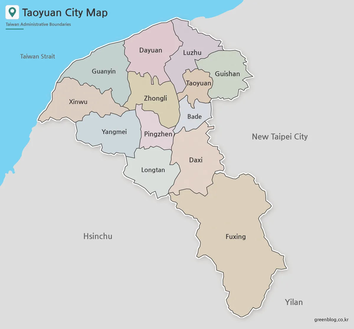
The color version is designed to make Taoyuan City’s 13 districts easier to compare at a glance. This is especially helpful in the central and northern parts of the city, where several urban districts sit close together. Without color separation, areas such as Taoyuan, Zhongli, Pingzhen, and Bade can feel visually crowded in a small layout.
The western side of the city also becomes easier to read in color because Dayuan, Guanyin, and Xinwu connect to coastal and industrial areas. Fuxing District, located toward the mountain side, appears much larger than many of the urban districts, so the color layout helps show the contrast between compact city areas and broader outer districts.
This version works well for presentation slides, blog posts, classroom reference pages, and regional comparison graphics where viewers need to understand the city structure quickly.
Black and White Taoyuan City Map for Printing
The black and white map reduces visual weight and keeps the focus on labels and boundary lines. For printed reports, worksheets, school assignments, and document inserts, a simpler map often reads better than a fully colored design.
Taoyuan City’s district layout includes both small urban districts and wider outer districts, so line thickness and label placement were adjusted to avoid a crowded look. The goal was to keep district names readable while still making the boundary lines clear enough for A3-size printing.
This version is a good choice when the map needs to sit beside text, tables, or explanations. It also works well for handouts where users may want to mark specific districts by hand.
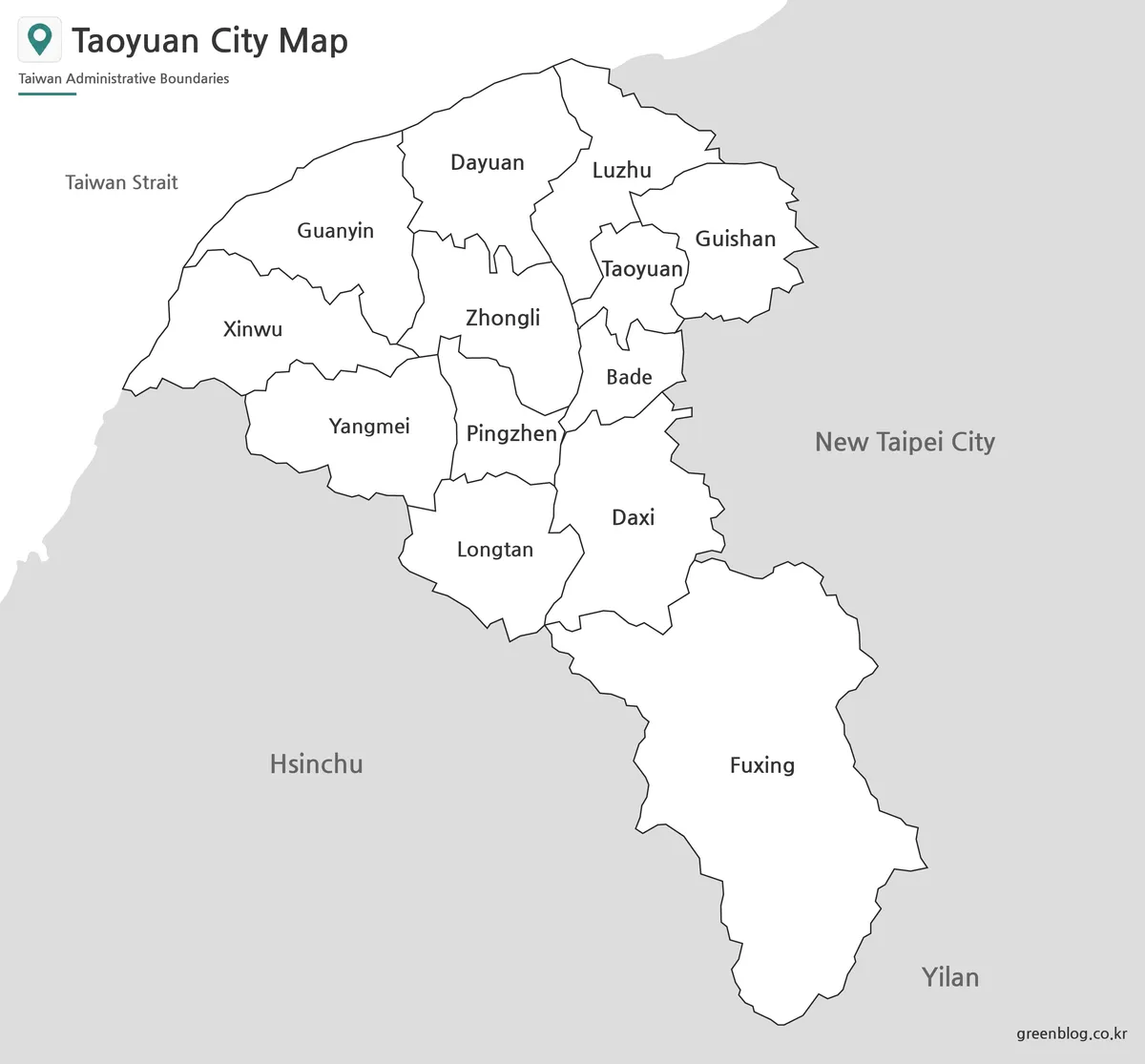
Blank Outline Map for Editing
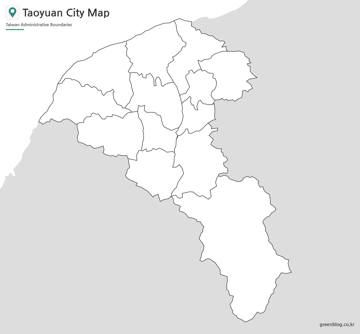
The outline map leaves only the district boundary lines, making it useful as a working base map. Teachers can use it for coloring activities, while designers can add custom labels, icons, data points, or travel routes.
For Taoyuan City, the outline version is especially useful when marking airport-related areas, comparing northern urban districts, or highlighting the mountain-side Fuxing District. It can also be used for infographic projects showing population distribution, transportation context, tourism points, or administrative grouping.
Because the background is kept simple, this version gives more freedom for editing. Users can add colors, arrows, notes, district highlights, or presentation labels without fighting against existing visual elements.
Built for Classroom, Blog, and Presentation Use
This Taoyuan City map collection was prepared for practical visual work. Teachers may use it for Taiwan geography lessons, students may include it in reports, and bloggers may use it when writing about Taiwan travel, airport access, or city comparisons.
Presentation creators can use the color map for quick visual explanation, while the black and white version is better for formal documents. The outline map is the most flexible option when custom information needs to be added.
The layout was checked with larger print use in mind, especially around the district labels. Since several districts are located close together, the map needed to remain readable without making the design feel too heavy.
Frequently Asked Questions
What is included in this Printable Taoyuan City Map collection?
The collection includes a color district map, a black and white map, and a blank outline map of Taoyuan City.
Is this map suitable for A3 printing?
Yes. The map was prepared with A3-size printing in mind, so it works well for larger handouts, classroom materials, and presentation boards.
What file format is included?
The map files are provided in JPG format.
Is the outline version editable?
Yes. The outline version is useful for adding colors, labels, markers, routes, data points, or custom annotations in graphic editing projects.
What can the Taoyuan City map be used for?
It can be used for classroom handouts, Taiwan travel materials, blog graphics, presentation slides, regional comparison projects, and infographic design.
Printable Taoyuan City Map Download
Download the Taoyuan City map collection with color, black and white, and outline versions. The files are designed for printing, classroom reference, presentation slides, blog graphics, and editable map projects.
- File Format: JPG
- Included Versions: Color Map / Black and White Map / Outline Map
- Printable Size: A3
- Intended Use: Classroom materials, presentations, blog images, infographic editing
Additional Resources
- National Land Surveying and Mapping Center : A useful official map-related resource for checking Taiwan administrative boundary and mapping information.
Related Maps
- Malaysia Map Resource with Color, Basic, Outline, and Flag Images
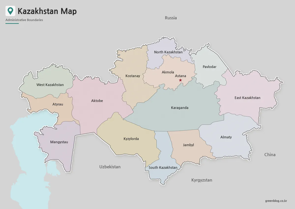
- Kazakhstan Map Download | Printable Color, Black and White & Outline Maps
- New Taipei City Map Download with District Boundarie
- Mactan Island Map Download – Printable Travel Map for Cebu Trips