
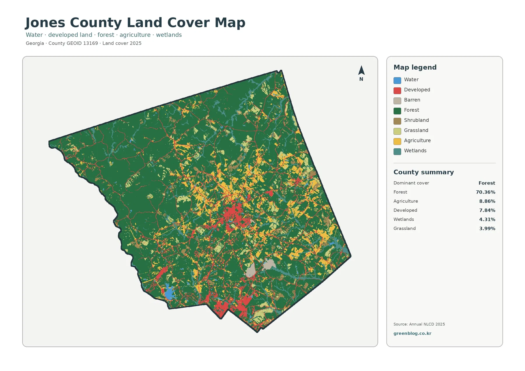
Jones County Georgia Land Cover Map | A 70% Forest County with Gray and Southern Built Pockets
Forest is the defining surface in the supplied 2025 Jones County data. It covers 70.36% of the county, while agriculture […]
Forest is the defining surface in the supplied 2025 Jones County data. It covers 70.36% of the county, while agriculture […]
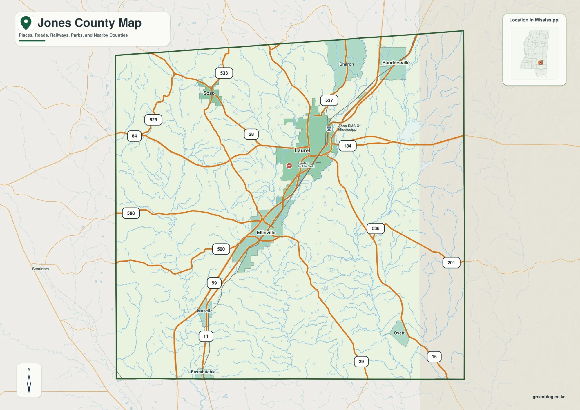
Jones County is easiest to understand by starting with the north-south relationship between Laurel and Ellisville. Laurel sits farther north
Jones County Mississippi Map – Laurel Roads, Leaf River, and Creek Valleys Read More »
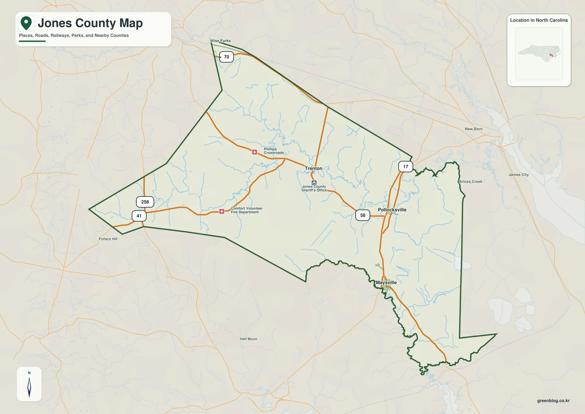
Jones County is easier to understand as a spread-out county of small communities, roads, and water than as a place
Maysville, Trenton and the Trent River — Jones County North Carolina Map Read More »
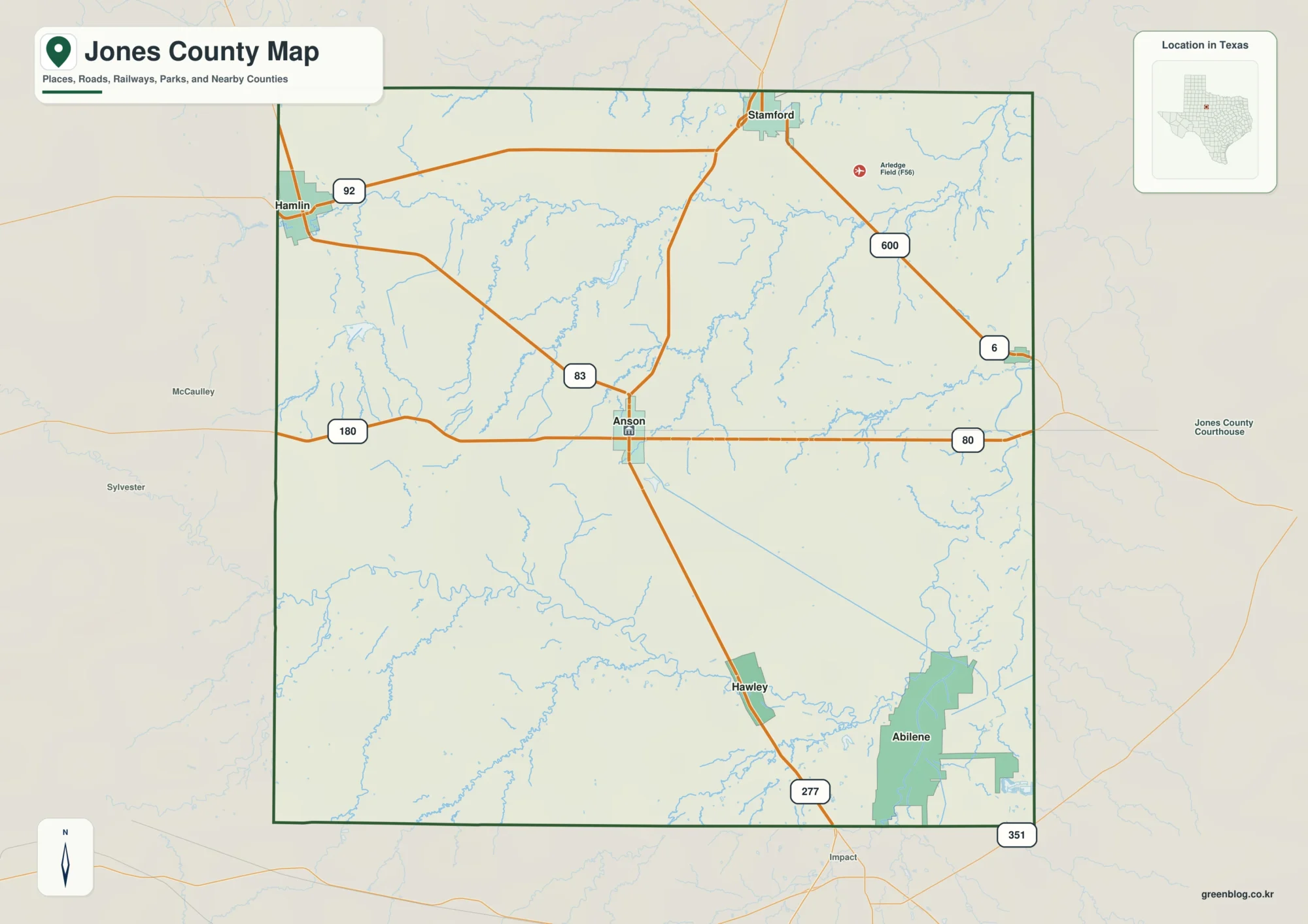
Jones County, Texas is centered on Anson, with Hamlin near the northwest edge, Hawley to the south, and Lueders near
Anson and Clear Fork Brazos on a Jones County Texas Map Read More »
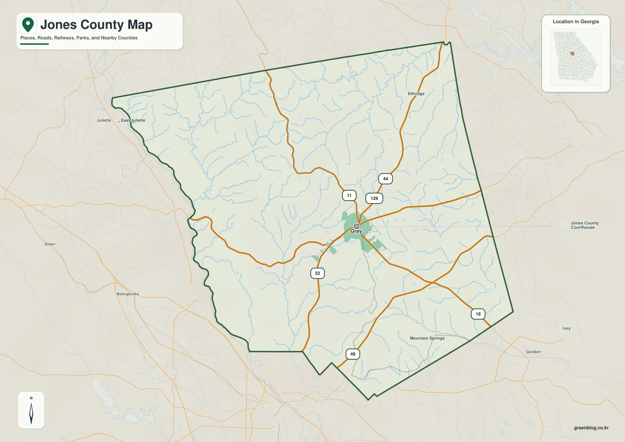
Jones County sits close to the geographic center of Georgia, northeast of Macon and west of Milledgeville. You can download
Gray, Creeks, and Elevation on a Jones County Georgia Map Read More »