
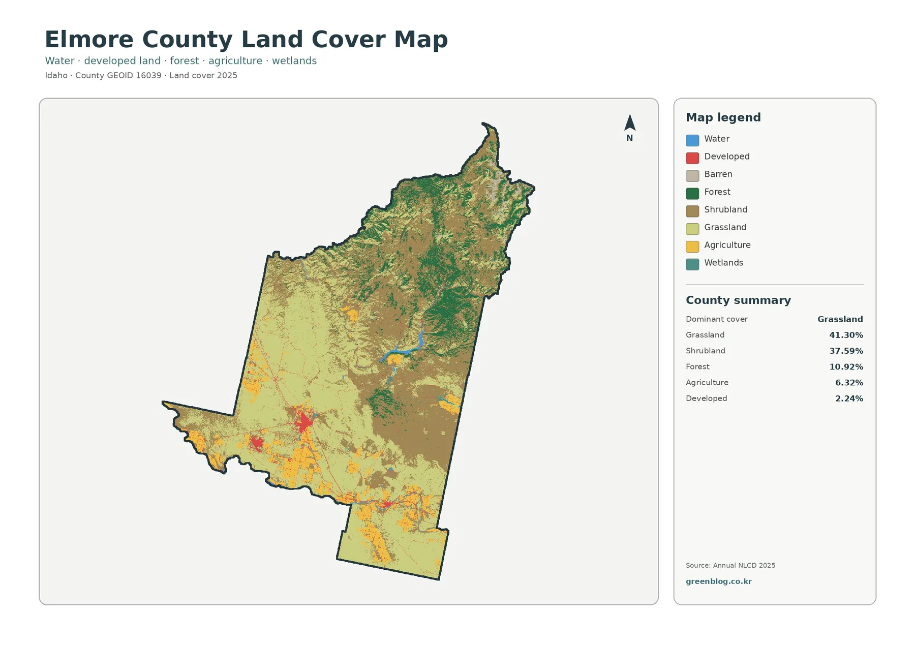
Elmore County Idaho Land Cover Map: Grassland, Shrubland, and a Concentrated Southern Farm Belt
Elmore County’s 2025 land cover is defined by broad grassland and shrubland, with forest concentrated toward the north and east […]
Elmore County’s 2025 land cover is defined by broad grassland and shrubland, with forest concentrated toward the north and east […]
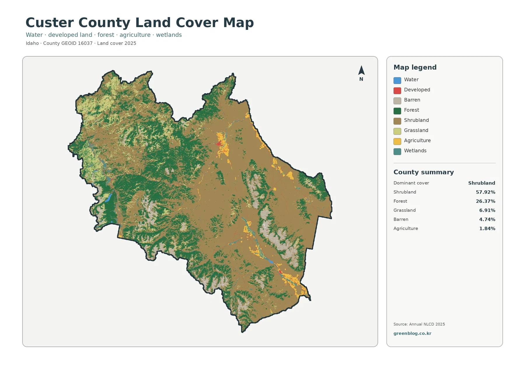
Custer County is dominated by open shrubland but broken by large mountain forests, grassland, exposed high-country ground, and narrow agricultural
Custer County Idaho Land Cover Map — 57.92% Shrubland, Mountain Forest, and Valley Farms Read More »
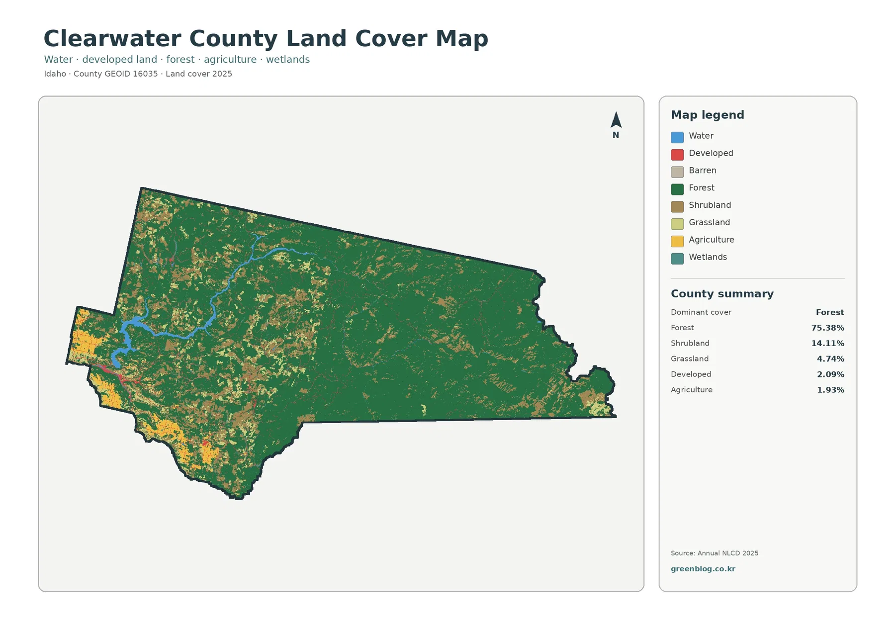
Forest is the defining cover in Clearwater County, Idaho. The 2025 summary places forest at 75.38% of the county, while
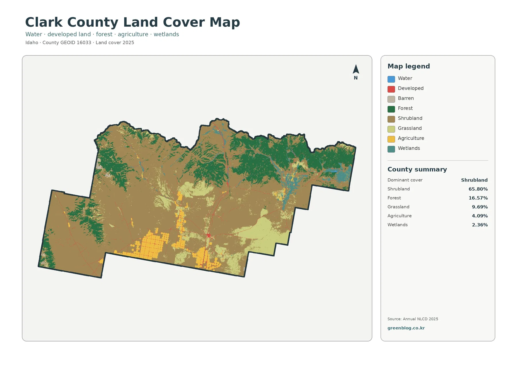
Clark County in eastern Idaho is dominated by open shrubland, while forest becomes much more visible along the mountainous northern
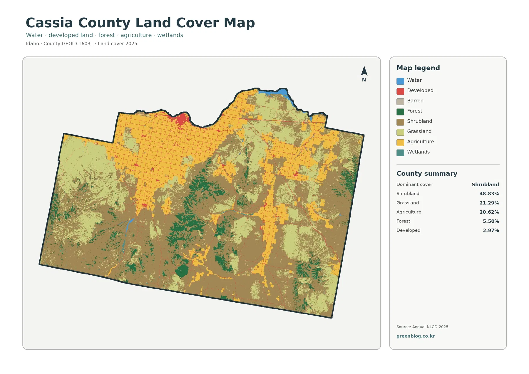
Cassia County in south-central Idaho has a land-cover pattern that changes sharply from broad farm blocks in the north to
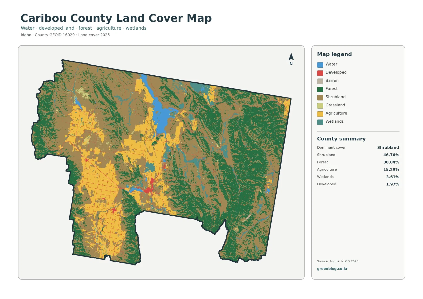
Caribou County in southeastern Idaho is dominated by open shrubland and forest, while broad farm blocks stand out in the
Caribou County Idaho Land Cover Map | Shrubland, Eastern Forest, and Western Farm Blocks Read More »