
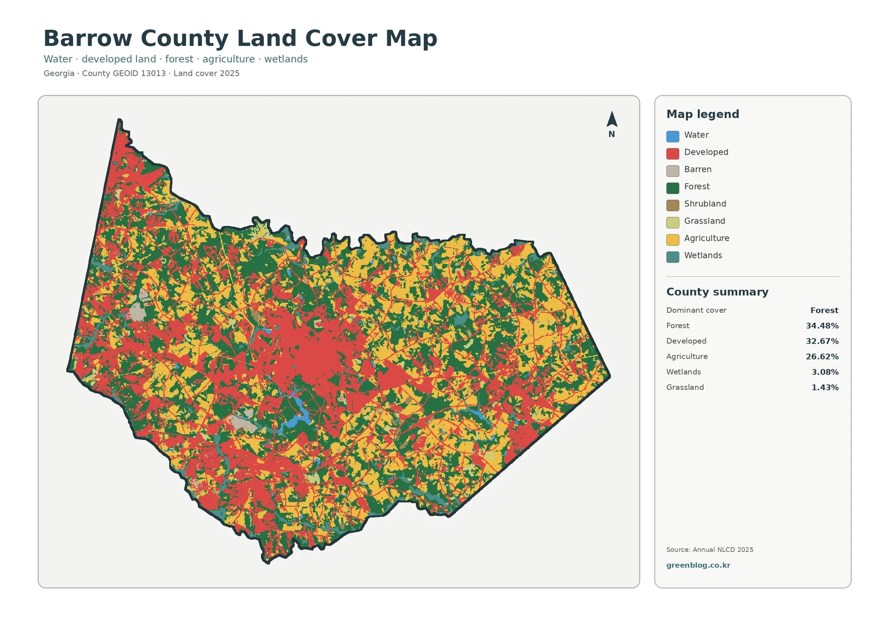
Barrow County Georgia Land Cover Map: Winder-Area Development Between Forest and Farmland
The Barrow County Georgia Land Cover Map depicts a county where forest, developed land, and agriculture all occupy major shares. […]
The Barrow County Georgia Land Cover Map depicts a county where forest, developed land, and agriculture all occupy major shares. […]
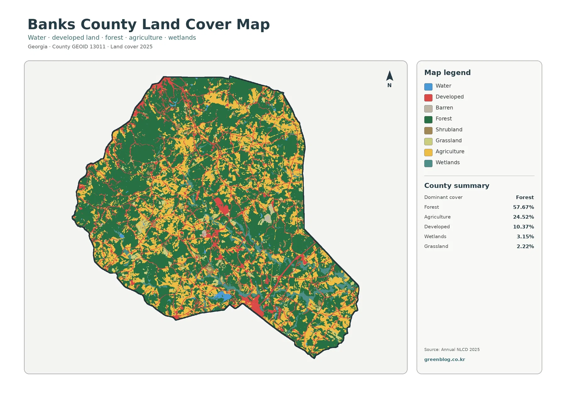
The Banks County Georgia Land Cover Map is overwhelmingly wooded, but it also contains a clear contrast between rural interior
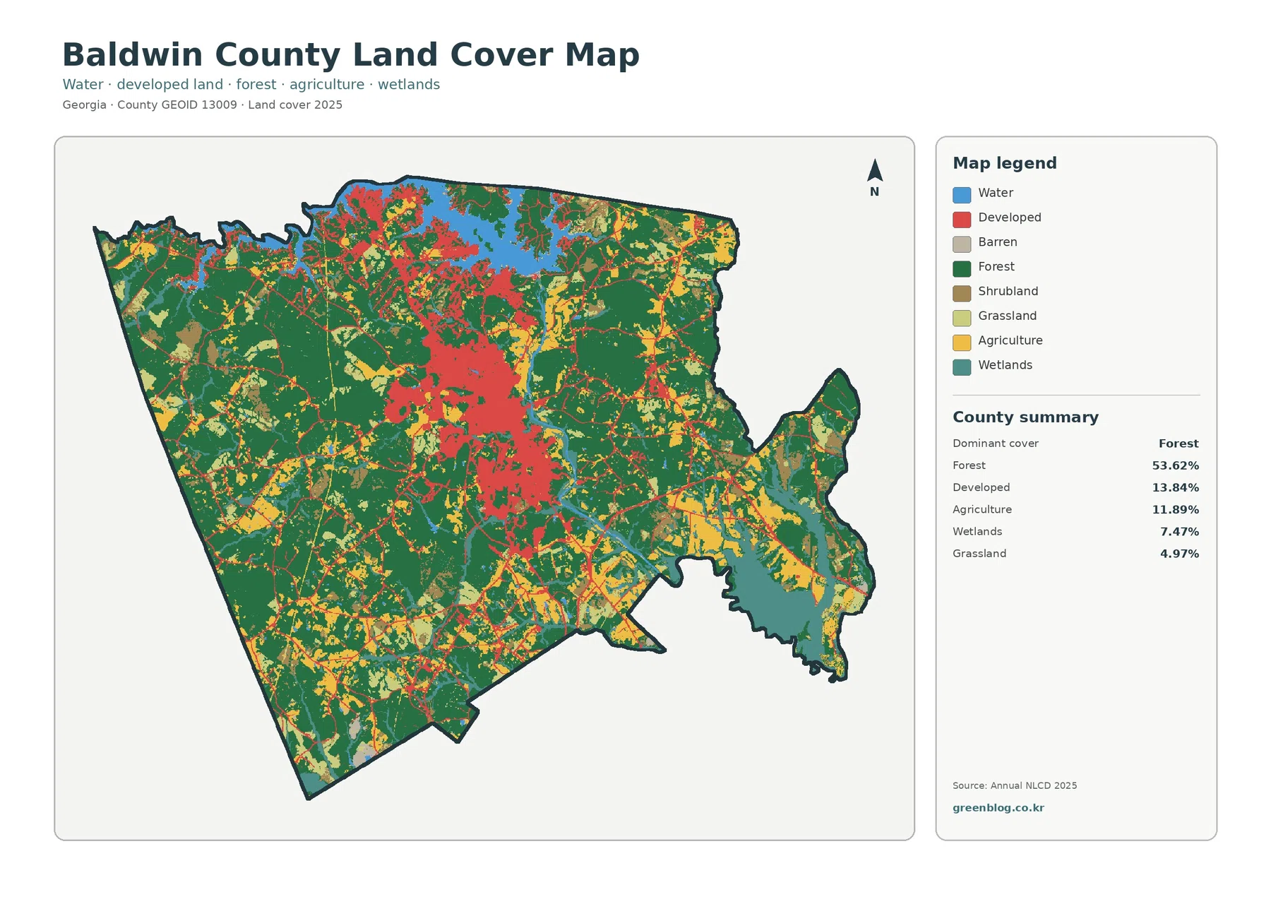
The Baldwin County Georgia Land Cover Map is primarily a forest map with a sizable urban center embedded inside it.
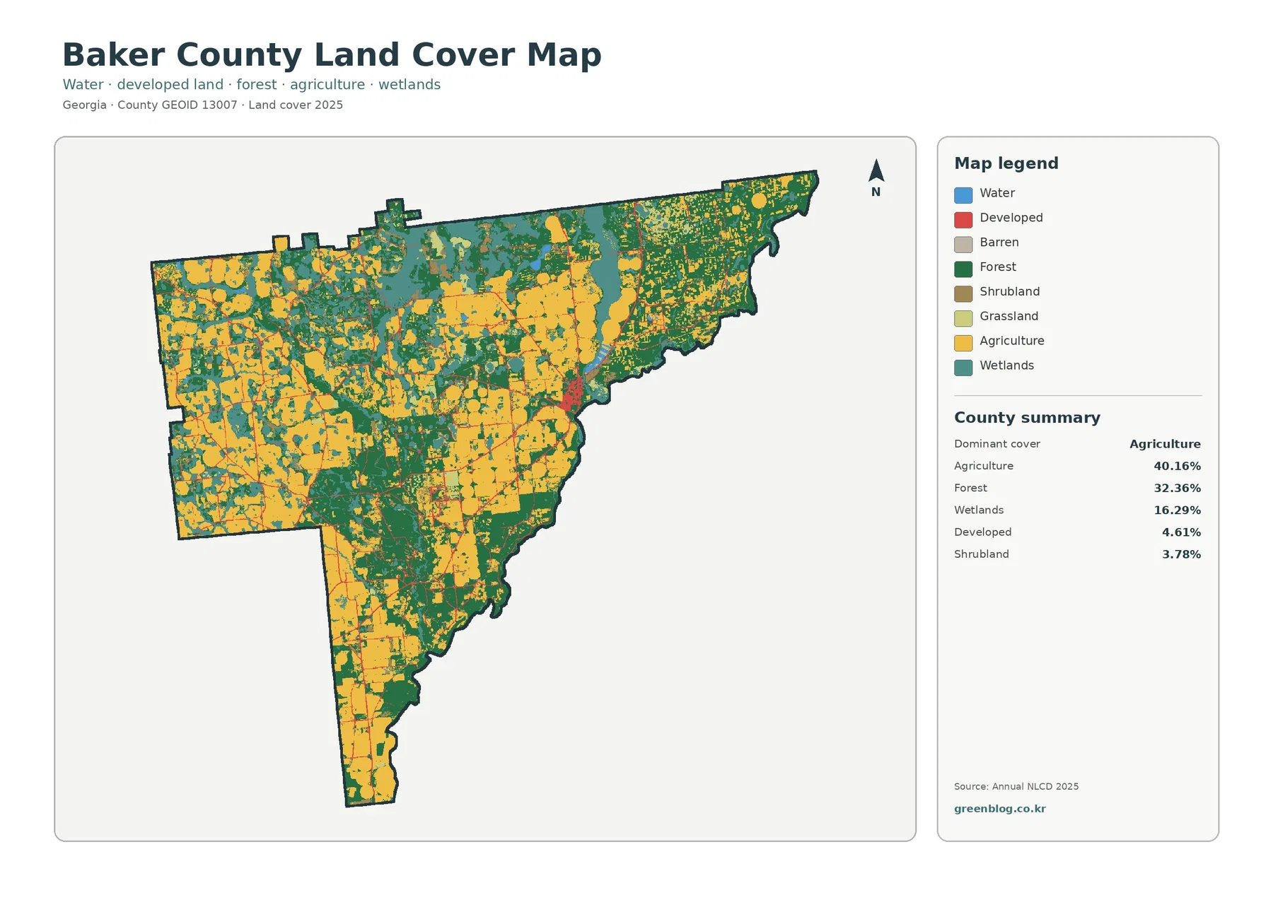
The Baker County Georgia Land Cover Map is dominated by working land and forest rather than developed cover. Agriculture accounts
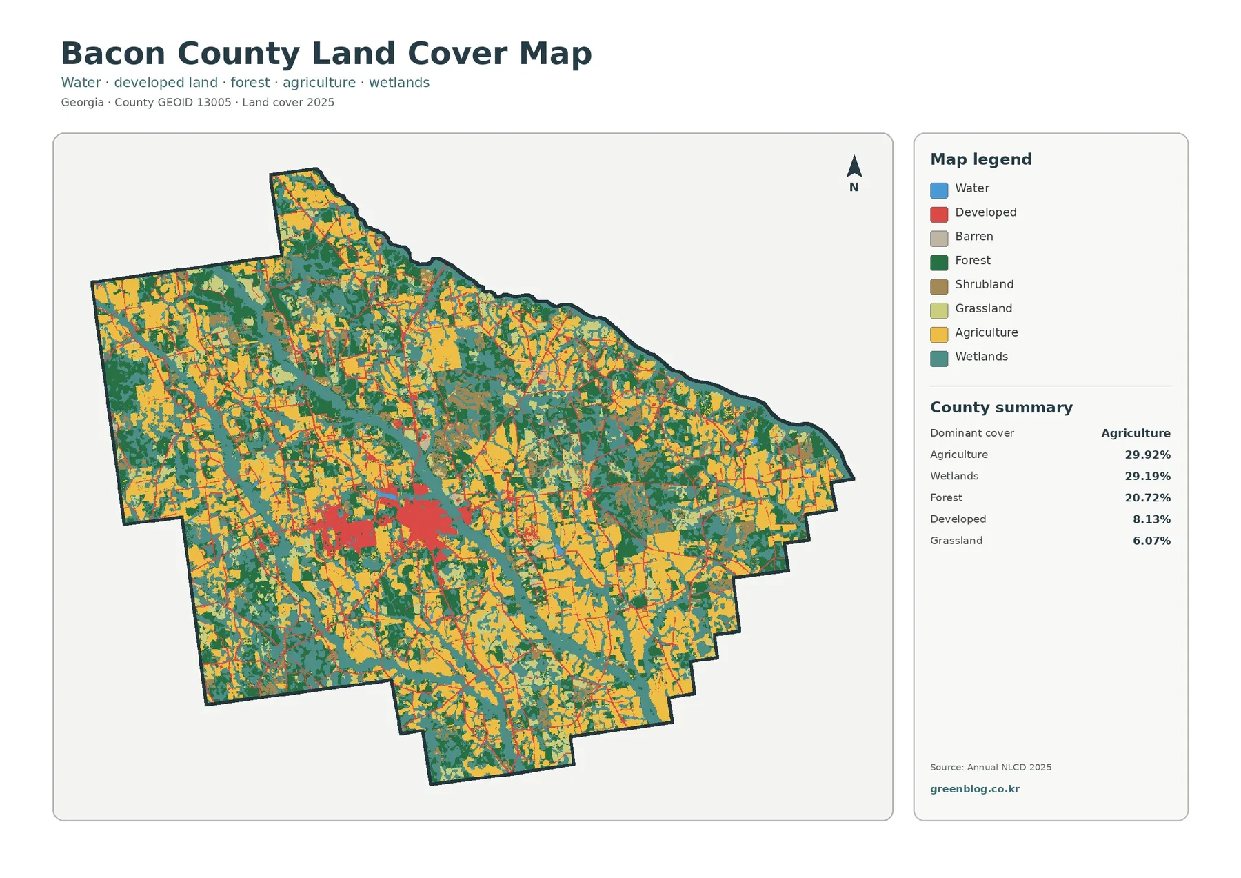
The Bacon County Georgia Land Cover Map is unusual for how closely its two leading classes match. Agriculture accounts for
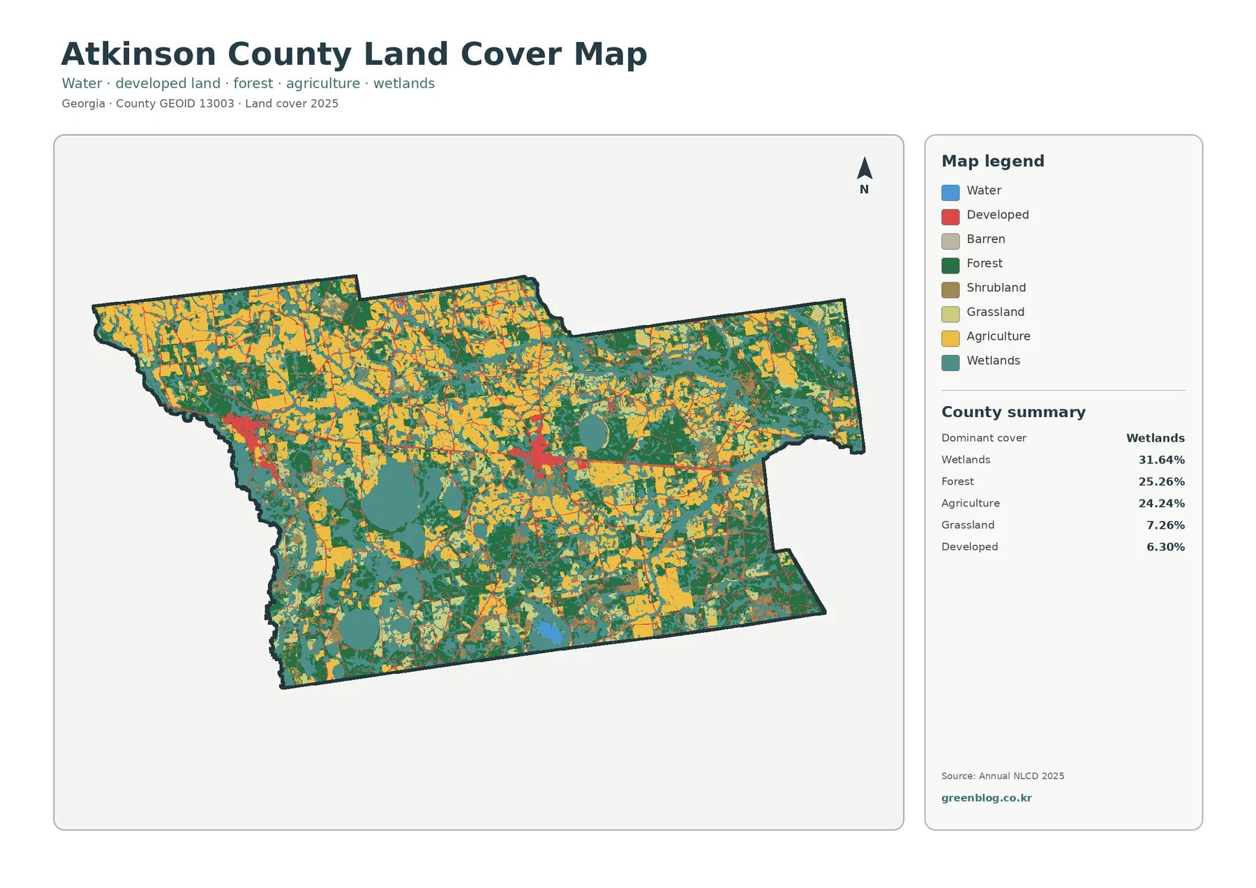
The Atkinson County Georgia Land Cover Map is best read as a three-way mix of wetlands, forest, and agriculture. Wetlands
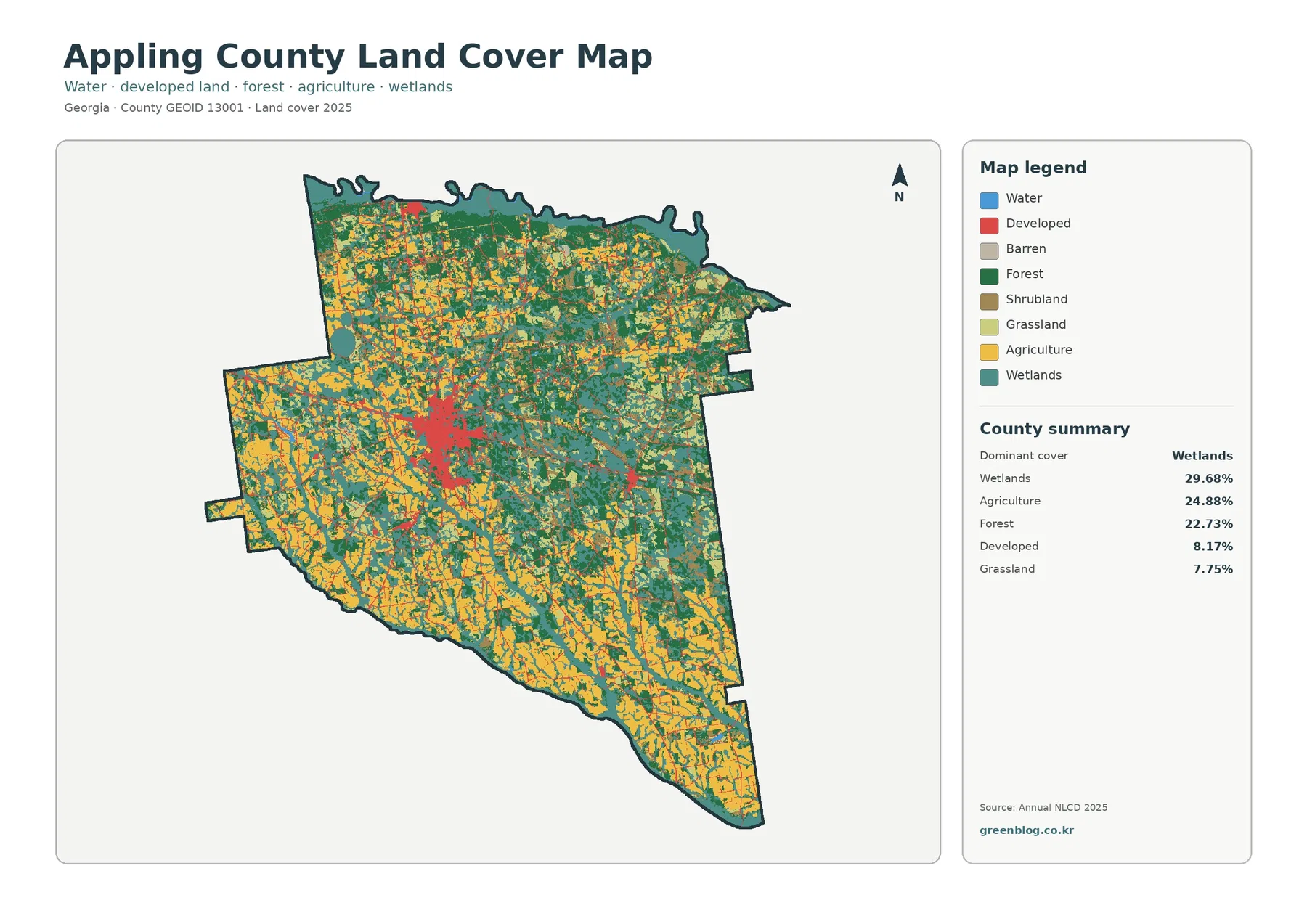
The Appling County Georgia Land Cover Map does not have one class that overwhelms everything else. Wetlands lead the 2025
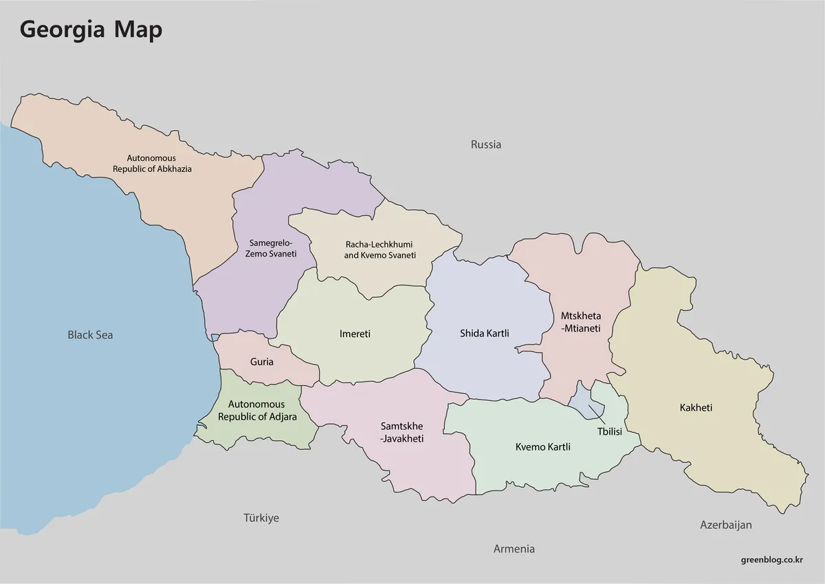
A Georgia Map of the country reveals an east–west territory positioned between the Black Sea and the Caucasus, not the
Georgia Map with Regions, Tbilisi, and the Black Sea Read More »
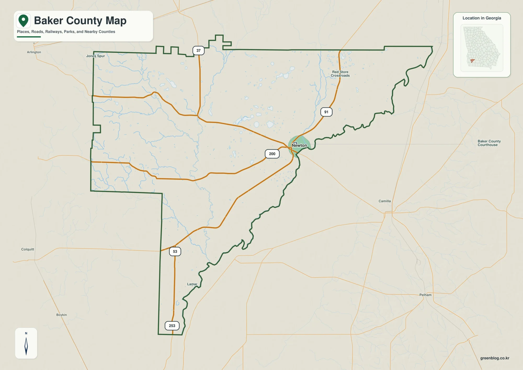
Baker County in southwest Georgia is easiest to understand by starting at Newton, the county seat pressed against the Flint
Newton and Flint River Lowlands on the Baker County Georgia Map Read More »