
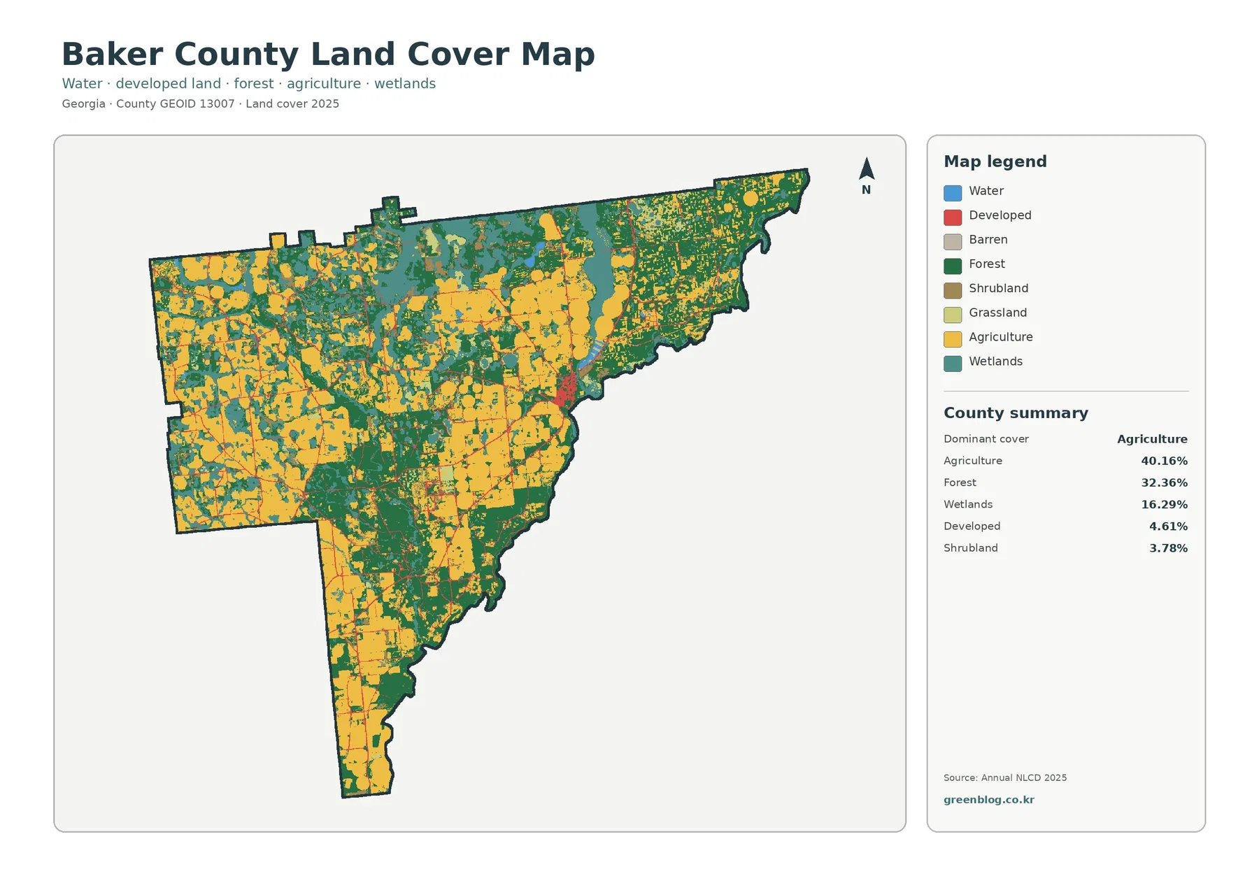
Baker County Georgia Land Cover Map: Broad Farm Country, Wooded Wetlands, and a Lightly Built Newton Area
The Baker County Georgia Land Cover Map is dominated by working land and forest rather than developed cover. Agriculture accounts […]
The Baker County Georgia Land Cover Map is dominated by working land and forest rather than developed cover. Agriculture accounts […]
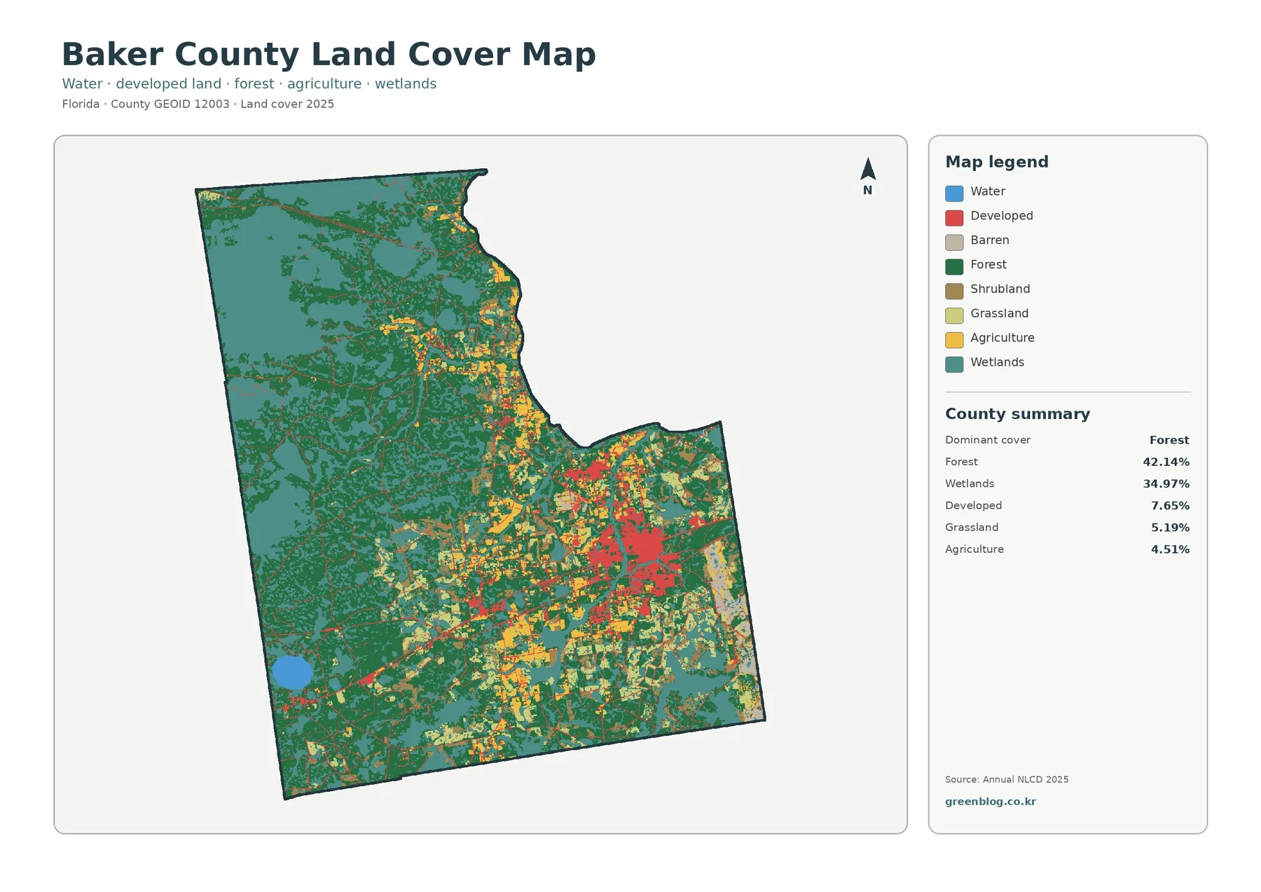
Baker County’s 2025 land-cover pattern is dominated by two classes: forest at 42.14% and wetlands at 34.97%. Together they account
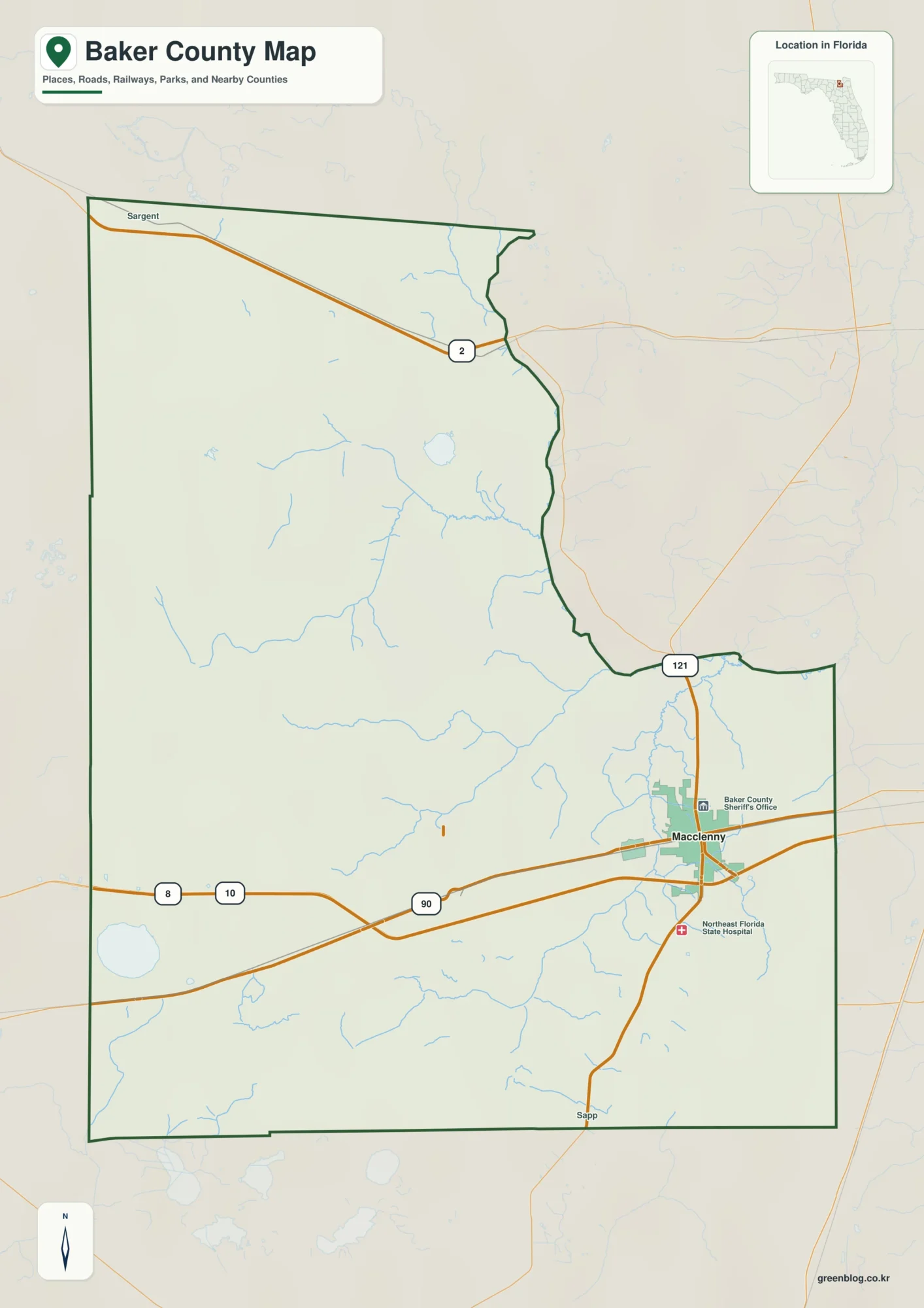
The Baker County Florida map makes the most sense when its compact eastern communities are contrasted with the much larger
Baker County Florida map | Macclenny, Olustee, and Osceola National Forest Read More »
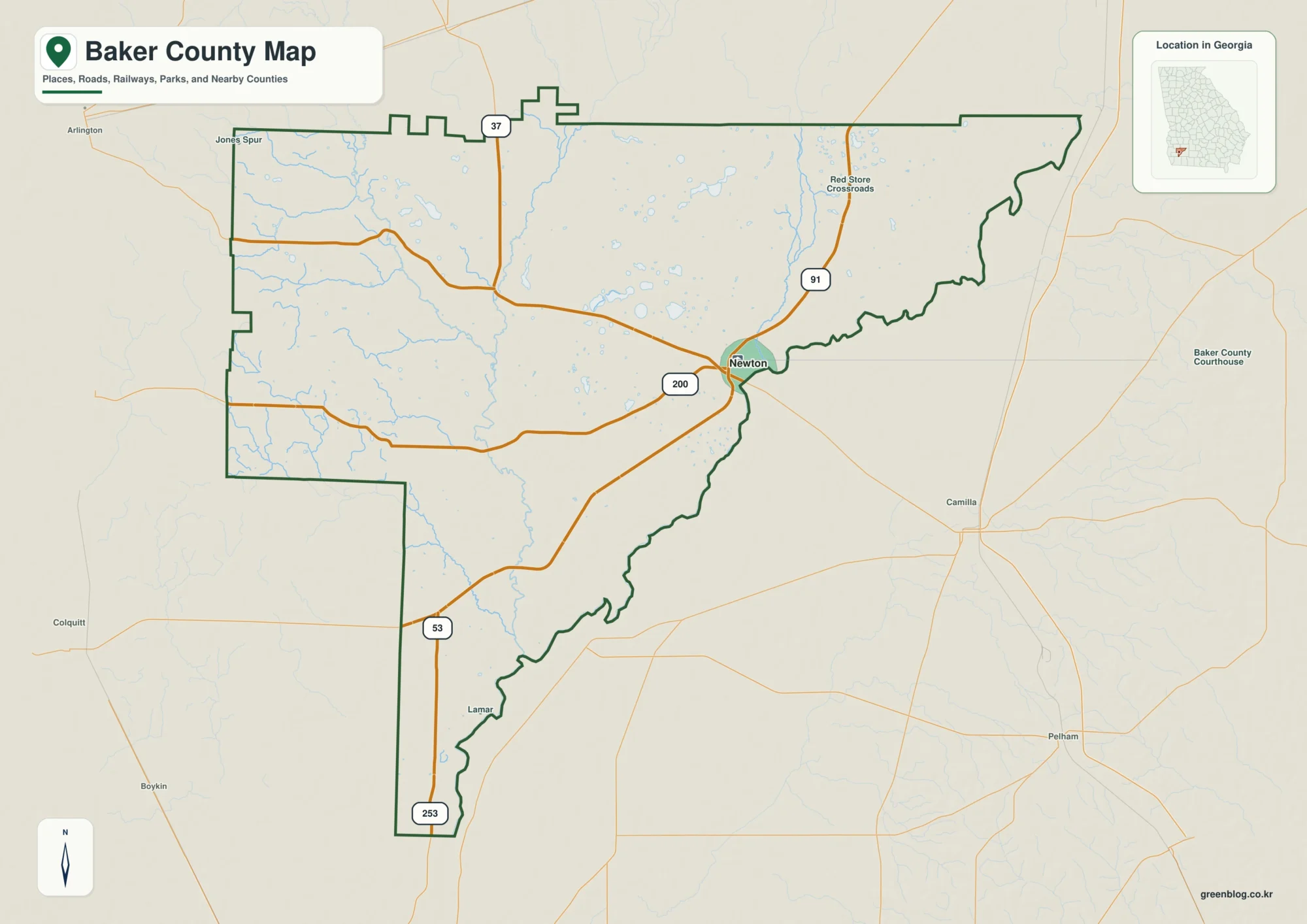
Baker County in southwest Georgia is easiest to understand by starting at Newton, the county seat pressed against the Flint
Newton and Flint River Lowlands on the Baker County Georgia Map Read More »
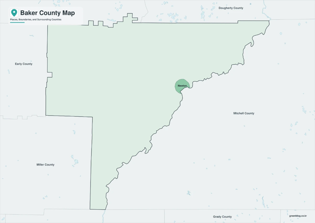
A Baker County Map needs to distinguish Georgia’s sparsely populated southwest county from other U.S. counties with the same name.
Newton and the Flint River Edge on a Baker County Map Read More »