
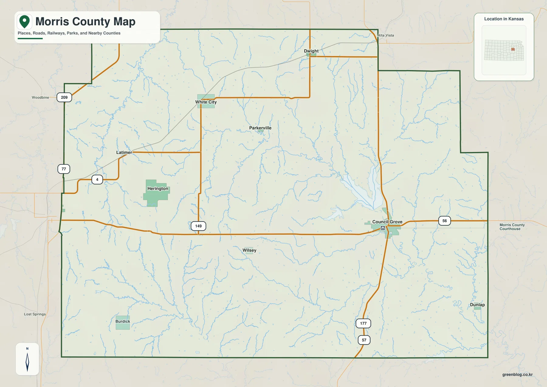
Council Grove to Herington — Morris County Kansas Map with Neosho River and Flint Hills Terrain
Morris County sits in the Flint Hills of east-central Kansas, but its geography is easiest to understand from two towns
Morris County sits in the Flint Hills of east-central Kansas, but its geography is easiest to understand from two towns
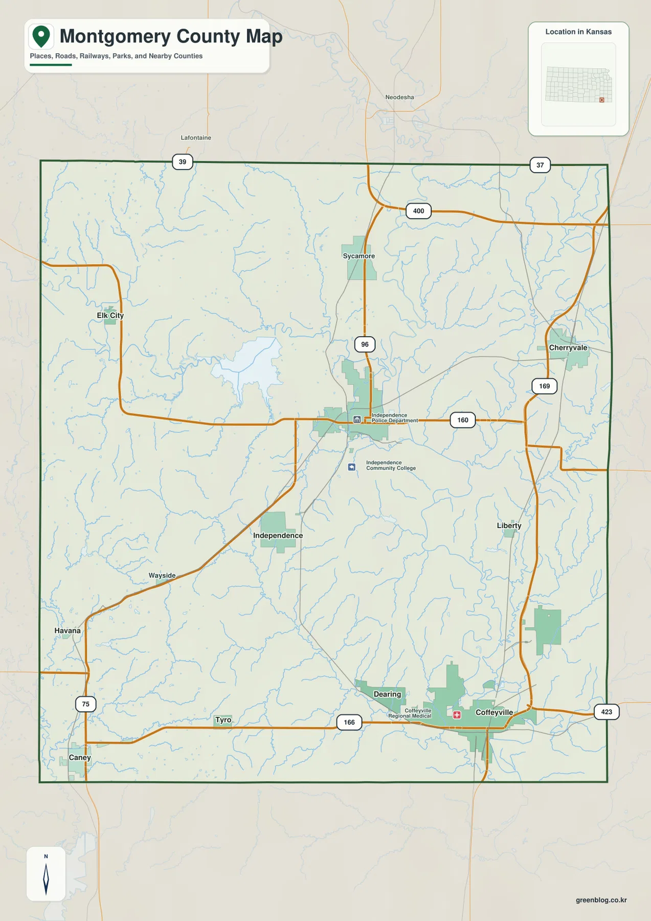
Montgomery County in southeastern Kansas is easiest to orient from two cities that sit in very different parts of the
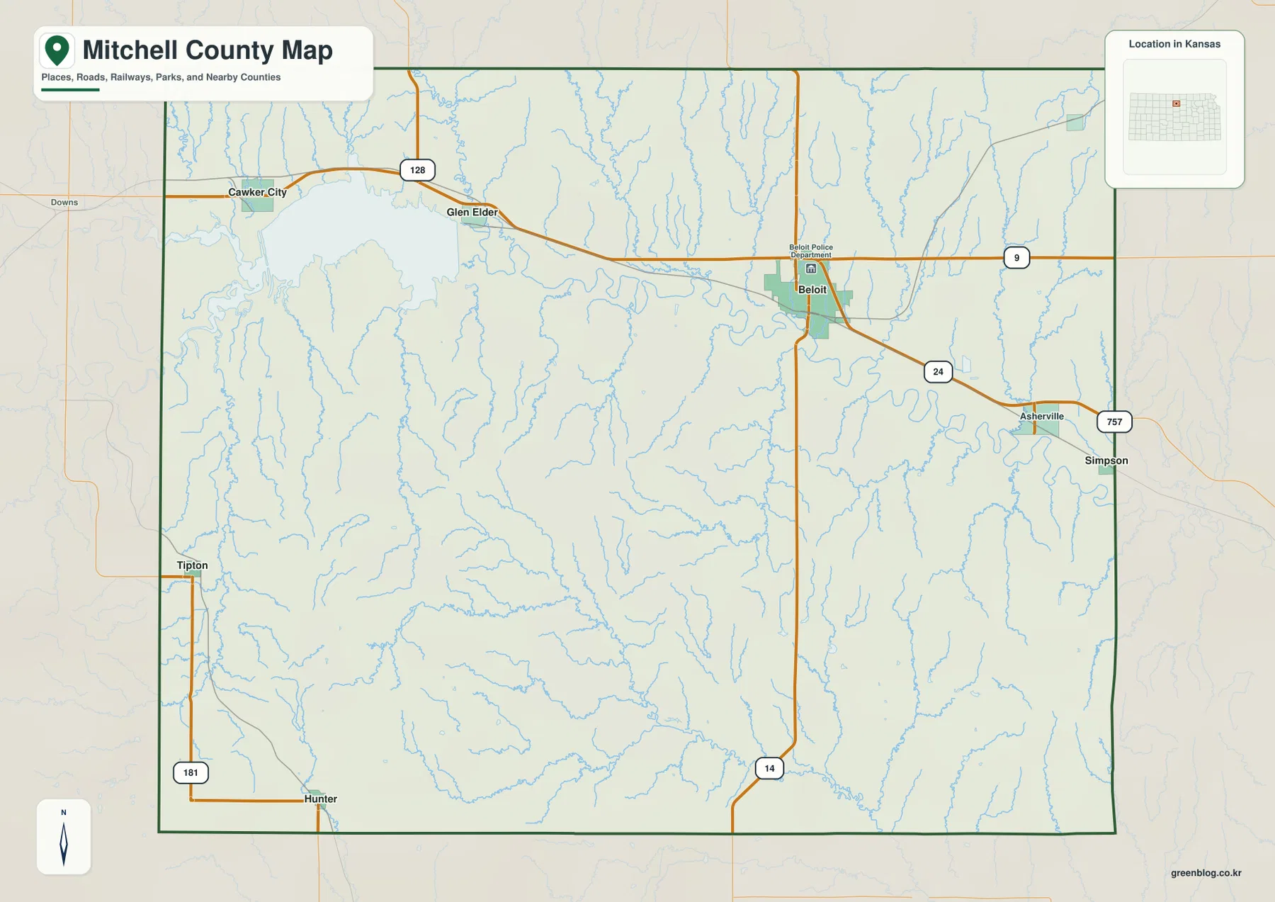
Mitchell County lies in north-central Kansas with Beloit as its most prominent mapped community and Glen Elder, Cawker City, Tipton,
Where Beloit Meets the Solomon River and Waconda Lake — Mitchell County Kansas Map Read More »
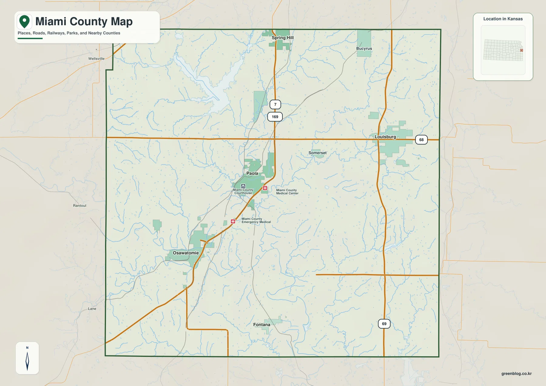
Miami County sits on the southern edge of the Kansas City metropolitan area, with Paola serving as the strongest central
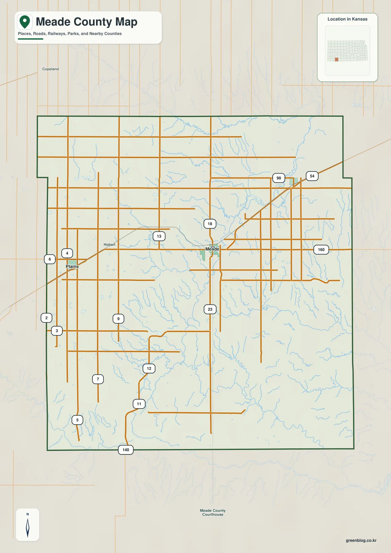
Meade County is easiest to understand by starting with three towns: Plains on the west, Meade near the center, and
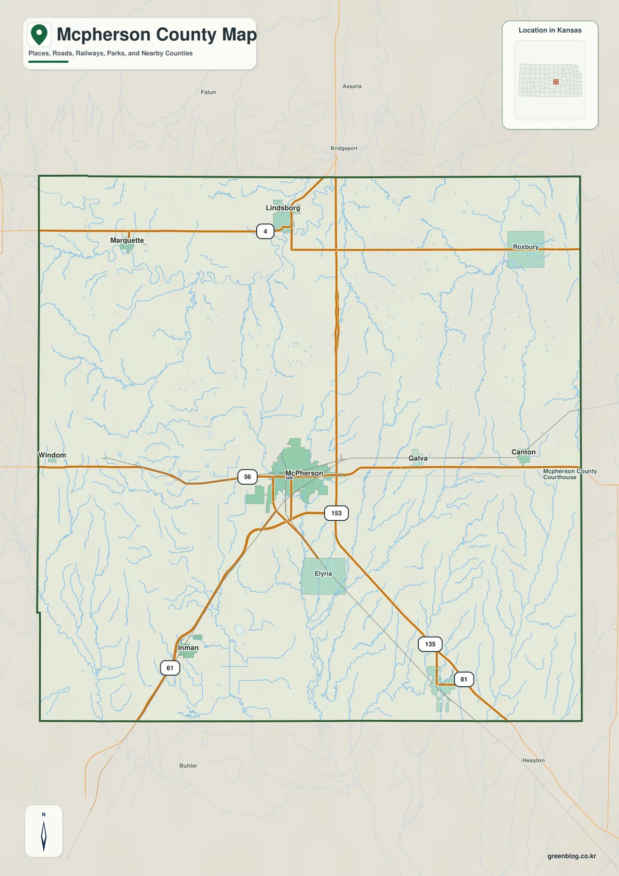
McPherson County lies in central Kansas with the city of McPherson serving as the strongest reference point on the supplied
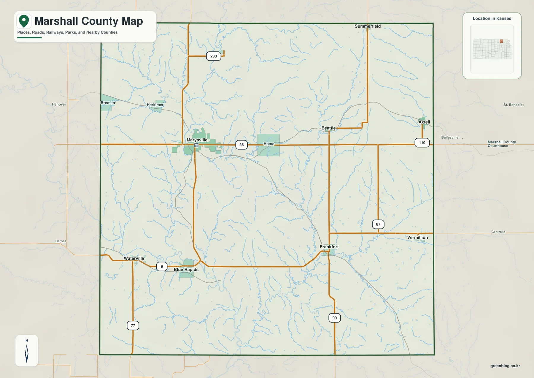
Marshall County occupies Kansas’s northern border with Nebraska, with Marysville serving as the most prominent center on the maps. US
Marysville, Big Blue River Valleys, and the Nebraska Line — Marshall County Kansas Map Read More »
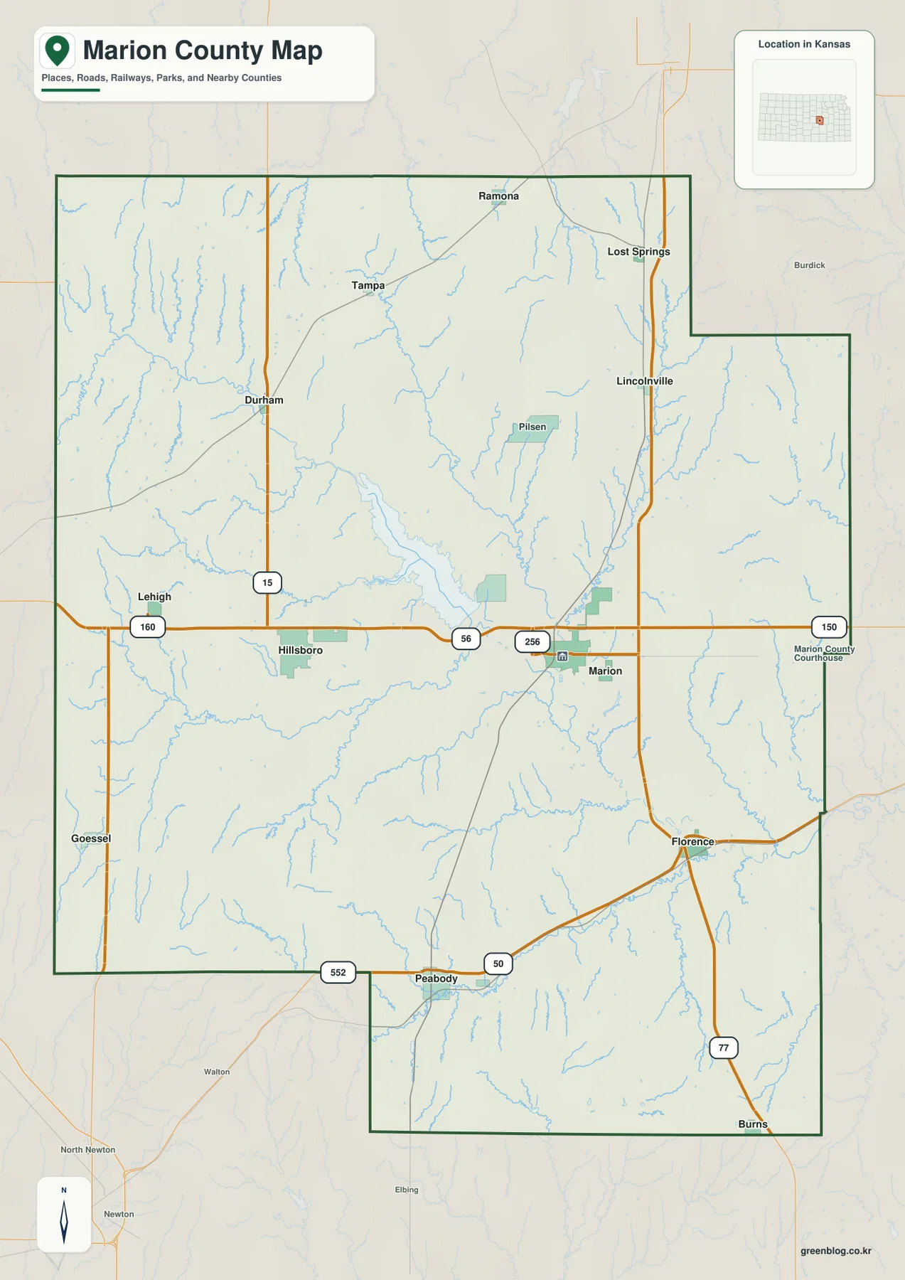
Marion County sits in central Kansas where Hillsboro, Marion, Peabody, Florence, and a network of smaller communities are spread across
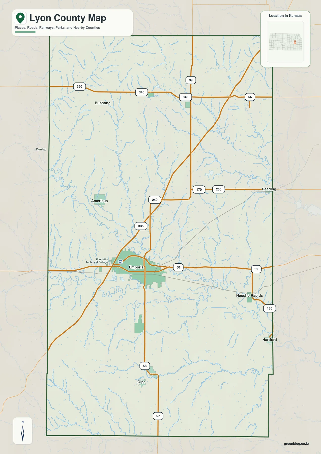
Lyon County sits in east-central Kansas where the road network around Emporia meets a landscape shaped by the Cottonwood and
Lyon County Kansas Map — Emporia, the Cottonwood–Neosho Rivers, and Flint Hills Relief Read More »