
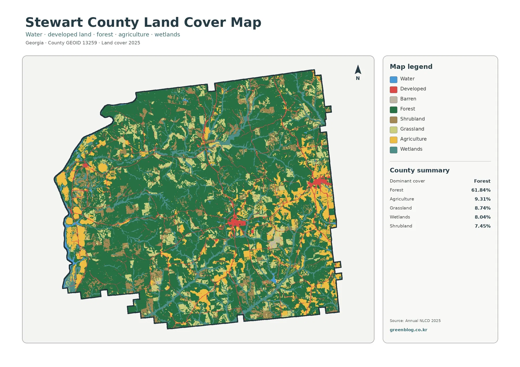
Stewart County Georgia Land Cover Map | Forest-Dominated Interior and the Chattahoochee River Edge
Stewart County in west-central Georgia is a strongly forested county with a very different western edge. Forest accounts for 61.84%
Stewart County in west-central Georgia is a strongly forested county with a very different western edge. Forest accounts for 61.84%
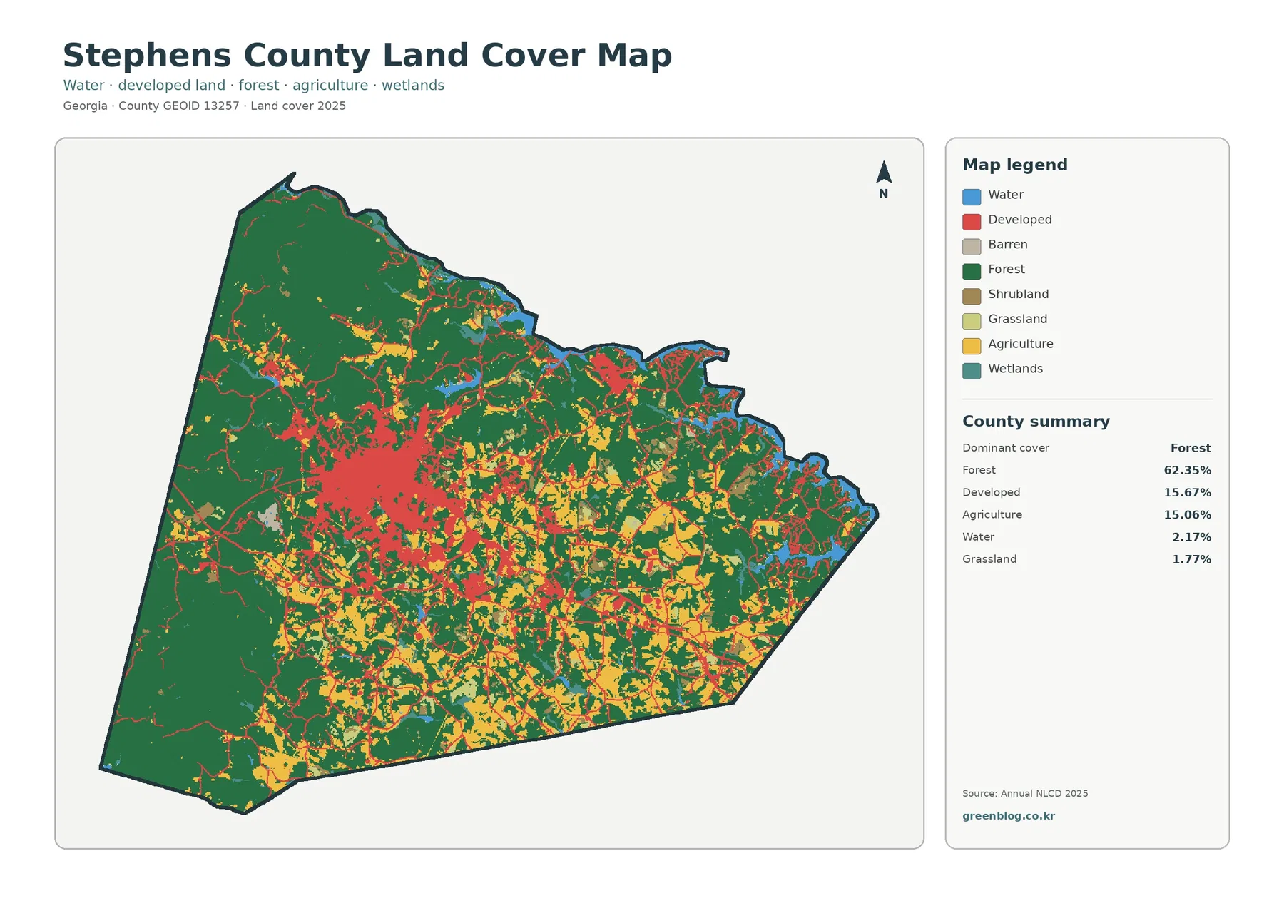
Stephens County is predominantly forested, yet its maps also contain a compact developed center, a broad rural patchwork, and a
Stephens County Georgia Land Cover Map: 62.35% Forest, Toccoa’s Built Core & Four JPGs Read More »
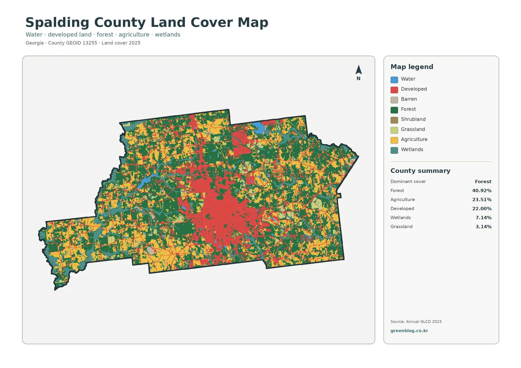
Spalding County combines a concentrated developed center around Griffin with a broad outer landscape of woods, fields, wetlands, and smaller
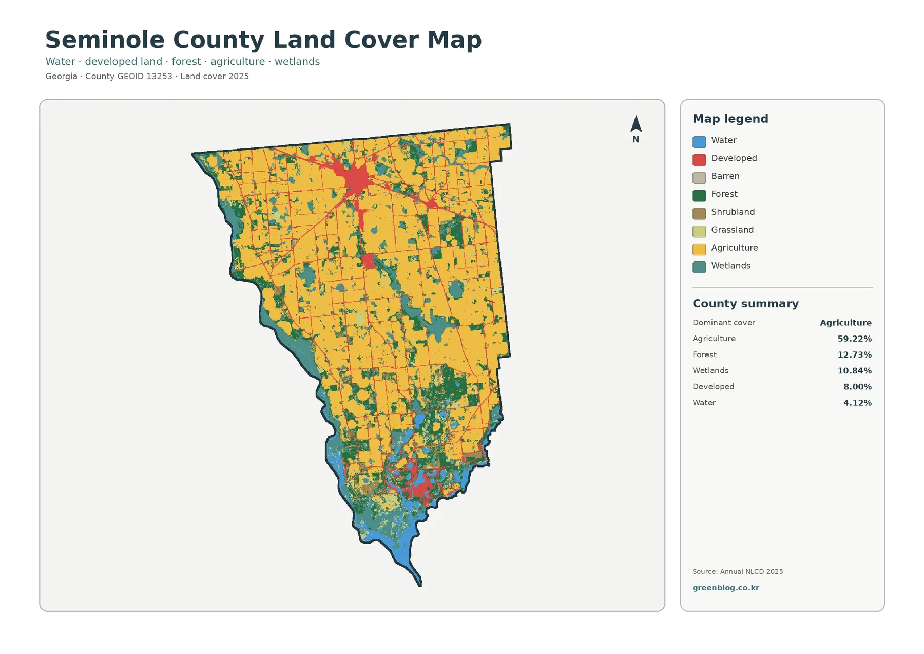
Seminole County is overwhelmingly agricultural in its northern and central sections, while the southern edge changes into a lake-and-wetland landscape.
Seminole County Georgia Land Cover Map — Farms, Donalsonville & Lake Seminole Read More »
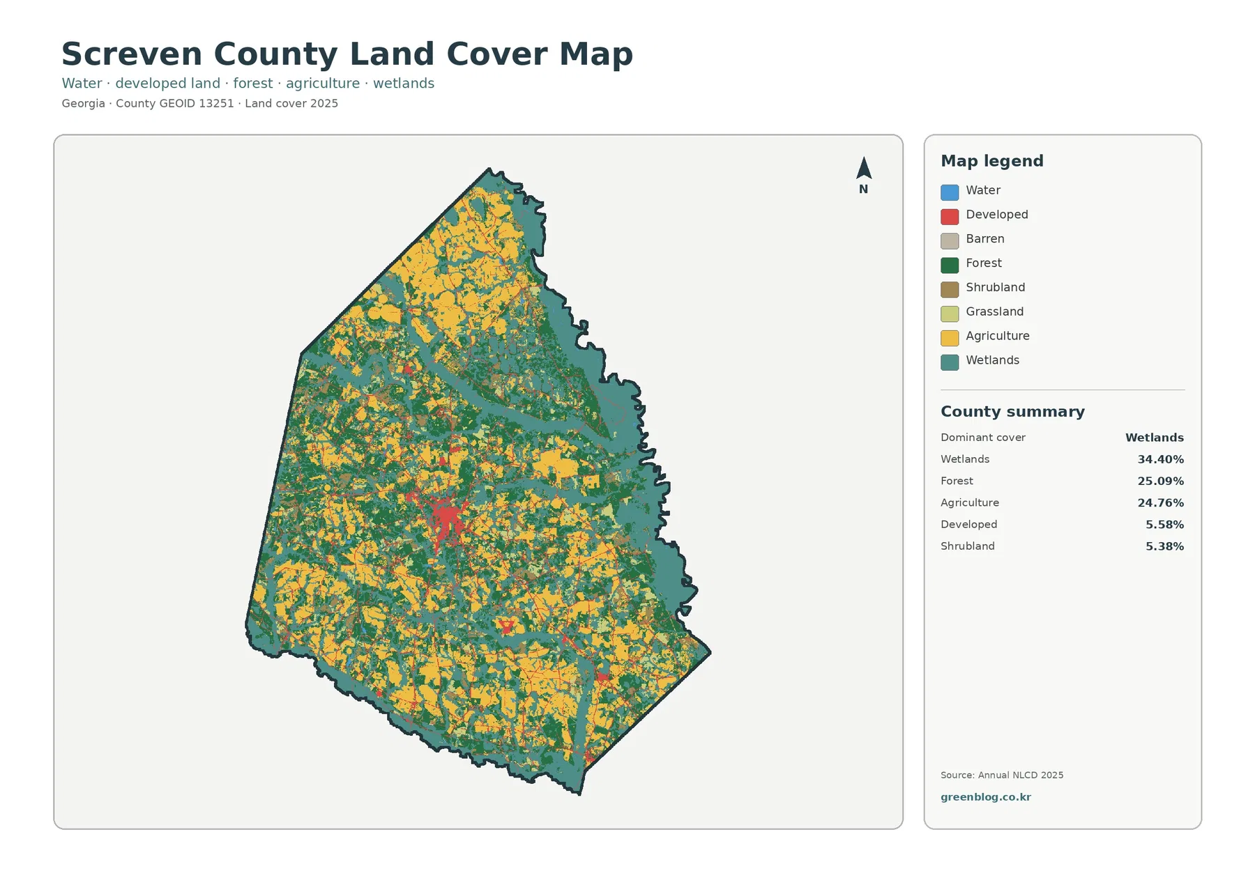
Screven County is not simply farm country. Wetlands are the largest 2025 class at 34.40%, while forest covers 25.09% and
Screven County Georgia Land Cover Map | Wetlands, Forest & Farmland Read More »
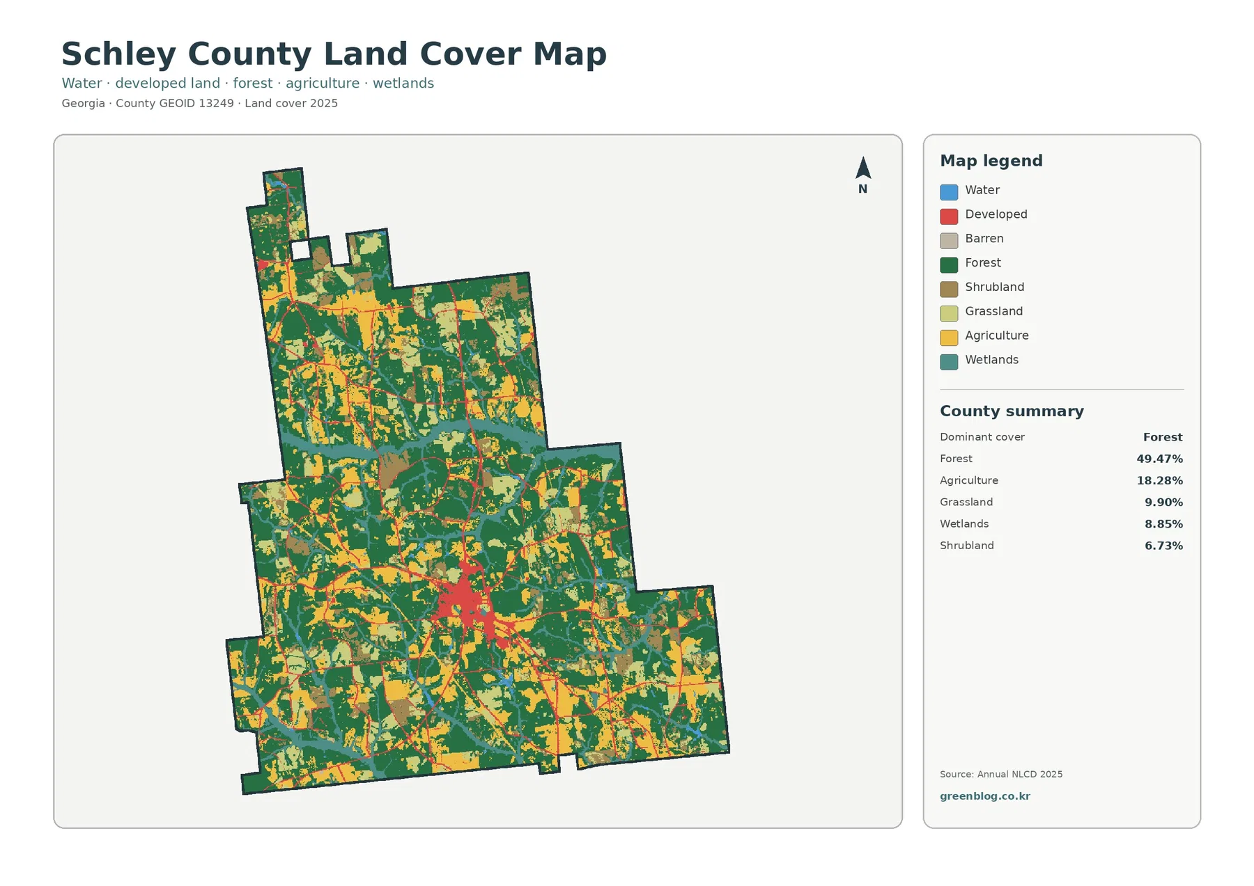
Schley County is a rural Georgia county where forest is the largest cover, but fields, grass, shrub cover, and wetlands
Schley County Georgia Land Cover Map | Ellaville, US 19–GA 26, Woods & Fields Read More »
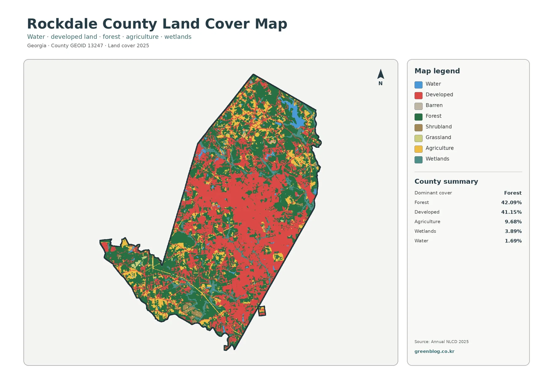
Rockdale County is almost evenly divided between forest and developed land. Forest covers 42.09% of the supplied 2025 classification, while
Rockdale County Georgia Land Cover Map | Conyers Growth & Northern Forest Read More »
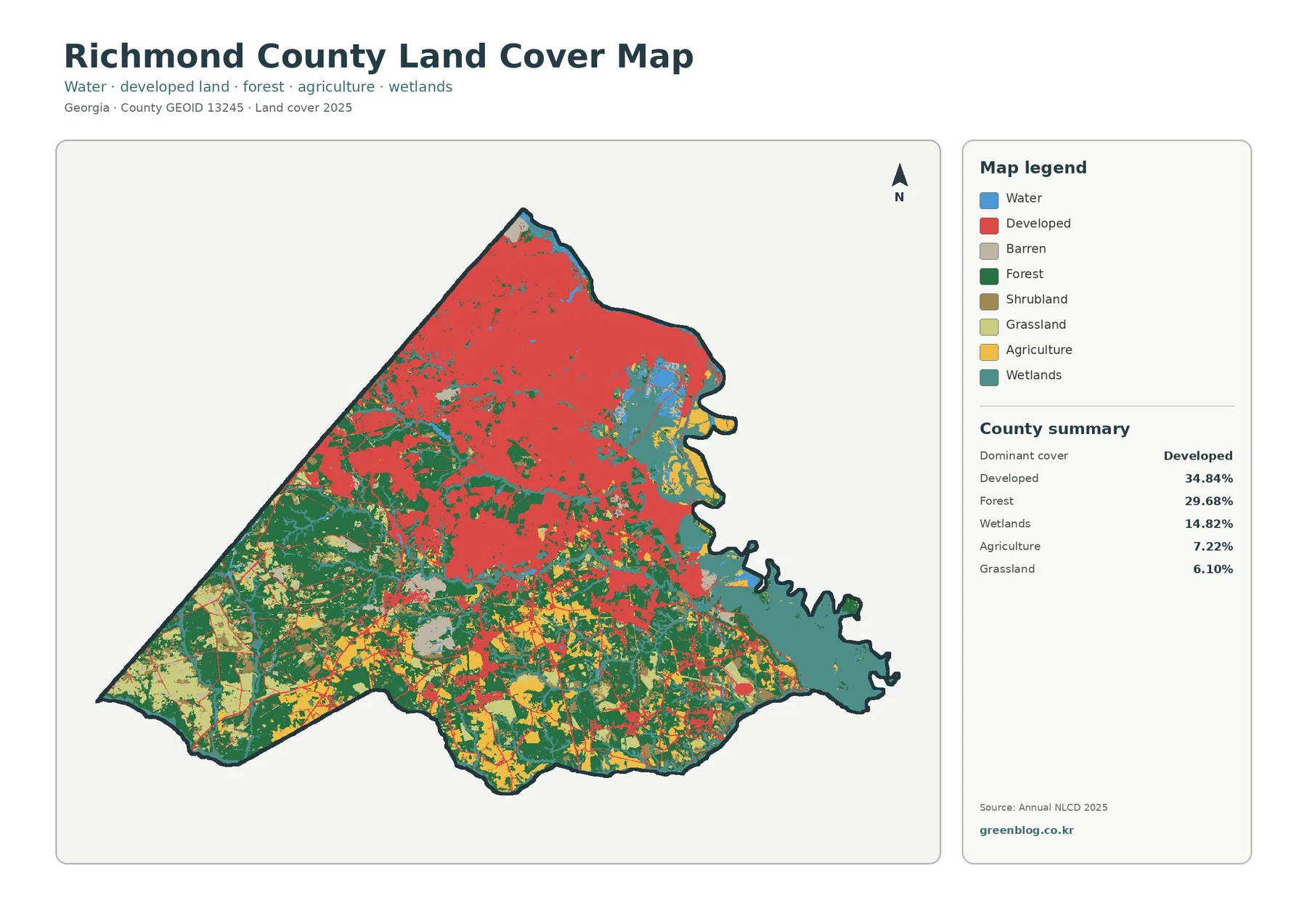
Richmond County has one of the clearest urban-to-rural gradients in this Georgia map series. Developed land is the largest 2025
Richmond County Georgia Land Cover Map | Augusta & Savannah River Wetlands Read More »
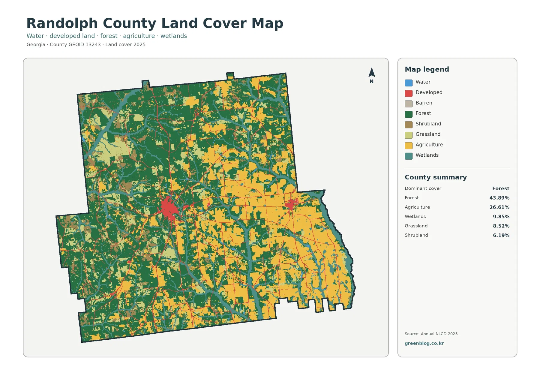
Randolph County is split visually between a more wooded western half and broad agricultural areas toward the east. Forest covers
Randolph County Georgia Land Cover Map: Cuthbert, Shellman, Forest and Farmland Read More »