
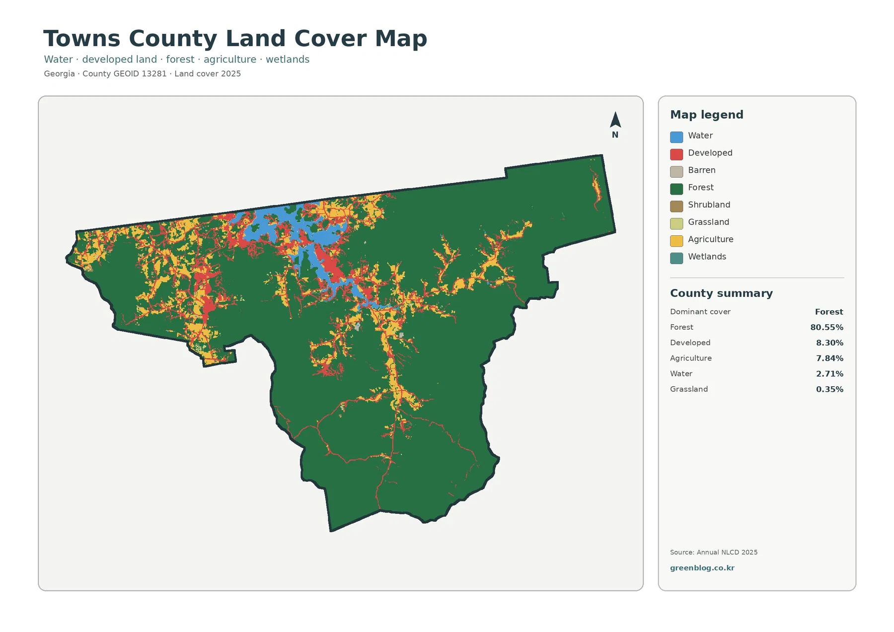
Towns County Georgia Land Cover Map — Forest Dominance, Lake Chatuge, and Compact Built Clusters
Towns County is overwhelmingly forested in the 2025 land-cover summary. Forest accounts for 80.55% of the county, while developed land
Towns County is overwhelmingly forested in the 2025 land-cover summary. Forest accounts for 80.55% of the county, while developed land
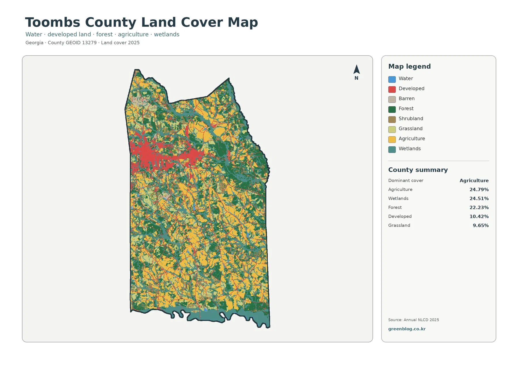
Toombs County has no single land-cover class that overwhelms the 2025 map. Agriculture accounts for 24.79%, wetlands for 24.51%, and
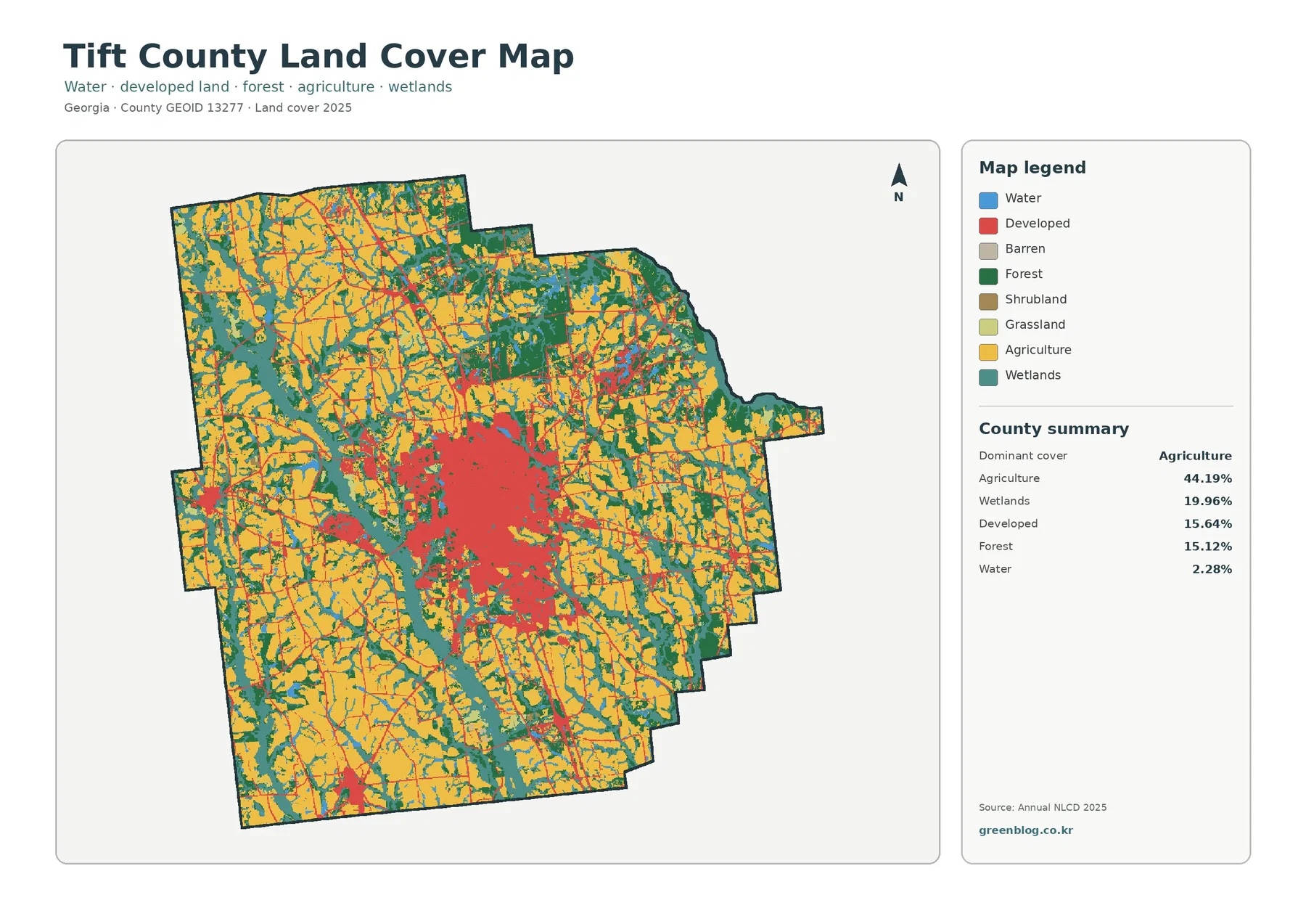
Tift County’s 2025 map has a clear rural–urban contrast. Agriculture is the largest mapped cover at 44.19%, spreading across much
Tift County Georgia Land Cover Map | Agriculture, Wetlands & Tifton Growth Read More »
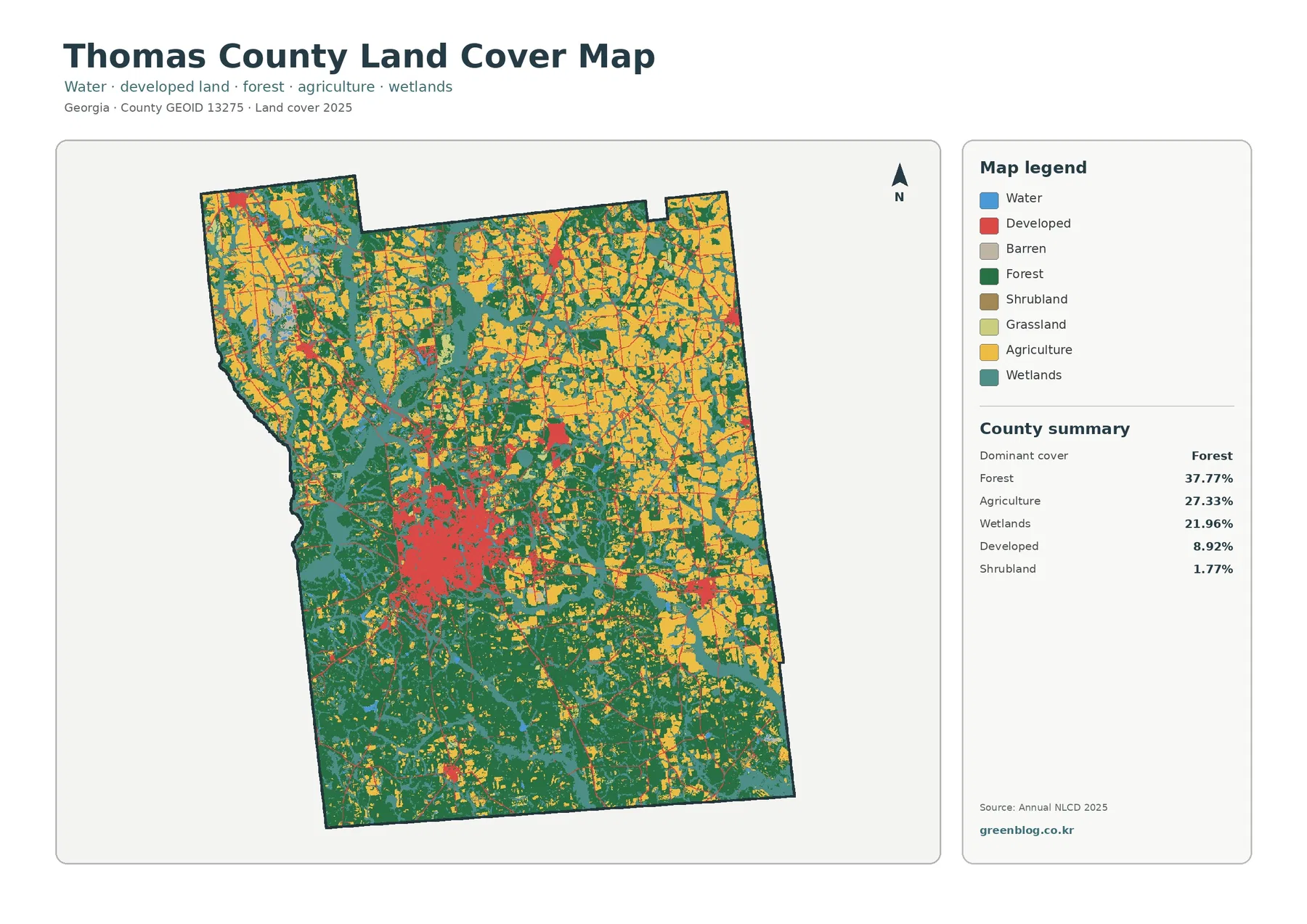
Thomas County’s 2025 land-cover pattern is not dominated by a single rural class. Forest leads at 37.77%, agriculture accounts for
Thomas County Georgia Land Cover Map | Forest, Farms & Thomasville Read More »
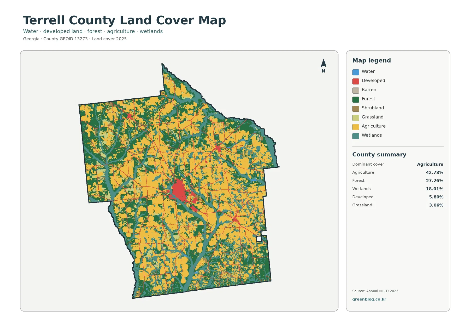
Terrell County’s 2025 land-cover map is dominated by agriculture, which accounts for 42.78% of the county. Large farm-colored blocks spread
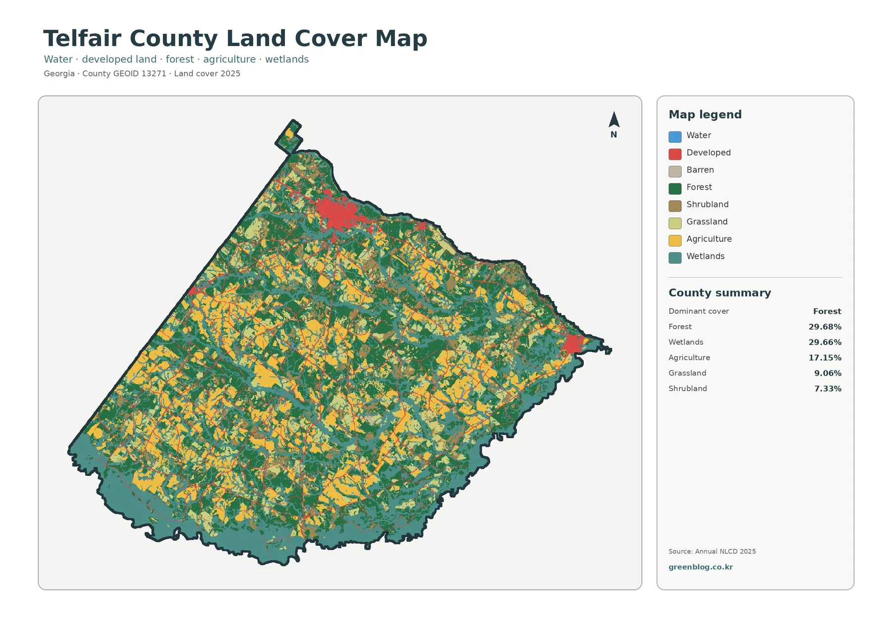
Telfair County’s 2025 land-cover pattern is unusual in how closely its two largest classes match: forest accounts for 29.68% and
Telfair County Georgia Land Cover Map | Forest, Wetlands & Built Clusters Read More »
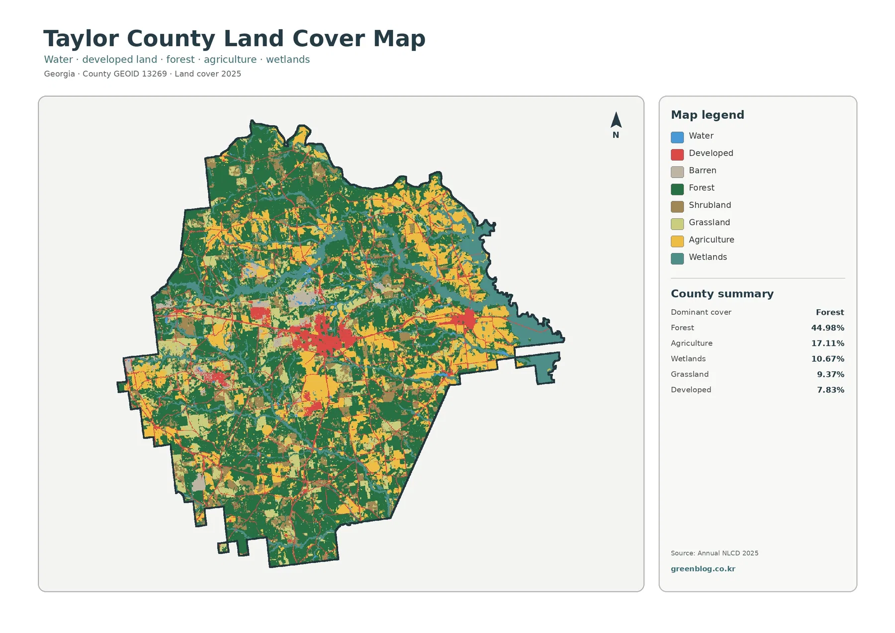
This Taylor County Georgia land cover map page provides four county map views for comparing current land cover, forest and
Taylor County Georgia Land Cover Map — Forest, Farms and Built Clusters Read More »
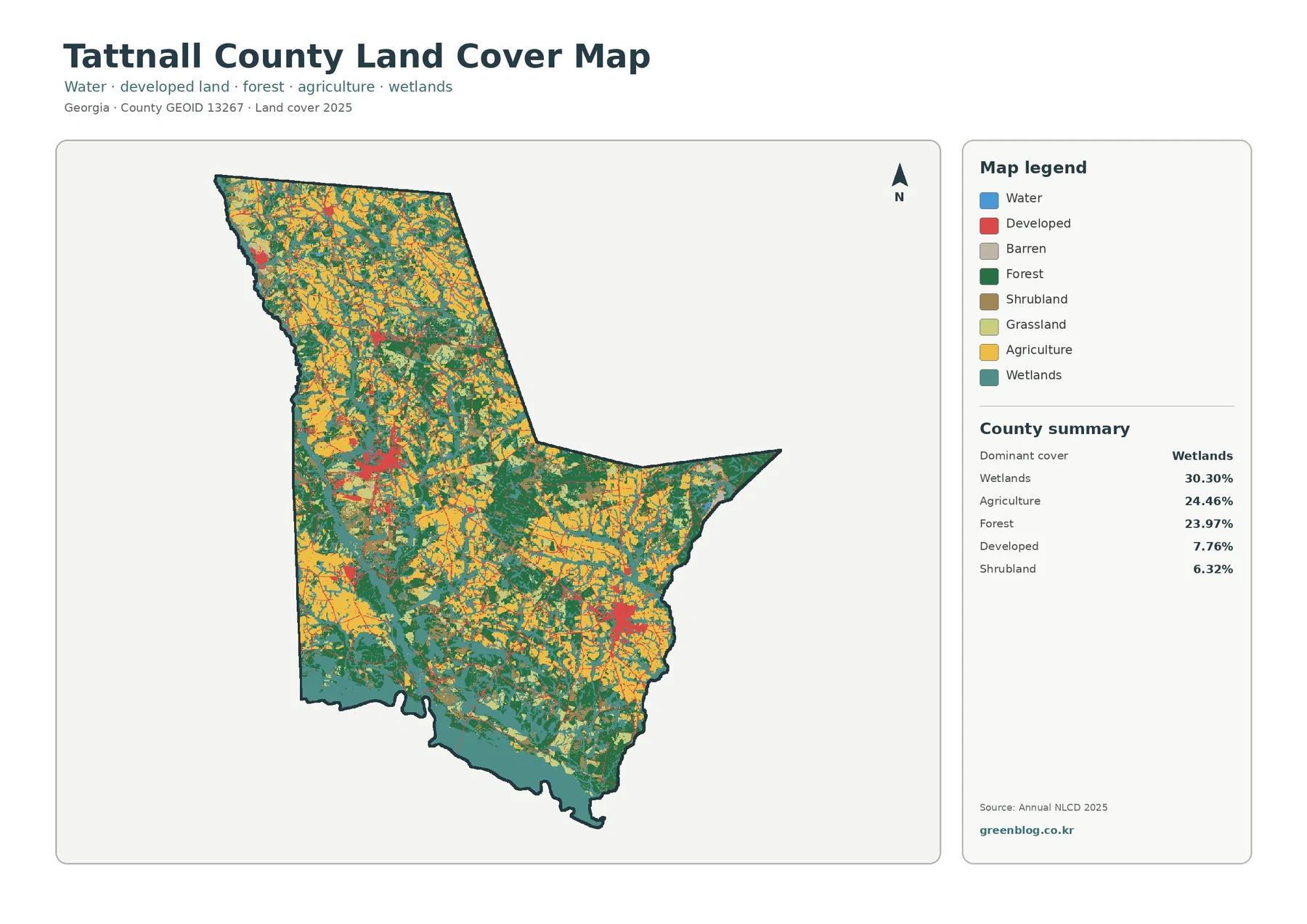
Wetlands lead Tattnall County’s supplied 2025 land-cover summary at 30.30%, but this is not a county where one class overwhelms
Tattnall County Georgia Land Cover Map — Wetlands, Agriculture, and River-Edge Patterns Read More »
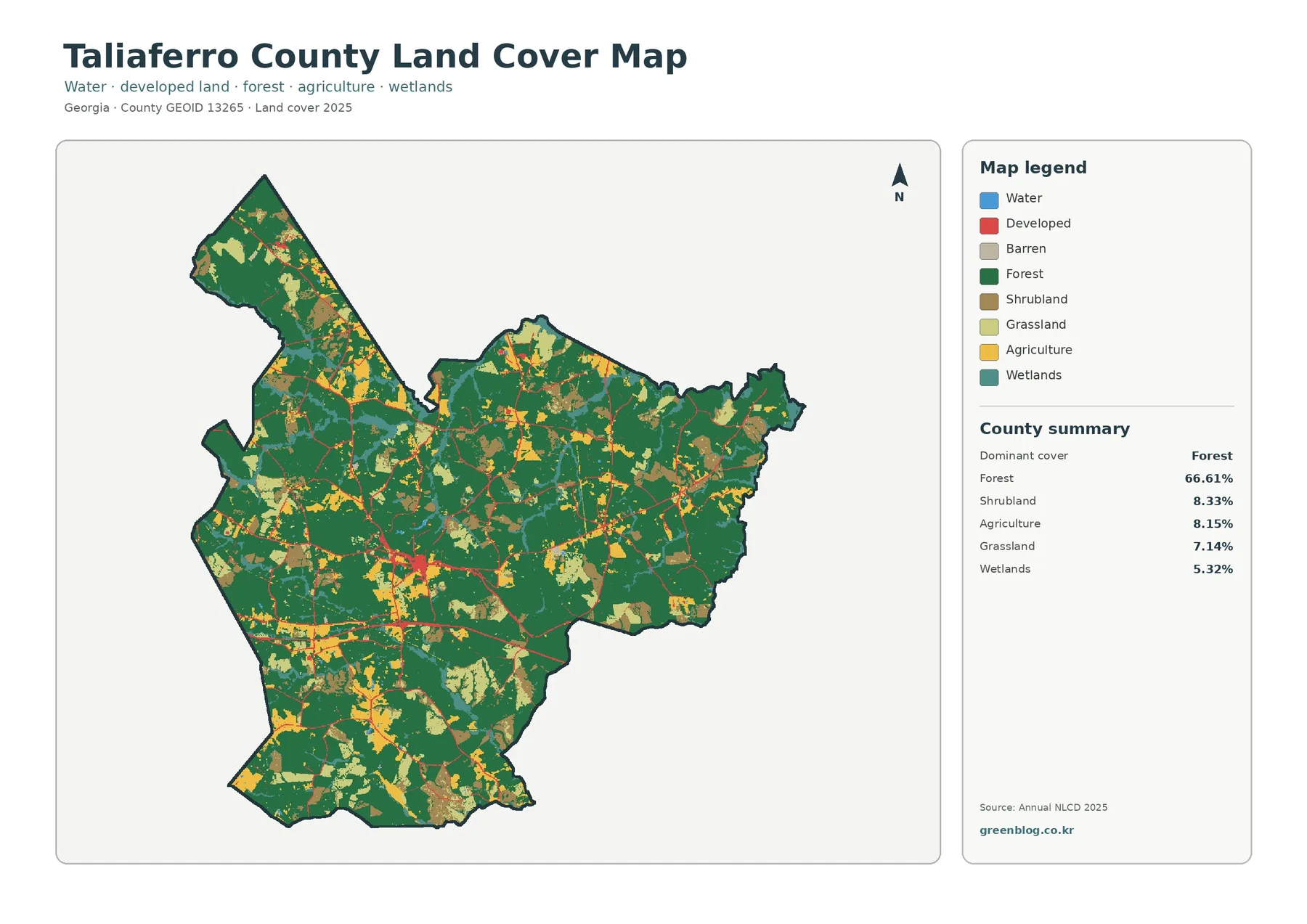
Taliaferro County is predominantly forested in the supplied 2025 land-cover summary. Forest accounts for 66.61% of the county, while shrubland,
Taliaferro County Georgia Land Cover Map: Forest and Sparse Development Read More »