
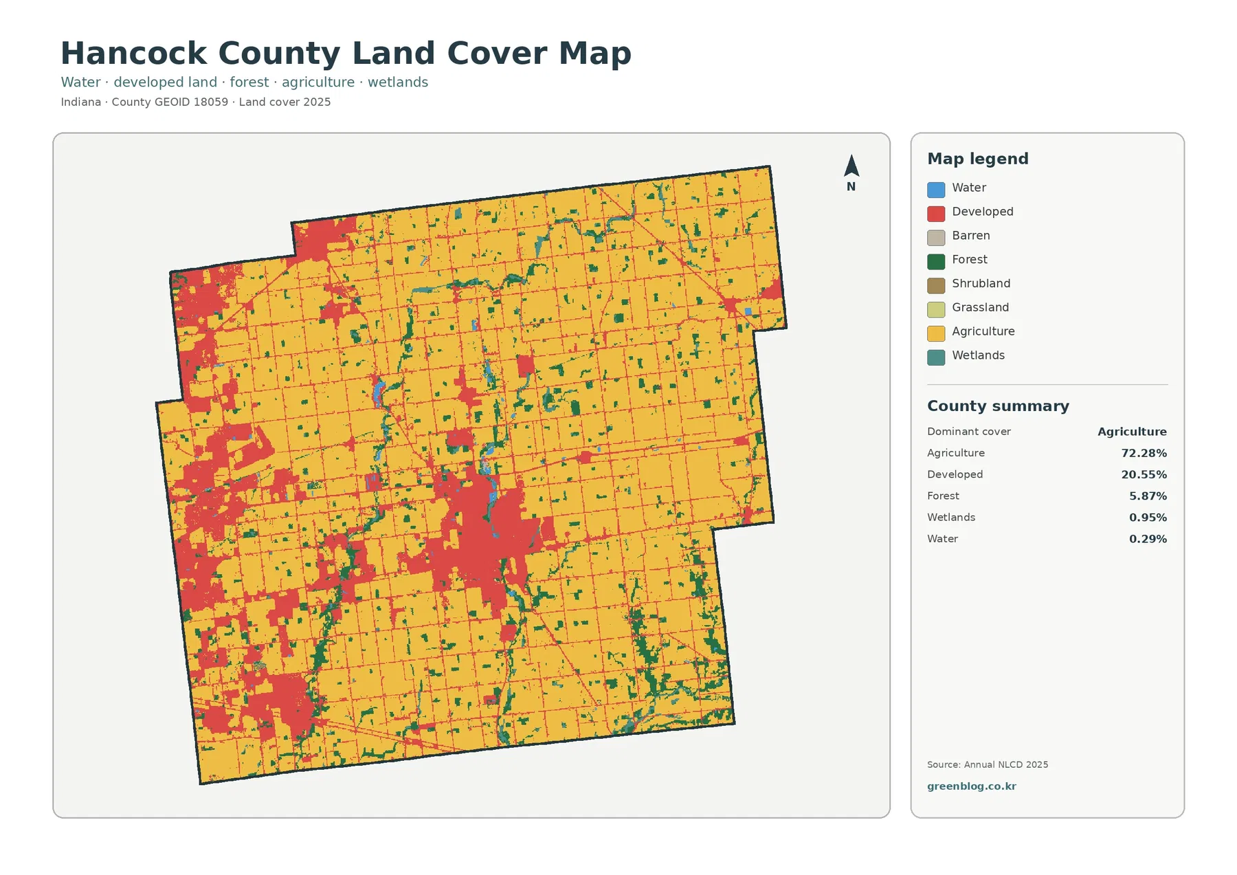
Hancock County Indiana Land Cover Map — From Western Built Areas to Broad Eastern Farmland
Hancock County is still dominated by farmland, yet the 2025 land-cover map shows a sharp internal contrast. Broad agricultural cover
Hancock County is still dominated by farmland, yet the 2025 land-cover map shows a sharp internal contrast. Broad agricultural cover
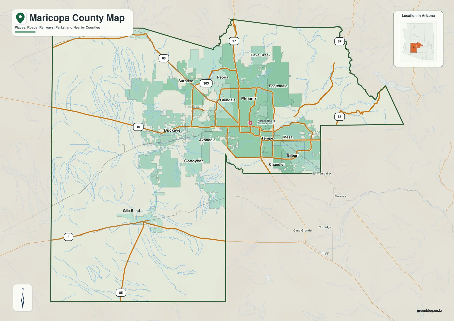
Maricopa County is defined by a striking contrast: a broad continuous urban area fills the middle of the county, while
Phoenix at the Center: Maricopa County map — Desert Cities, Rivers, and Mountain Edges Read More »
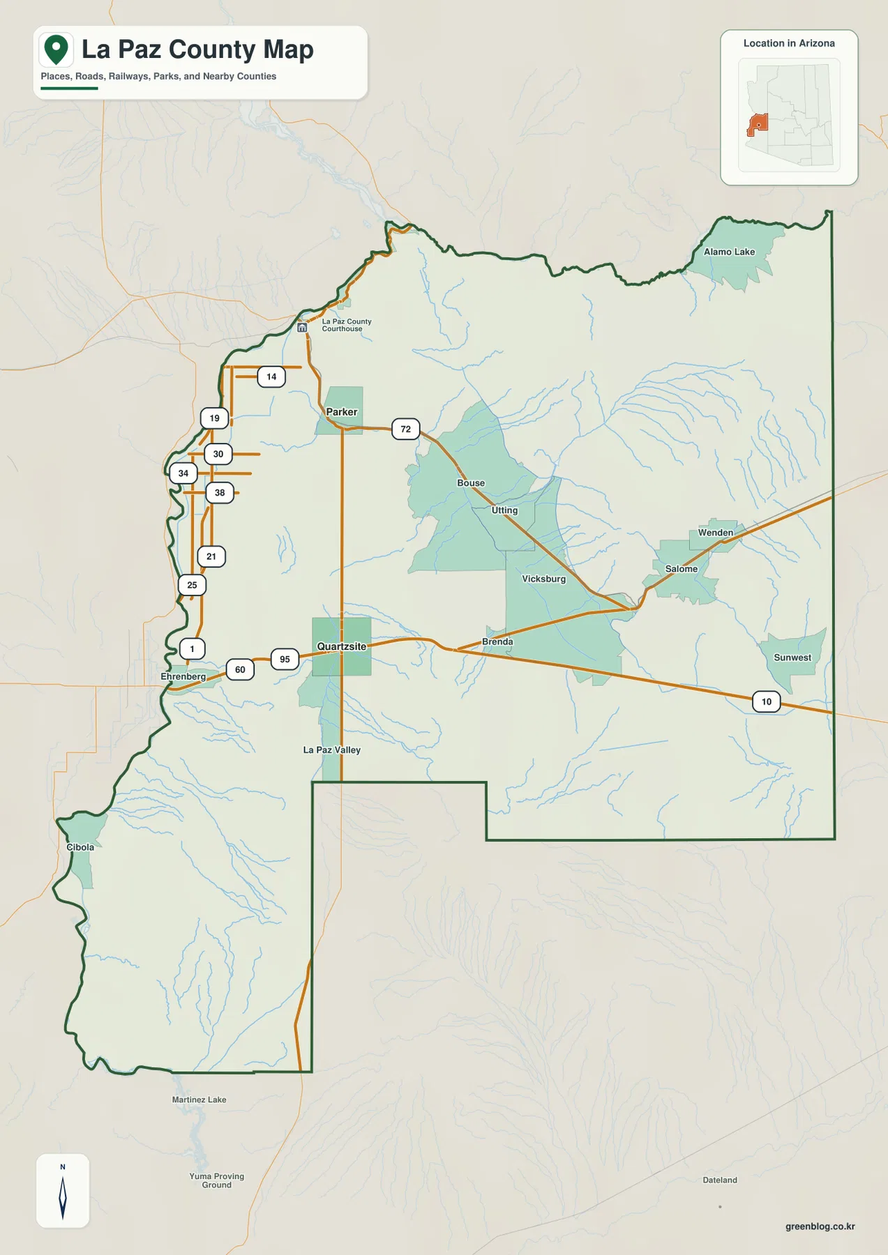
La Paz County sits in western Arizona where the Colorado River edge meets a broad desert interior. Parker, the county
La Paz County Map: Colorado River Towns, Quartzsite, and Desert Routes Read More »
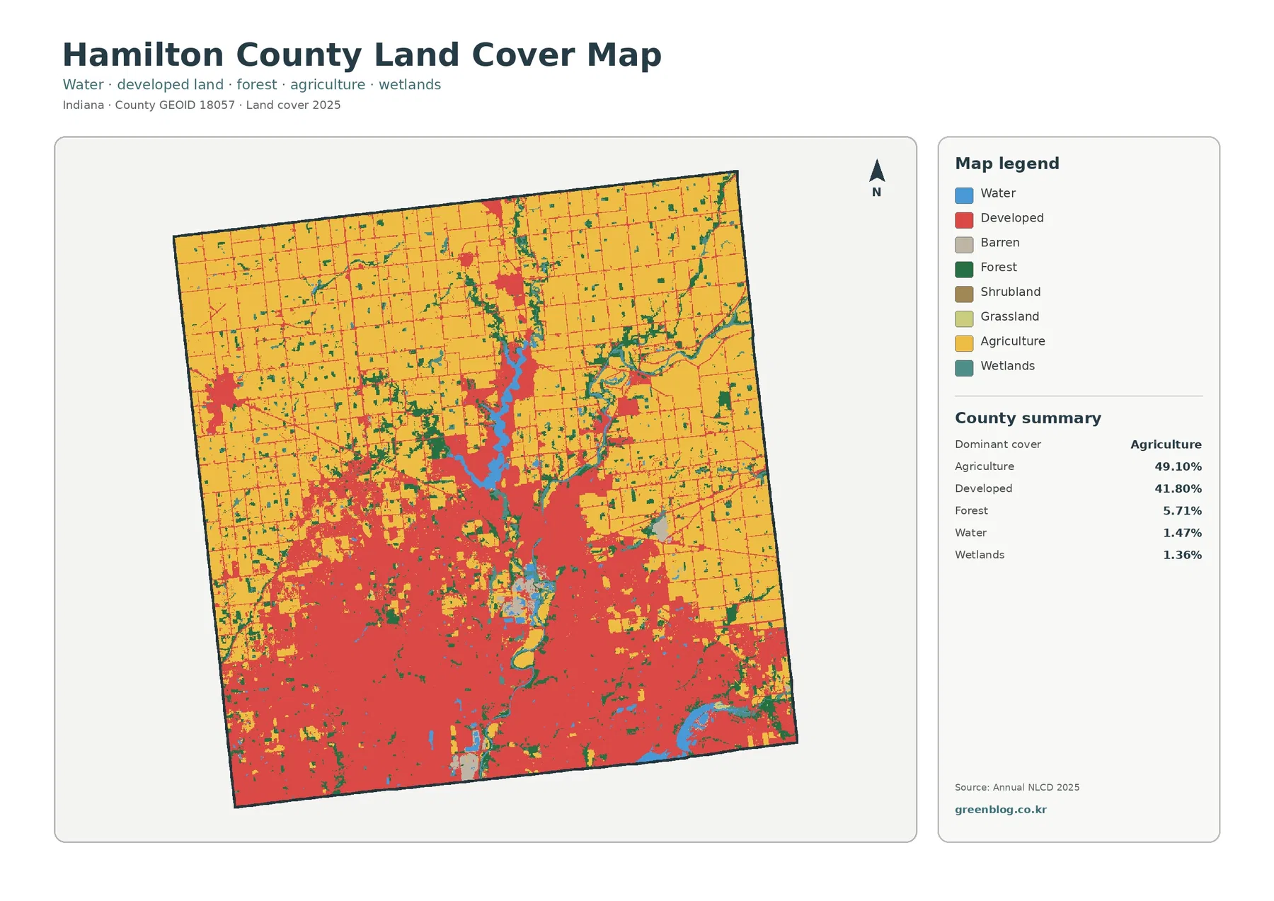
Hamilton County is a useful place to see two very different Indiana landscapes inside one county boundary. The 2025 land-cover
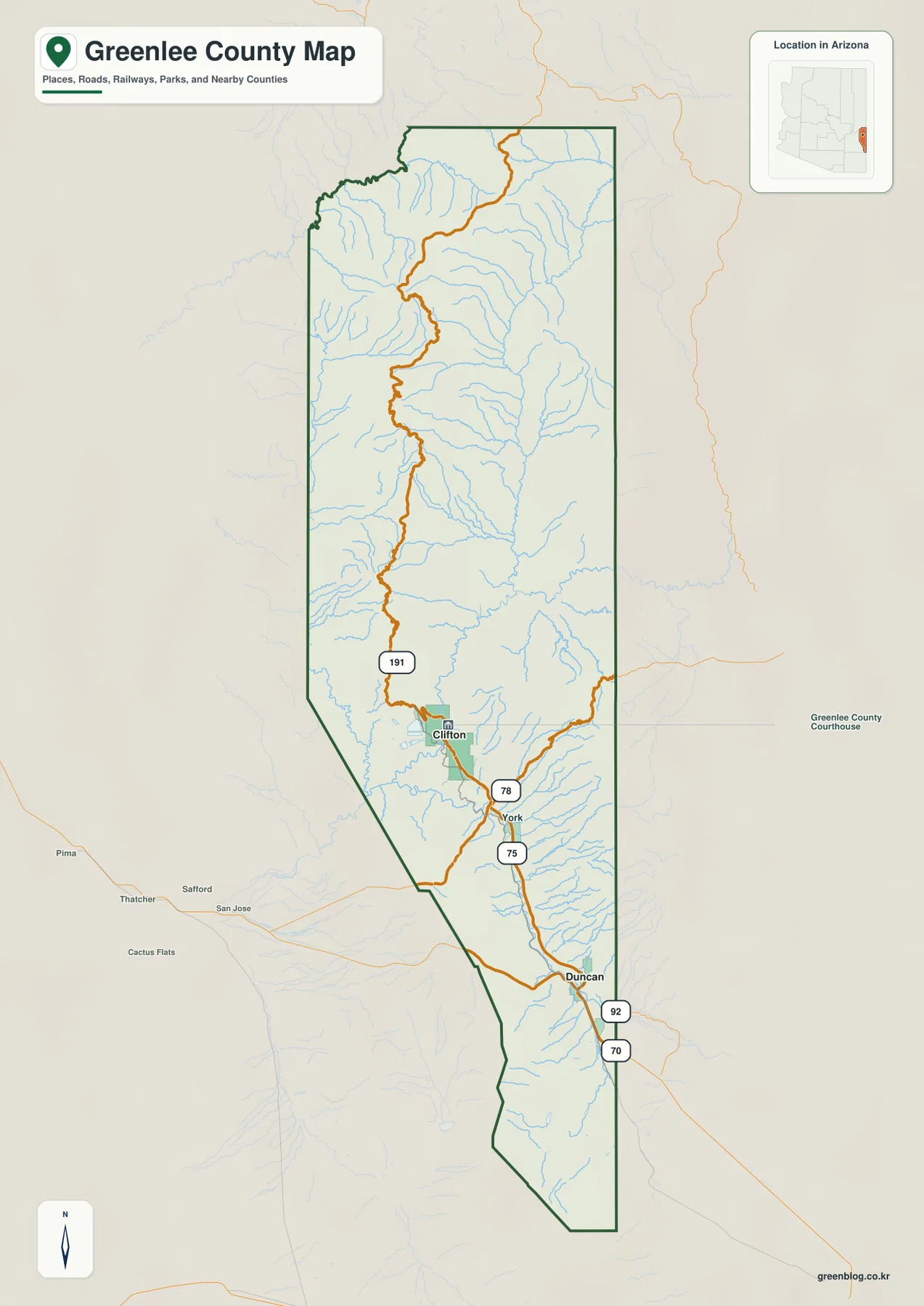
Greenlee County is easiest to understand as a long, narrow county with two very different halves. The north is dominated
Clifton to the High Country — A Greenlee County Map of Roads, Rivers, and Elevation Read More »
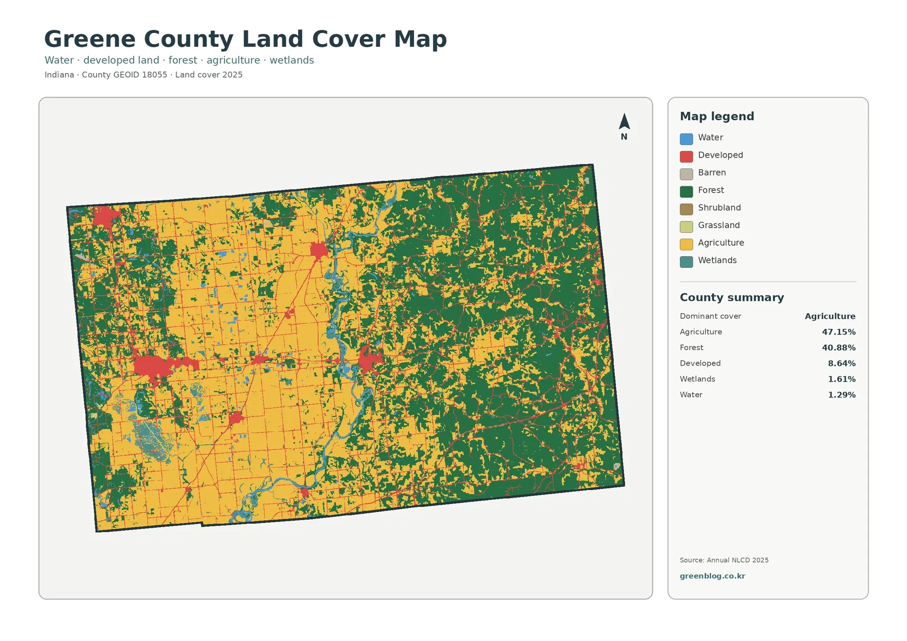
Greene County is one of the Indiana counties where the broad land-cover story cannot be reduced to a single dominant
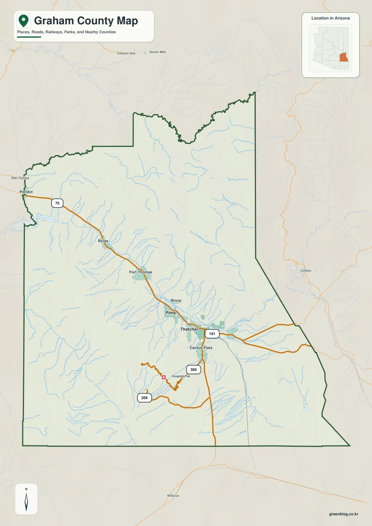
Graham County is easiest to understand as a broad landscape organized around a lower central corridor rather than as one
Safford and the Gila River Valley | Graham County Arizona Map Read More »
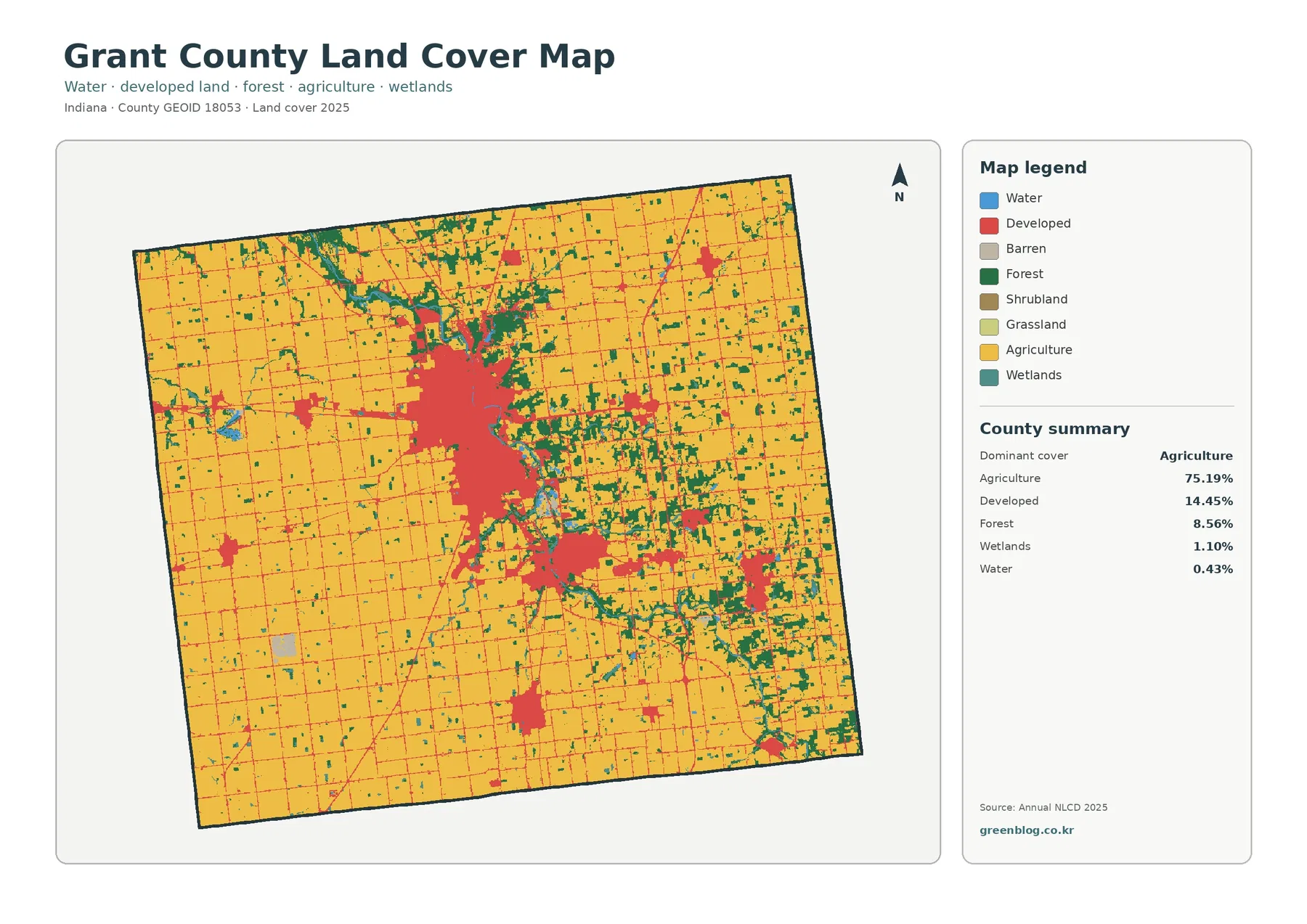
Grant County is overwhelmingly agricultural in the 2025 land-cover summary, with agriculture covering 75.19% of the county. The map is
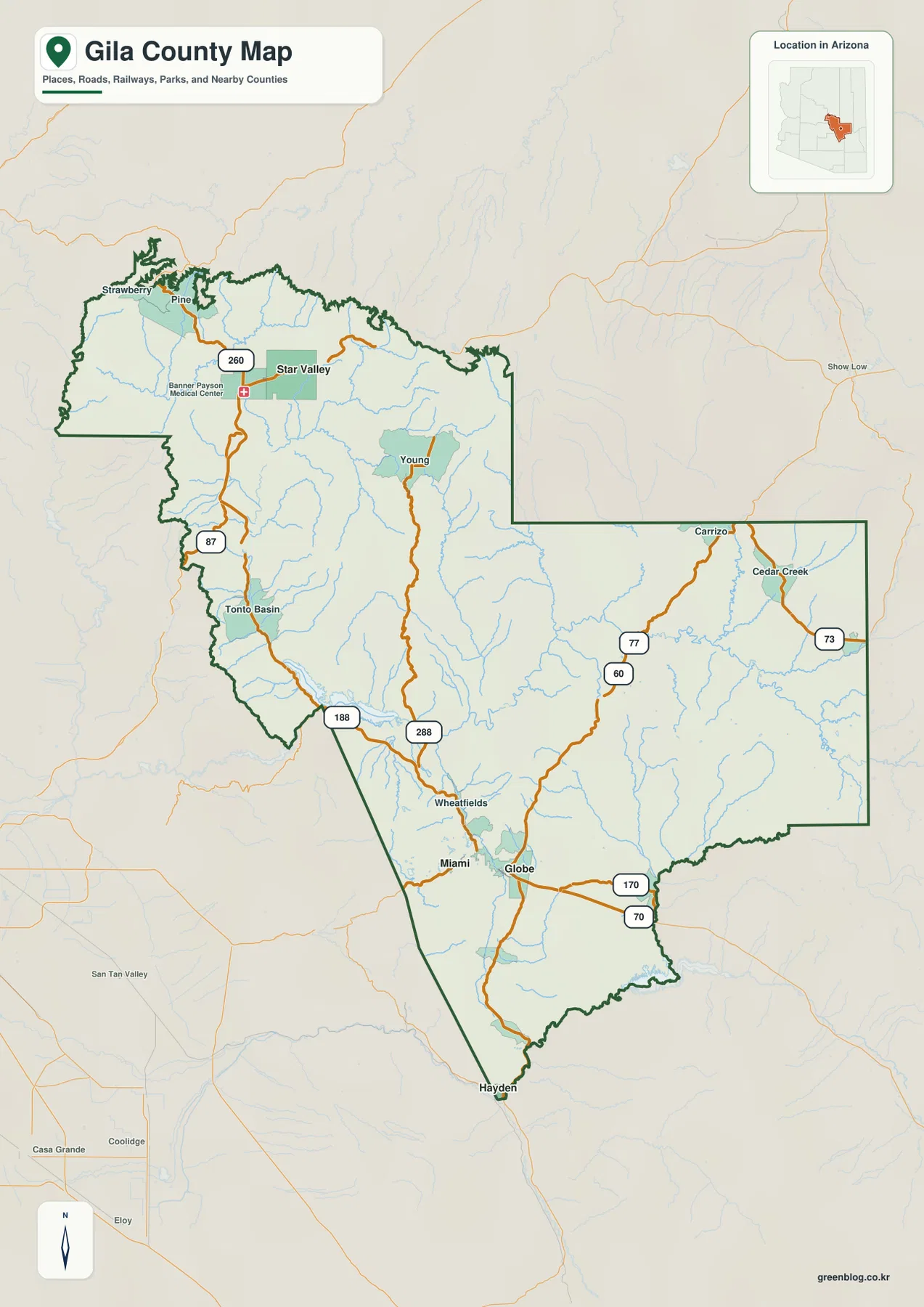
Gila County is not a compact urban county on the map. Its largest labeled communities are split between a northwest
Payson to Globe on the Gila County Map: Roosevelt Lake and Mountain Roads Read More »