
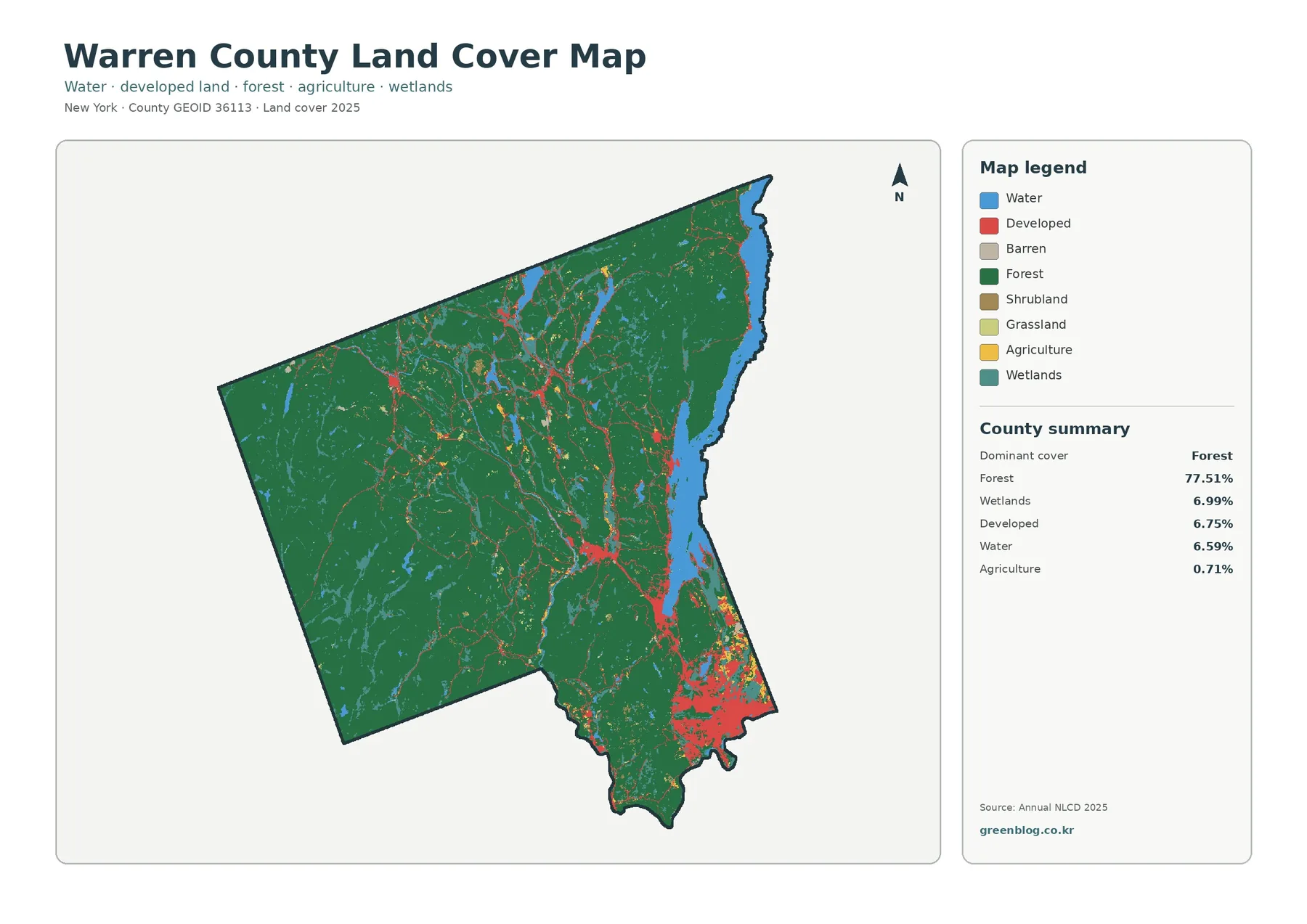
Warren County New York Land Cover Map: Adirondack Forest, Lake George, and the Developed South
Forest is the defining land-cover pattern in Warren County in 2025. It accounts for 77.51% of the county, while large
Forest is the defining land-cover pattern in Warren County in 2025. It accounts for 77.51% of the county, while large
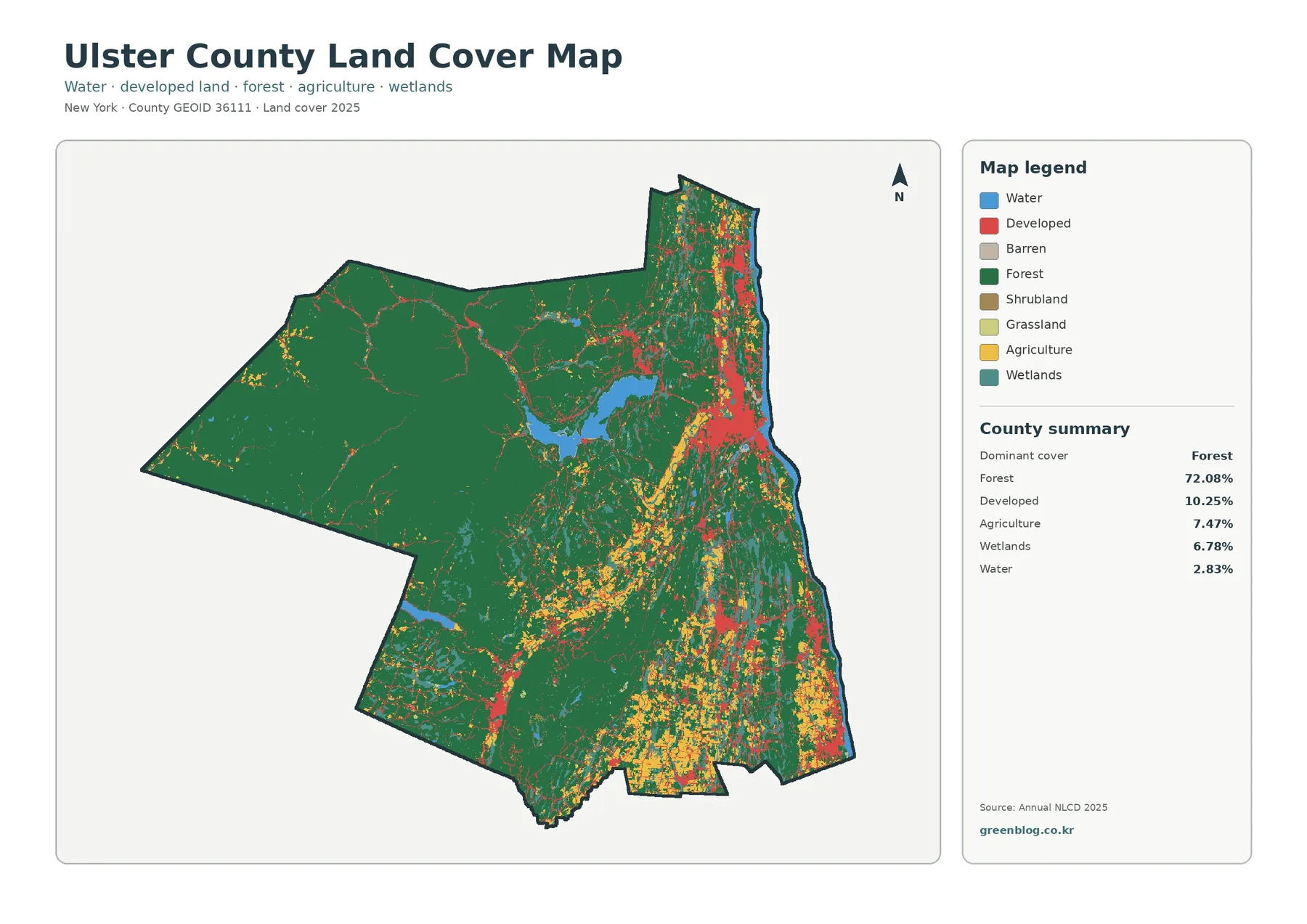
Forest is the defining land-cover pattern in Ulster County in the 2025 map set. It accounts for 72.08% of the
Ulster County New York Land Cover Map: Forest Majority and Eastern Developed Areas Read More »
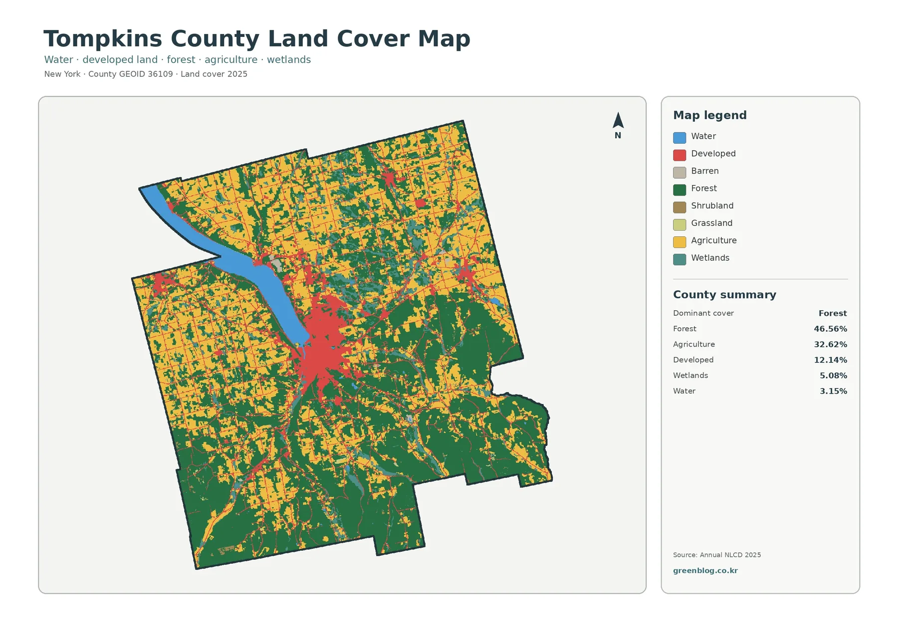
Tompkins County is a mixed forest-and-farm landscape in the 2025 classification rather than a county defined by one cover alone.
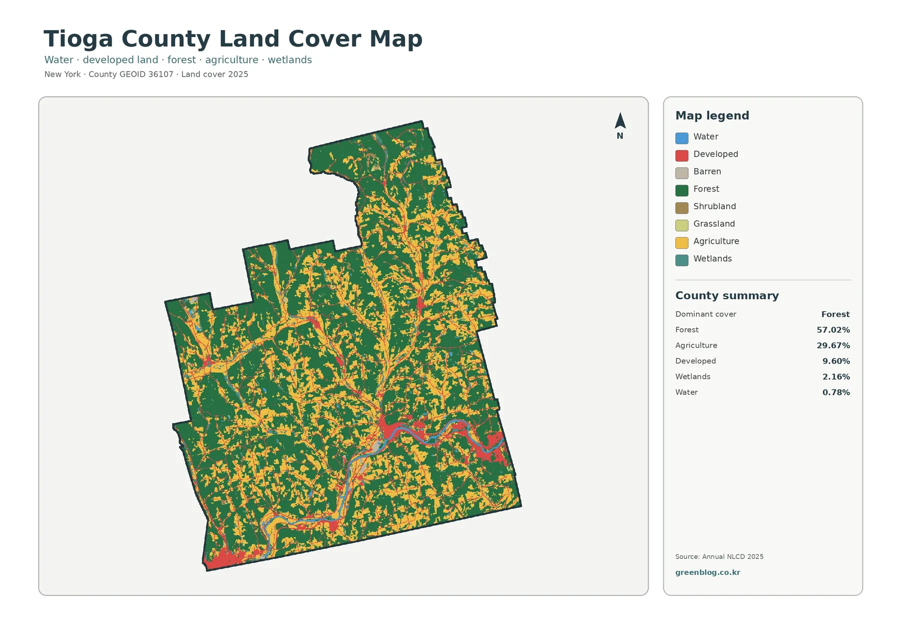
Tioga County has a strongly rural land-cover pattern in 2025: forest occupies 57.02% of the county, agriculture 29.67%, developed land
Tioga County New York Land Cover Map – Forested Uplands Around the Susquehanna Valley Read More »
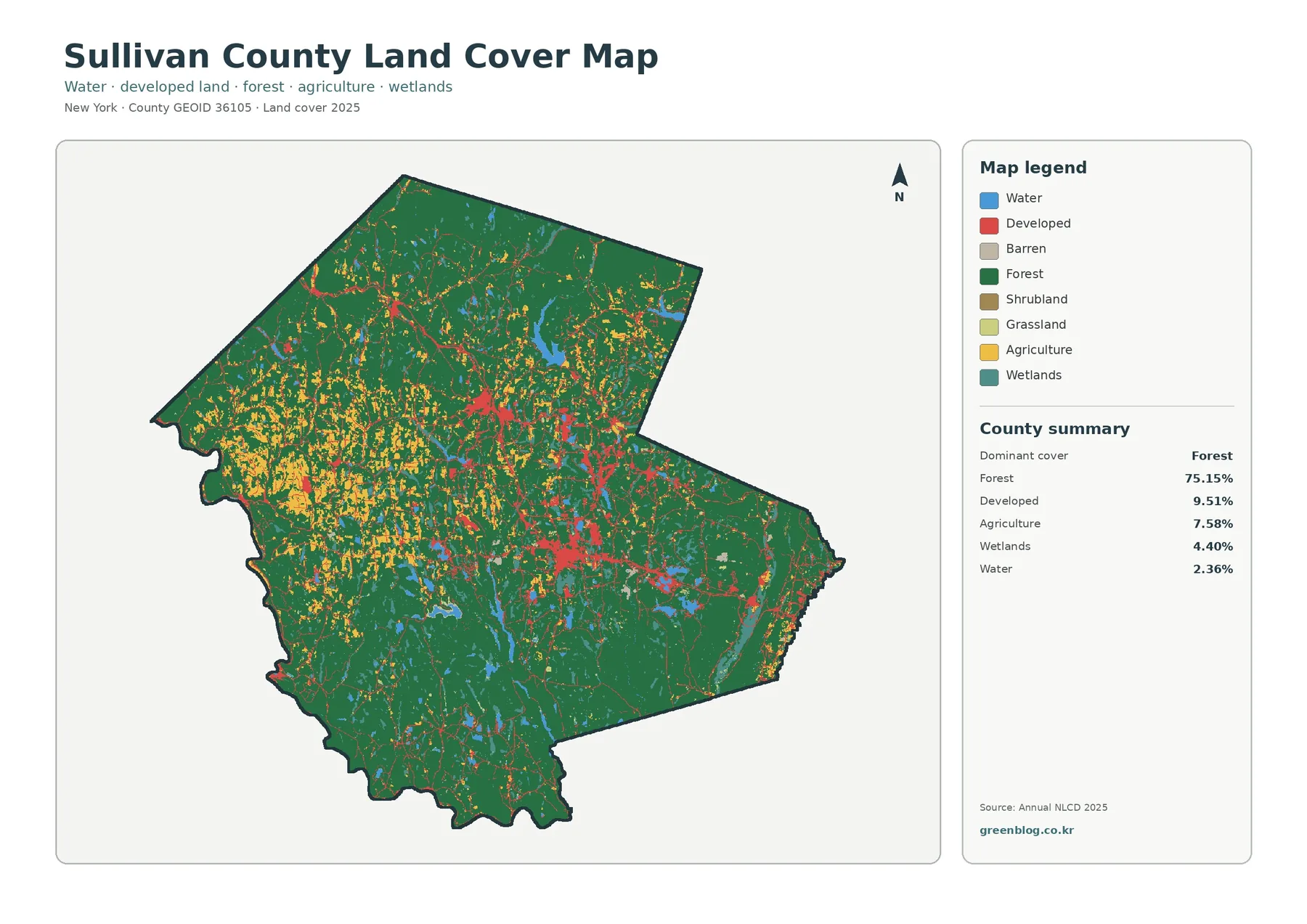
Forest sets the visual baseline for Sullivan County. In the supplied 2025 summary, forest covers 75.15 percent of the mapped
Sullivan County New York Land Cover Map — Catskill Forest & Developed Centers Read More »
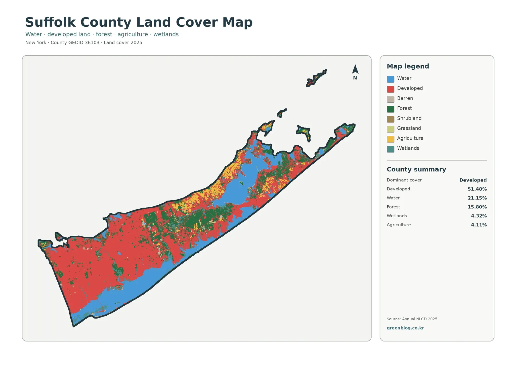
Suffolk County changes character markedly from west to east, and the 2025 land-cover data make that contrast easy to see.
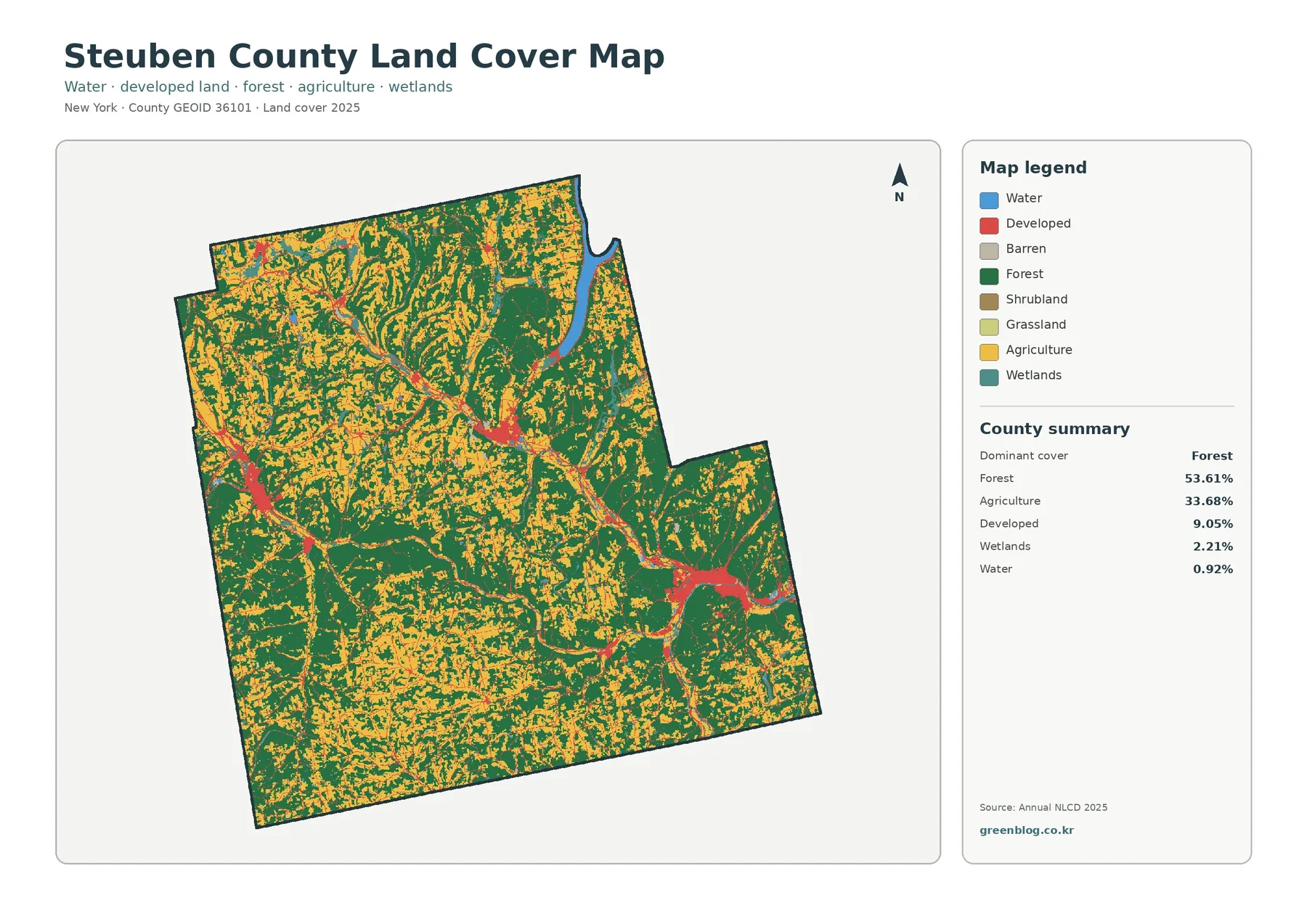
Steuben County’s 2025 land-cover pattern is defined by two large surfaces rather than one: forest covers 53.61% of the county
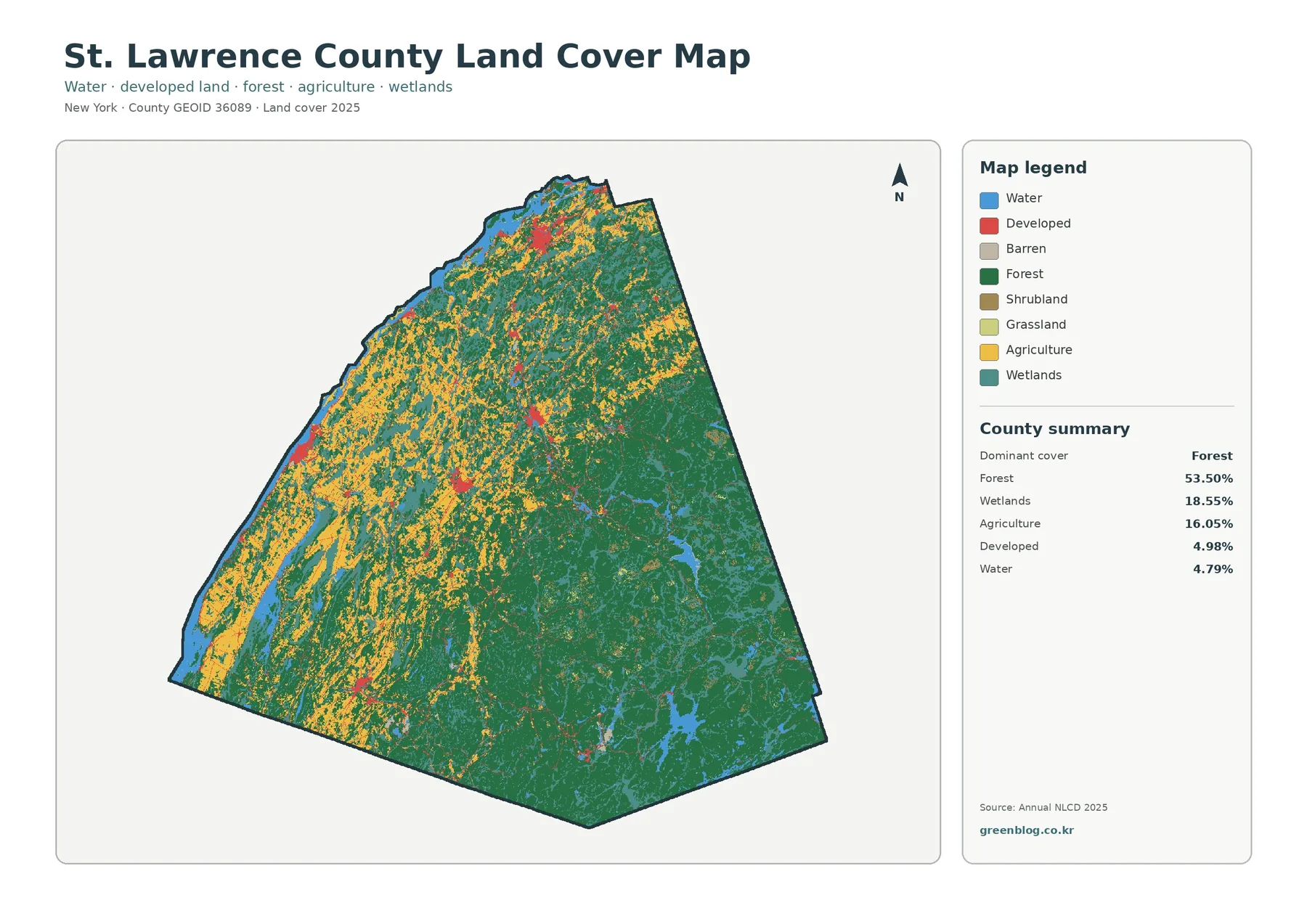
A single countywide average does not describe St. Lawrence County very well because its west and southeast look strikingly different.
St. Lawrence County New York Land Cover Map | Forest, Wetlands & River Lowlands Read More »
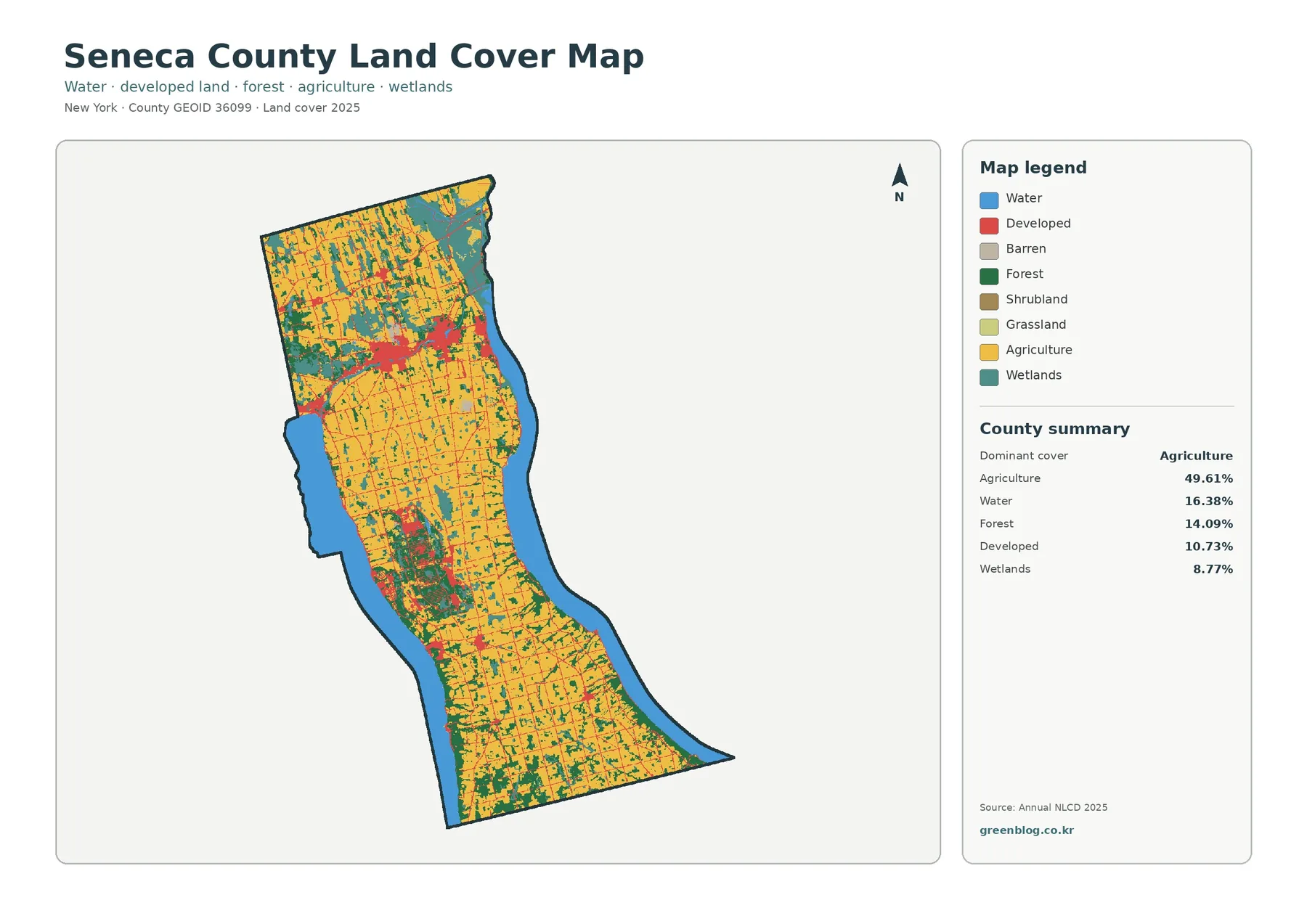
Seneca County has a map pattern that is easy to recognize before any numbers are read. Agriculture fills much of
Seneca County New York Land Cover Map: Farmland, Water and Northern Development Read More »