

Henderson County Illinois Land Cover Map — Western Water and Wetlands Beside a 72.38% Agricultural Interior
Henderson County, Illinois has a strongly agricultural interior, yet its western edge gives the county a much more varied land-cover
Henderson County, Illinois has a strongly agricultural interior, yet its western edge gives the county a much more varied land-cover
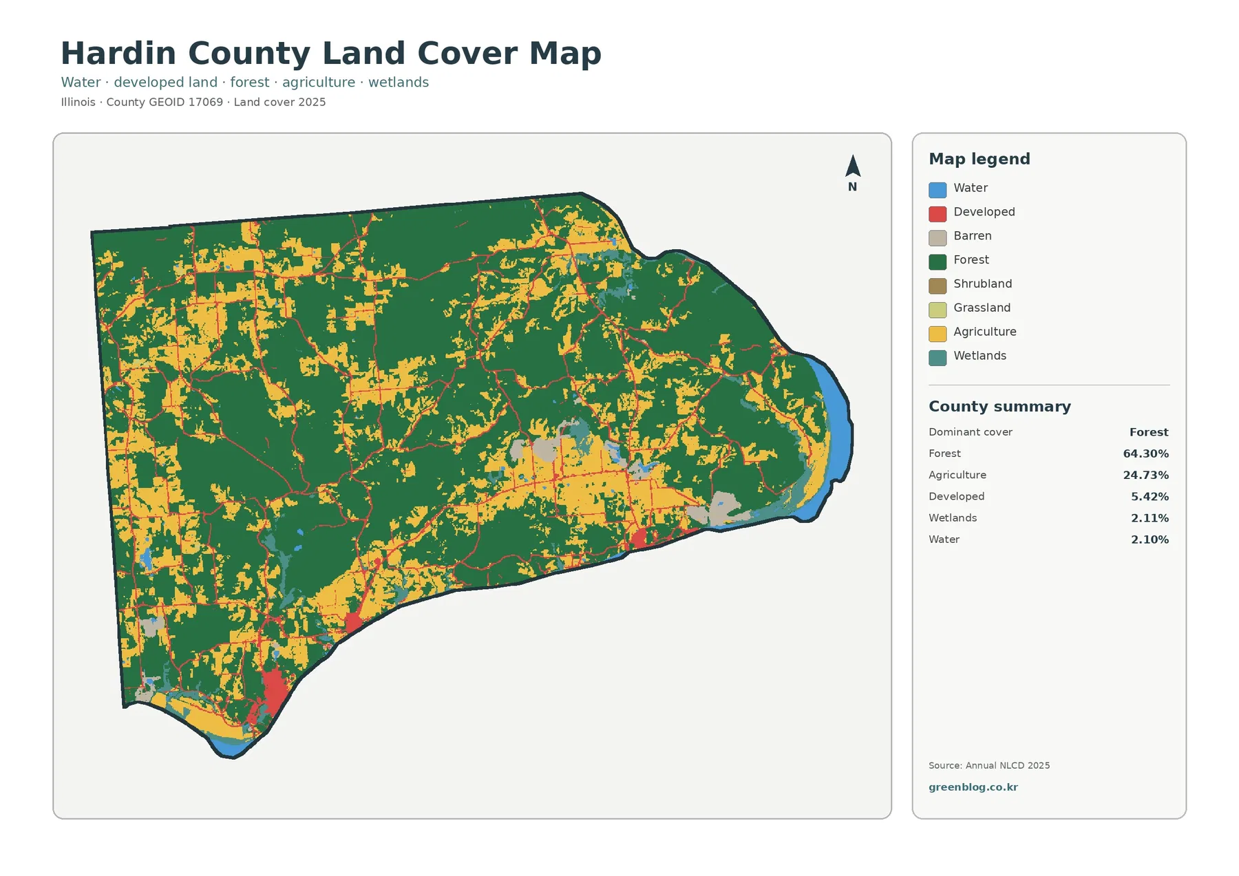
Hardin County, Illinois stands out for a forest share that covers nearly two-thirds of the 2025 map. Forest accounts for
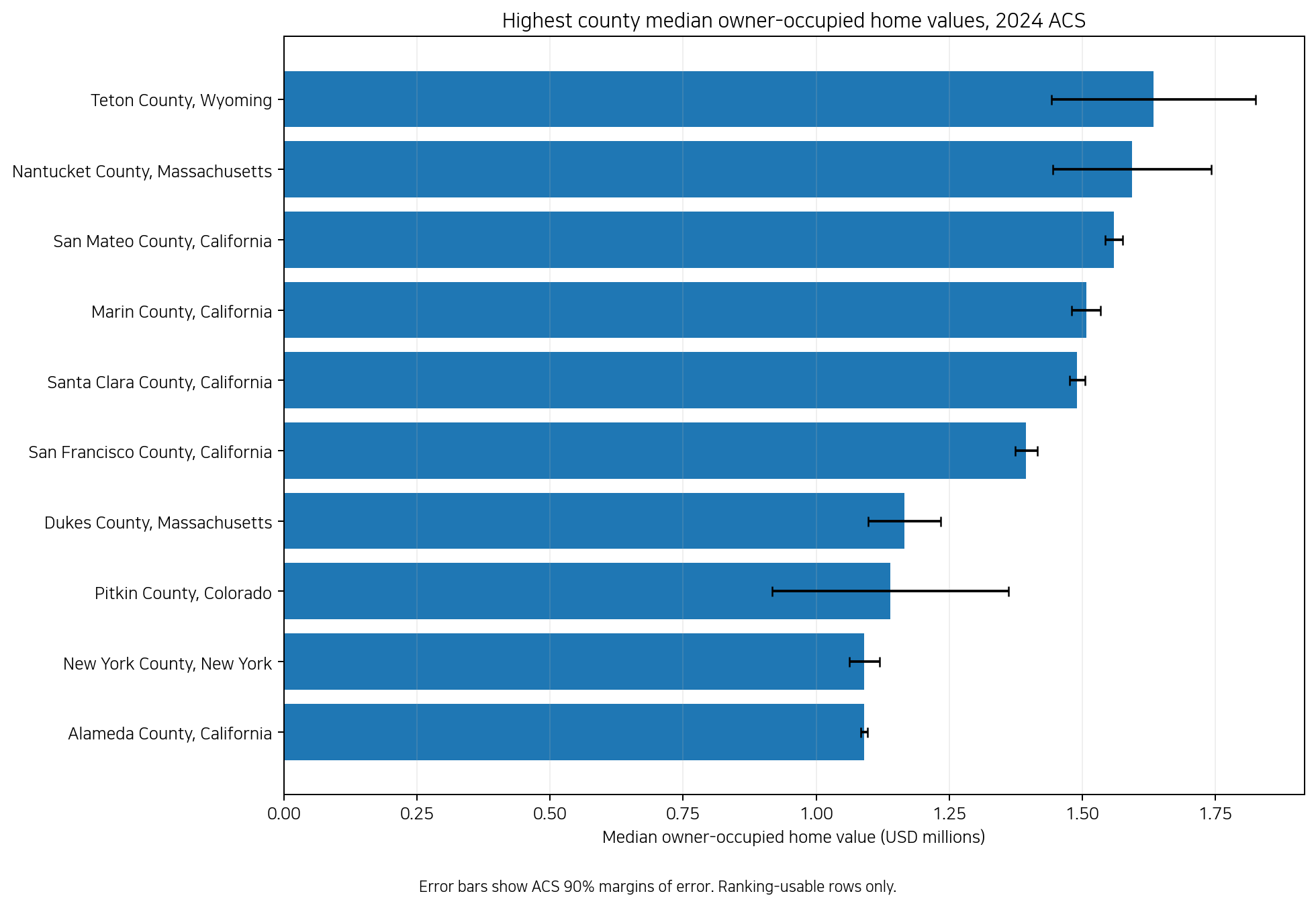
A county-by-county comparison of 2024 ACS median owner-occupied home value, with national distribution, neighboring contrasts, state summaries, and survey uncertainty.
U.S. County Median Home Values in 2024 – ACS Regional Gaps Read More »
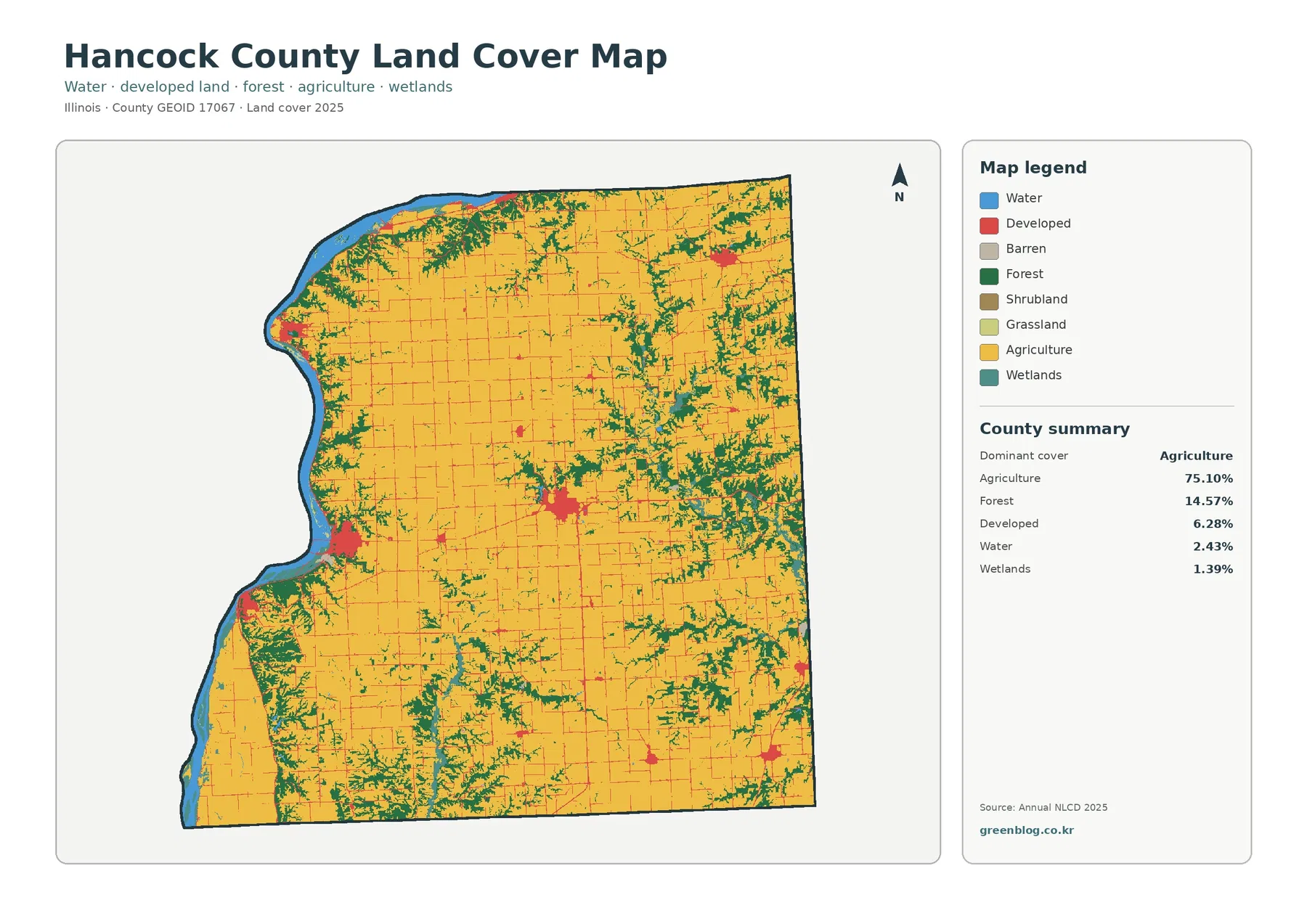
Hancock County, Illinois has a strongly agricultural 2025 land-cover pattern, but the western edge changes the picture. Agriculture covers 75.10%
Hancock County Illinois Land Cover Map | Farms & Mississippi River Forest Read More »
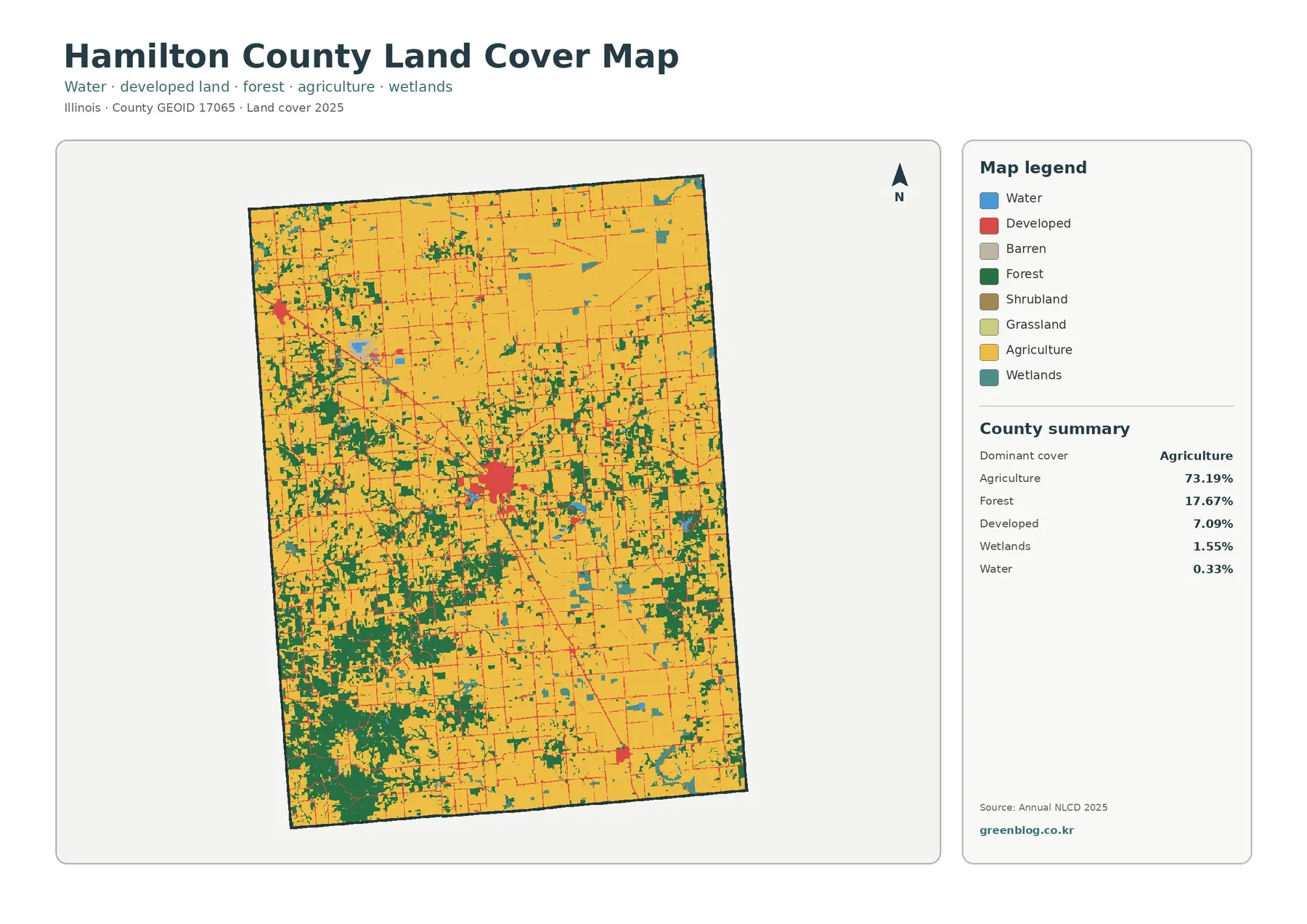
Hamilton County, Illinois is dominated by agricultural cover, but the map does not look uniform from one end of the
Hamilton County Illinois Land Cover Map — Farm-Dominant North and a Wooded Southwest Read More »
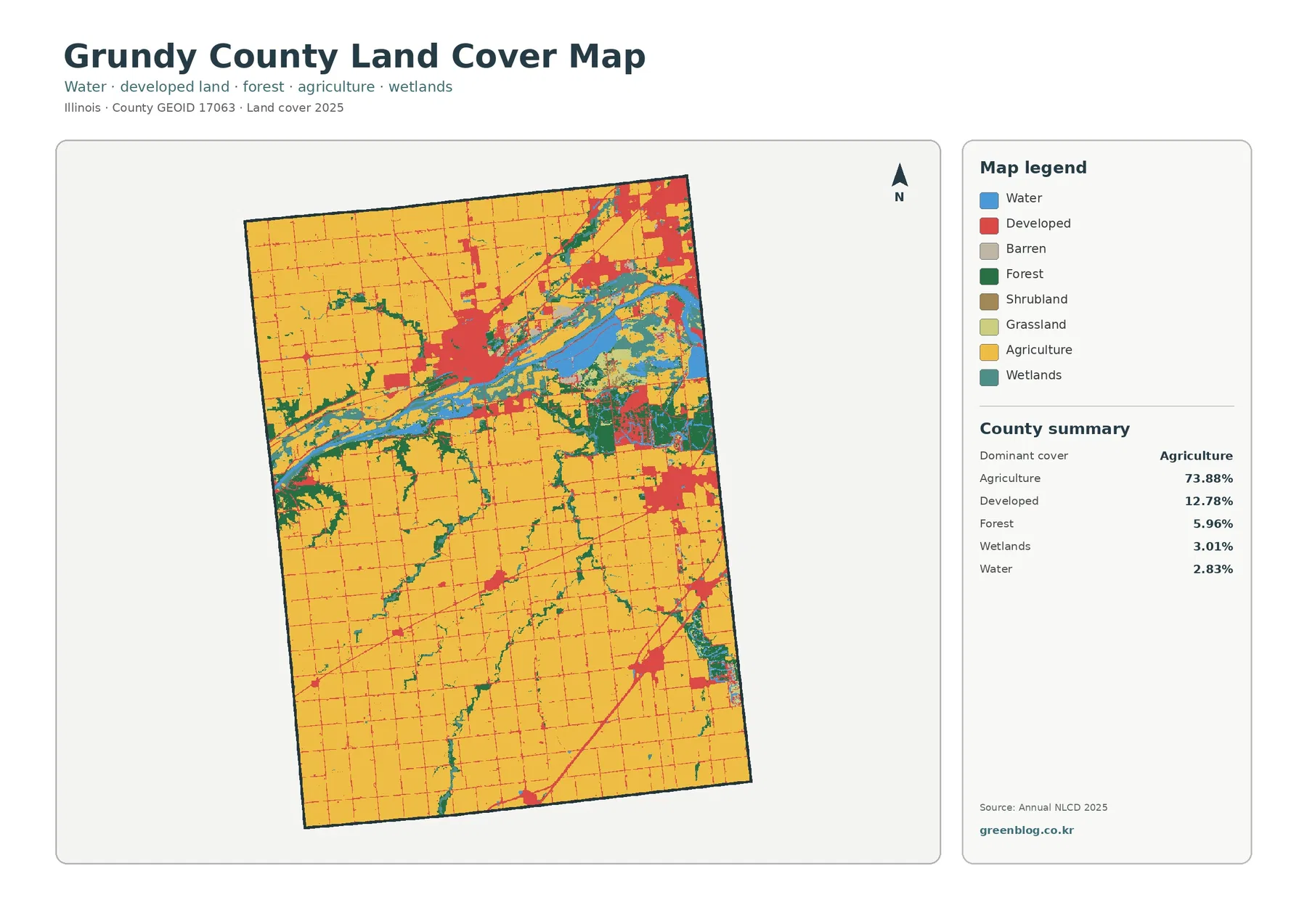
Grundy County combines a broad agricultural landscape with a much more complex northern river corridor. The 2025 summary lists agriculture
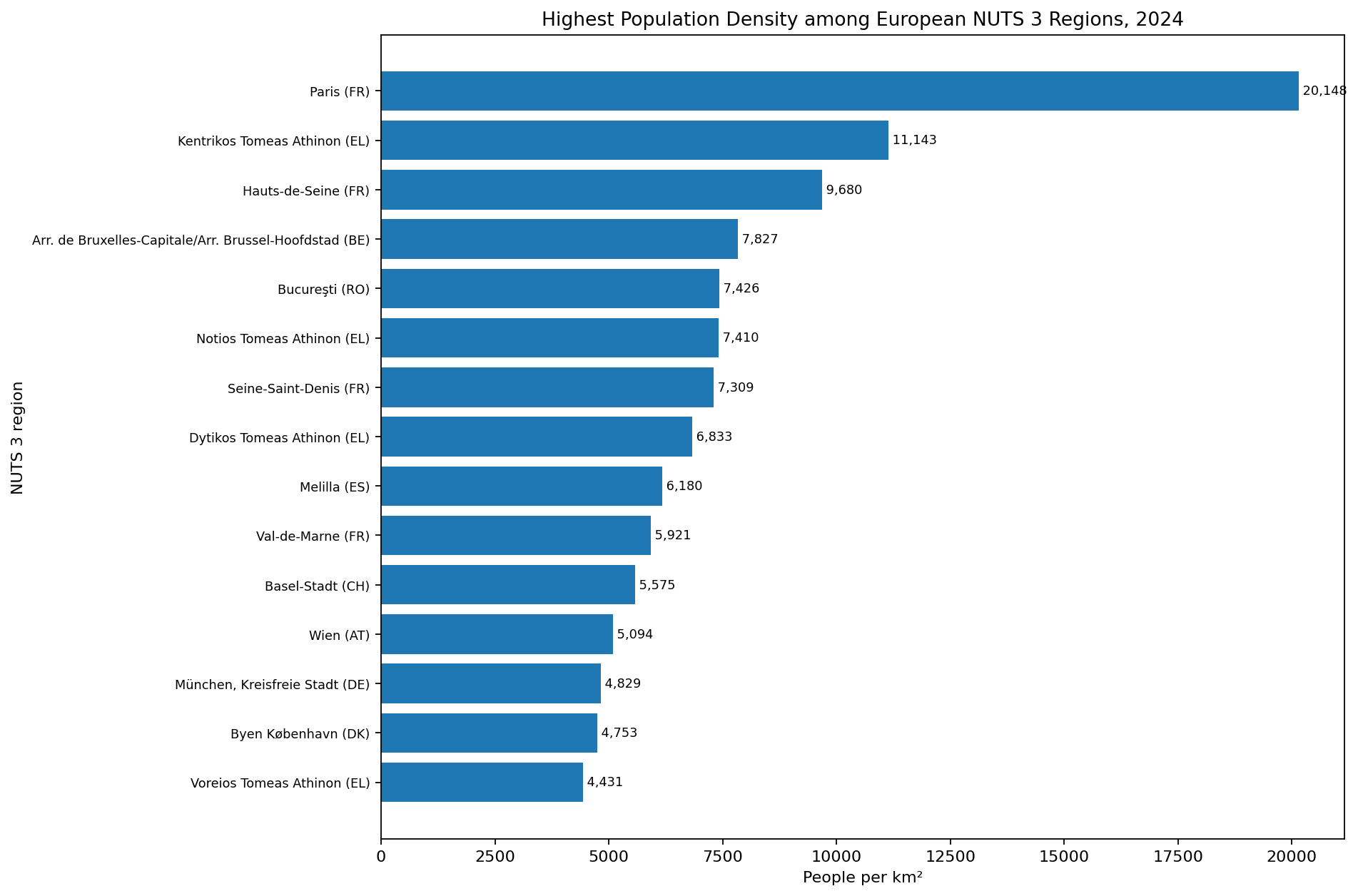
A 2024 Eurostat comparison of population density across 1,279 NUTS 3 regions, including regional extremes and changes from 2023.
Population Density Across European NUTS 3 Regions in 2024 Read More »
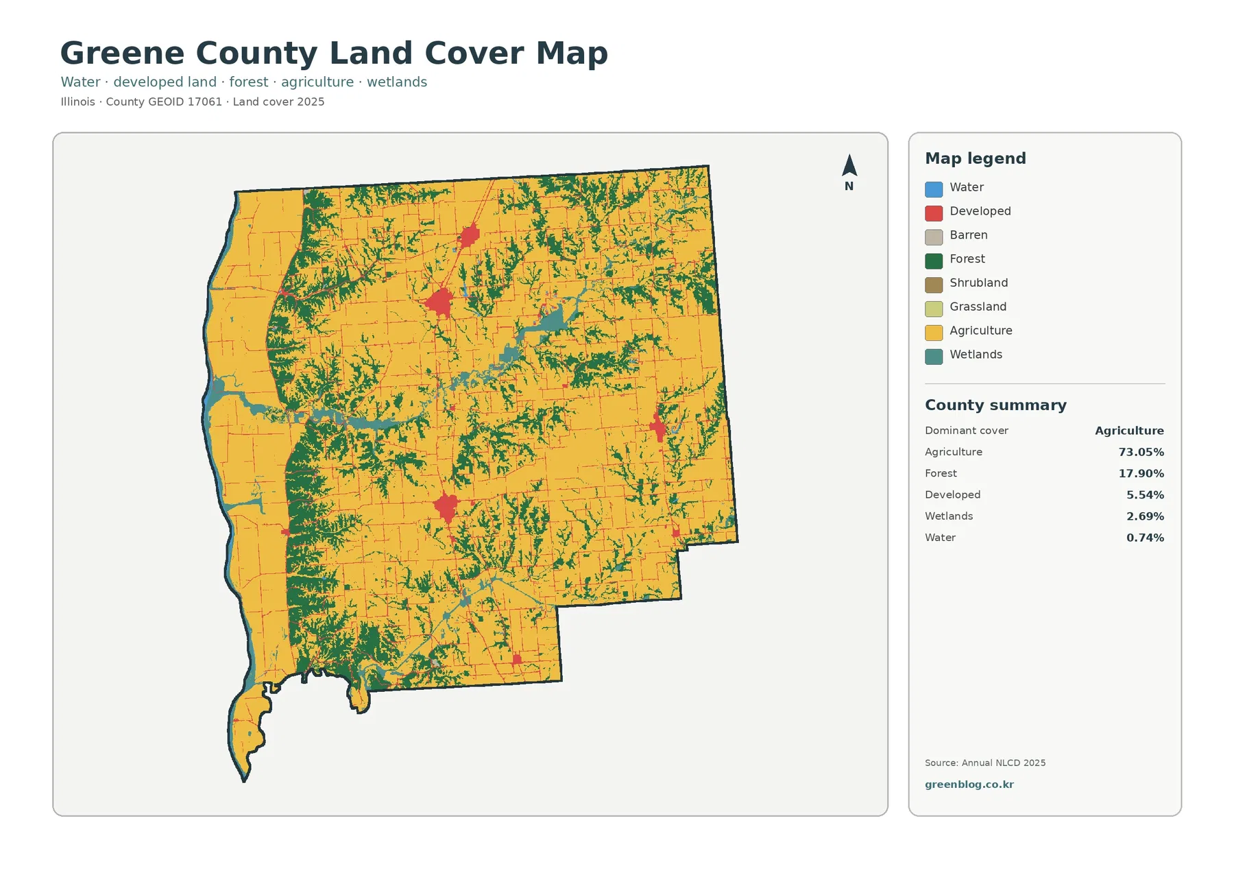
Greene County is dominated by agriculture in the 2025 land-cover data, but the county does not read as one uninterrupted
Greene County Illinois Land Cover Map — River-Edge Wetlands and 17.90% Wooded Cover Read More »
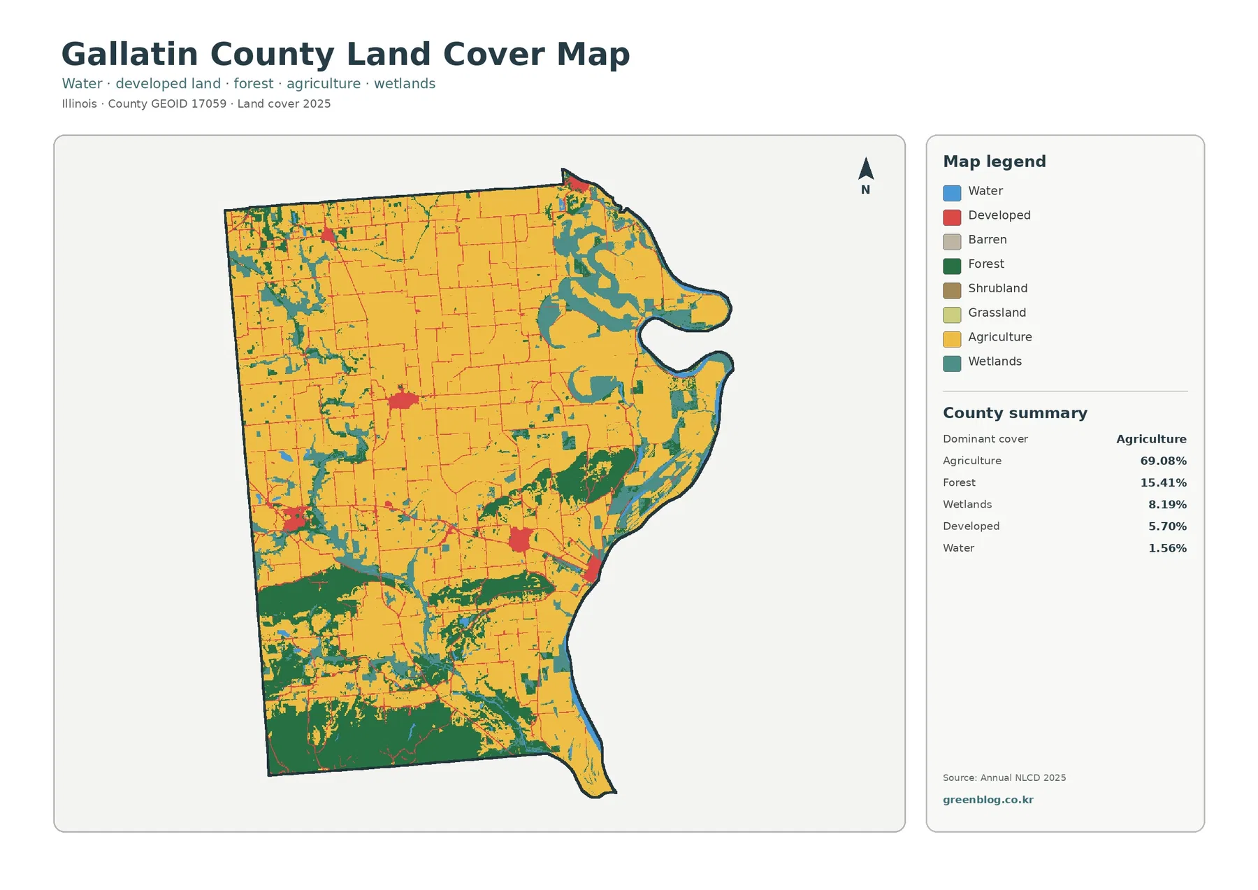
Gallatin County, Illinois, is mostly agricultural on the 2025 land-cover map, but the county is not a uniform sheet of