
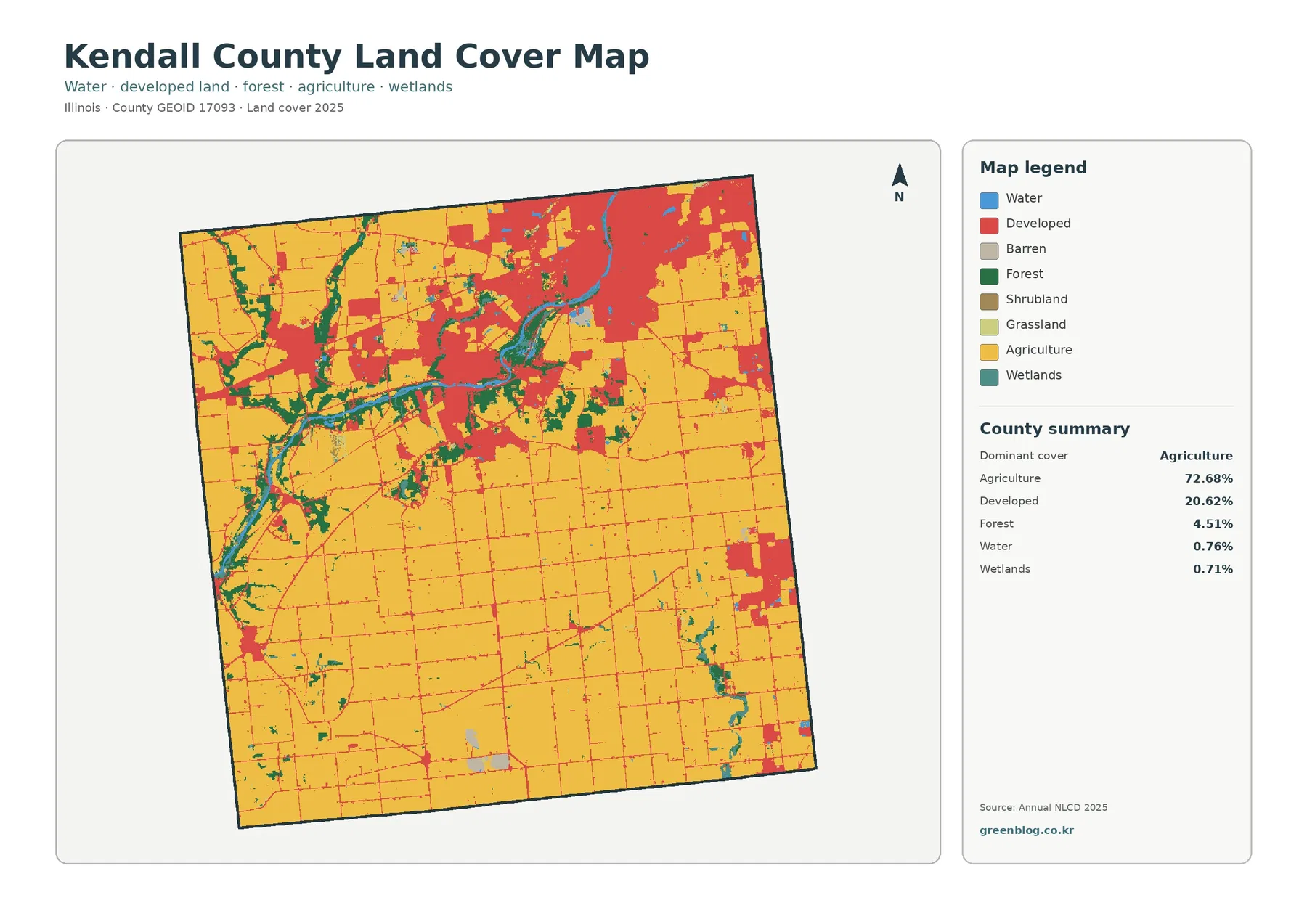
Kendall County Illinois Land Cover Map — Agricultural South, Developed Northeast, and a Mixed Central Belt
Kendall County, Illinois has a clear split in its 2025 land-cover pattern. Agriculture covers 72.68% and dominates the south, while
Kendall County, Illinois has a clear split in its 2025 land-cover pattern. Agriculture covers 72.68% and dominates the south, while
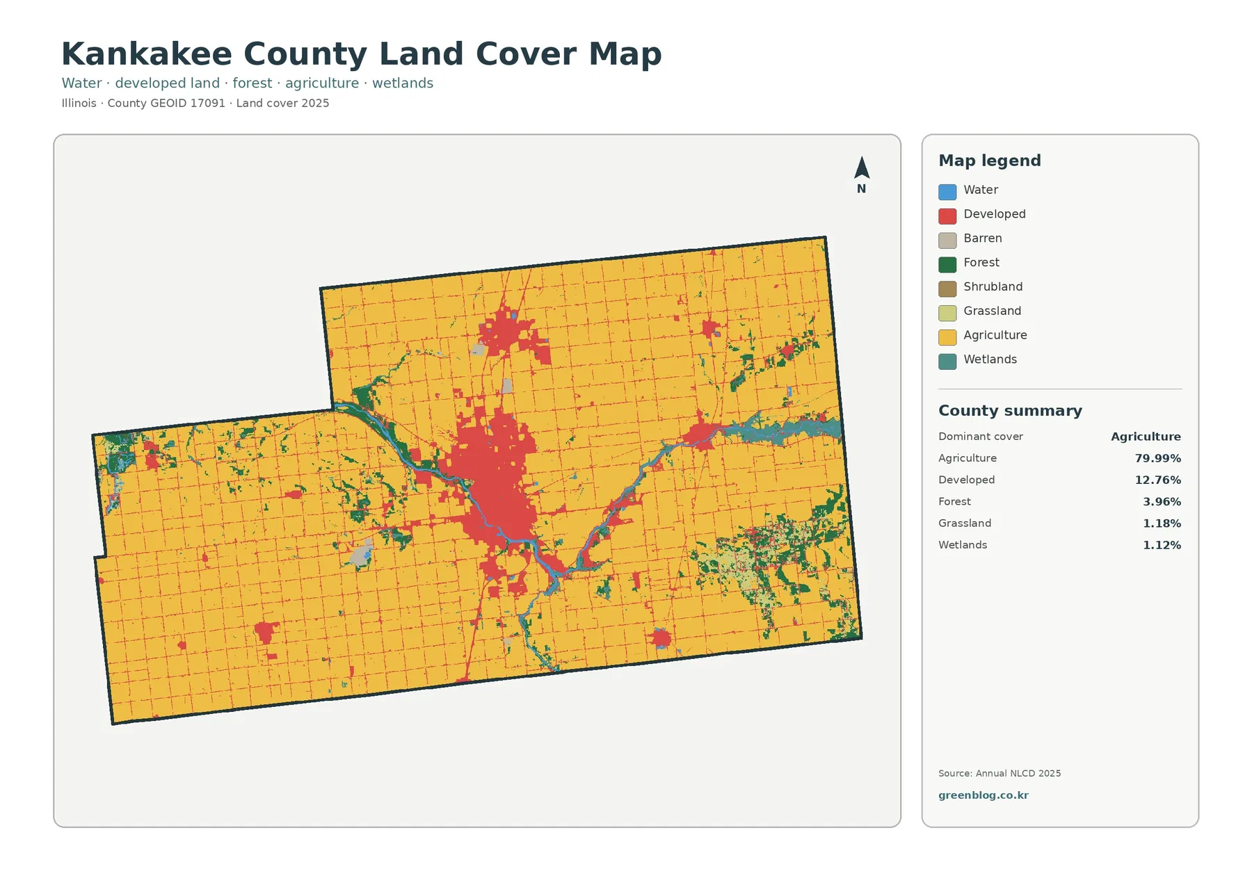
Kankakee County, Illinois is overwhelmingly agricultural in the 2025 land-cover summary, with agriculture accounting for 79.99%. Developed land is the
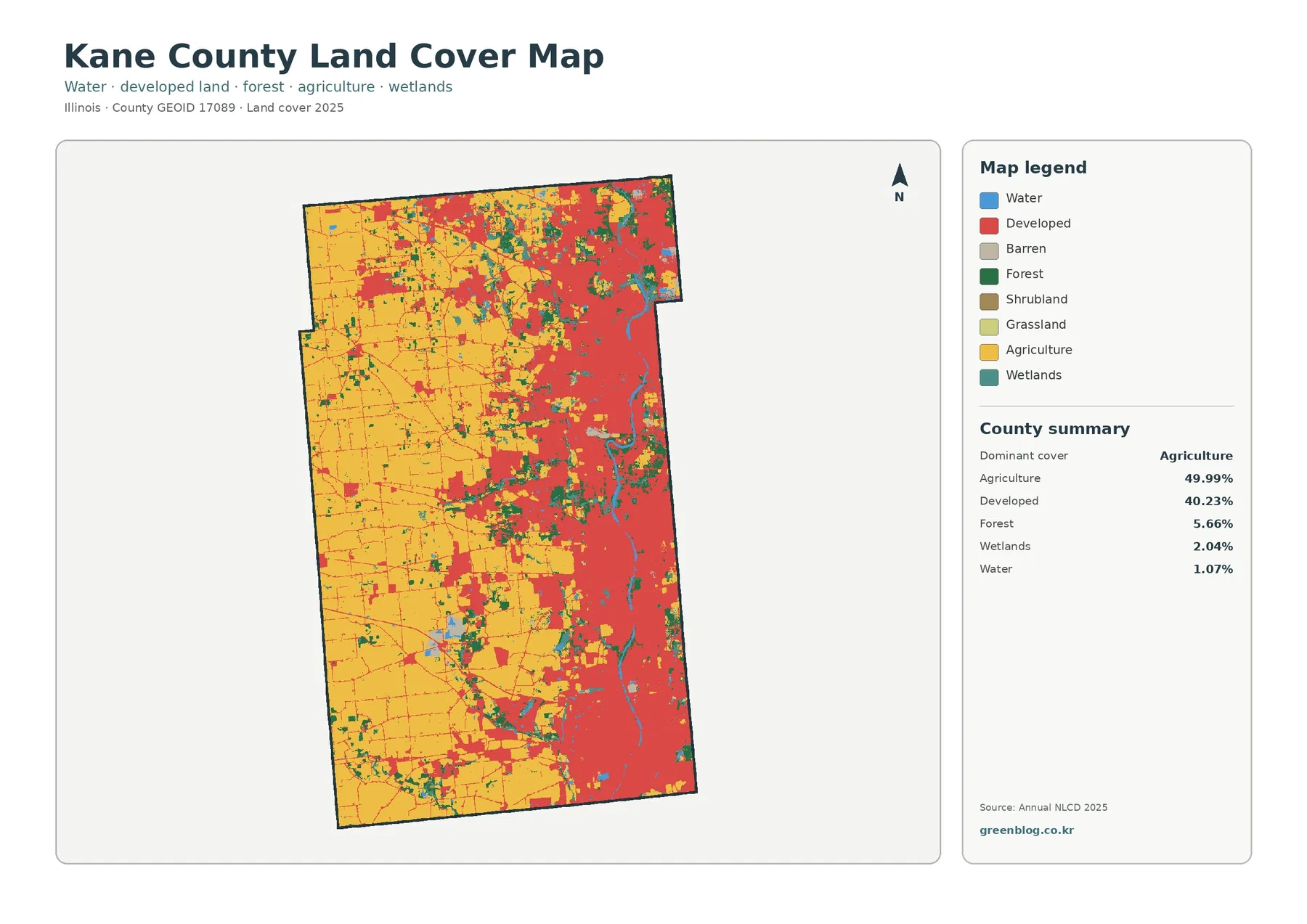
Kane County, Illinois has one of the clearest east-west land-cover contrasts in this county map series. Agriculture is the largest
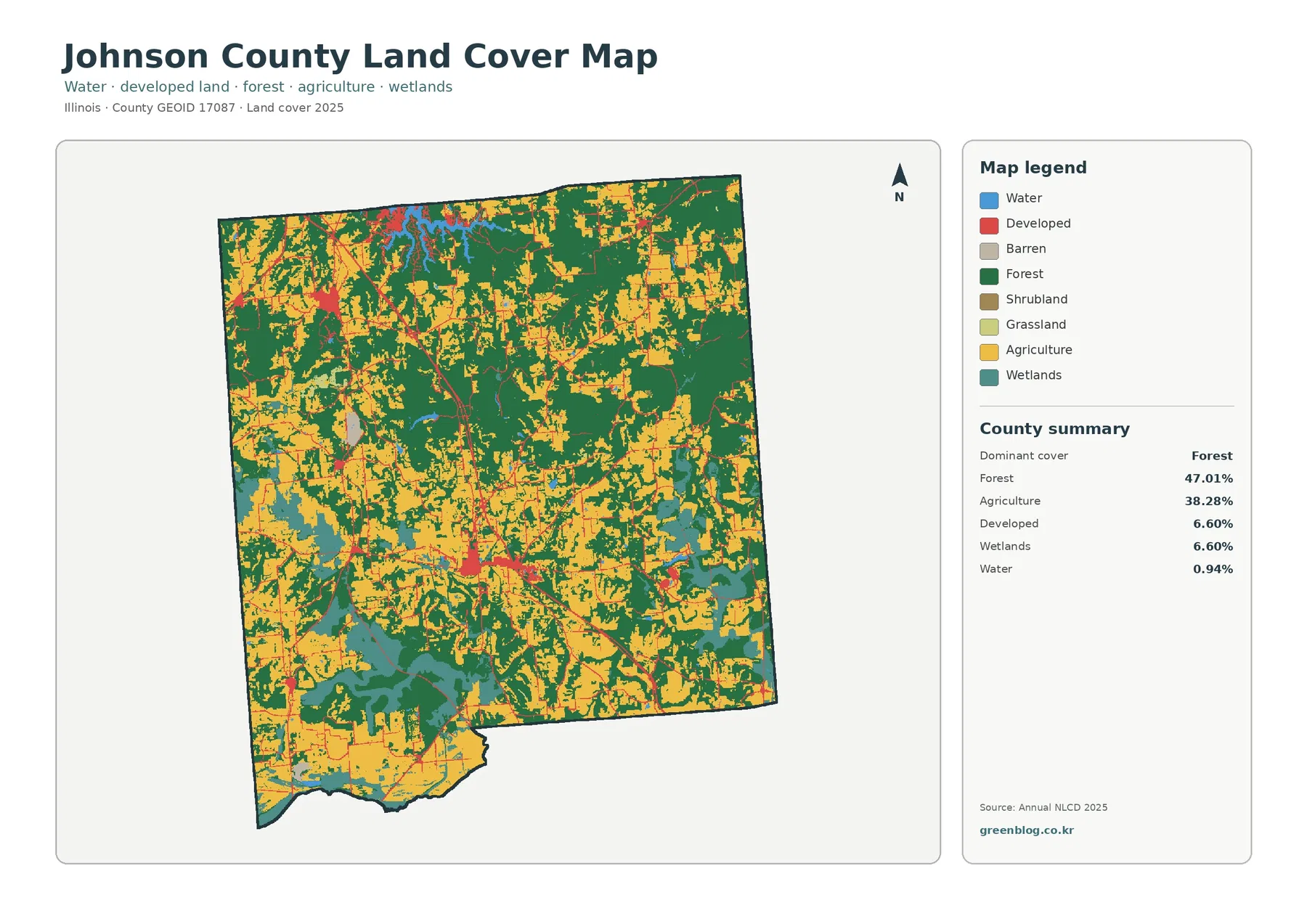
Johnson County, Illinois is one of the more forest-oriented counties in this map set. Forest accounts for 47.01% of the
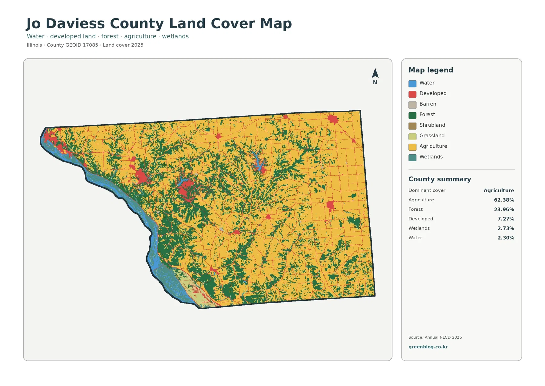
Jo Daviess County, Illinois has a farm-dominant 2025 land-cover mix, but the western half is broken up by extensive forest
Jo Daviess County Illinois Land Cover Map | 2025 Cover & Change Read More »
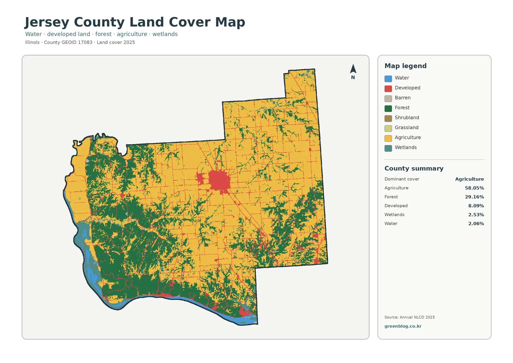
Jersey County, Illinois combines a large agricultural interior with a much more wooded southwest and a visible band of water
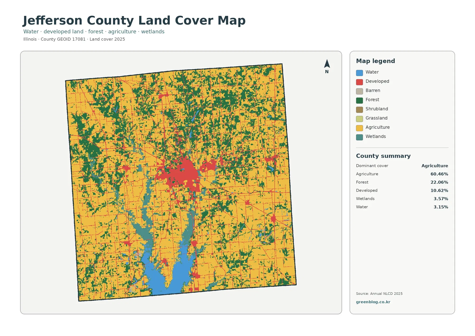
Jefferson County, Illinois has a mixed 2025 land-cover pattern rather than a single uninterrupted agricultural surface. Agriculture is the largest
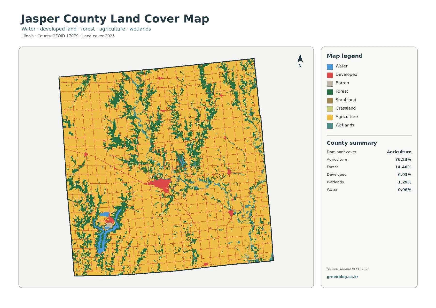
Jasper County, Illinois is overwhelmingly agricultural, but the 2025 map is more varied than the 76.23% agriculture figure suggests. Forest
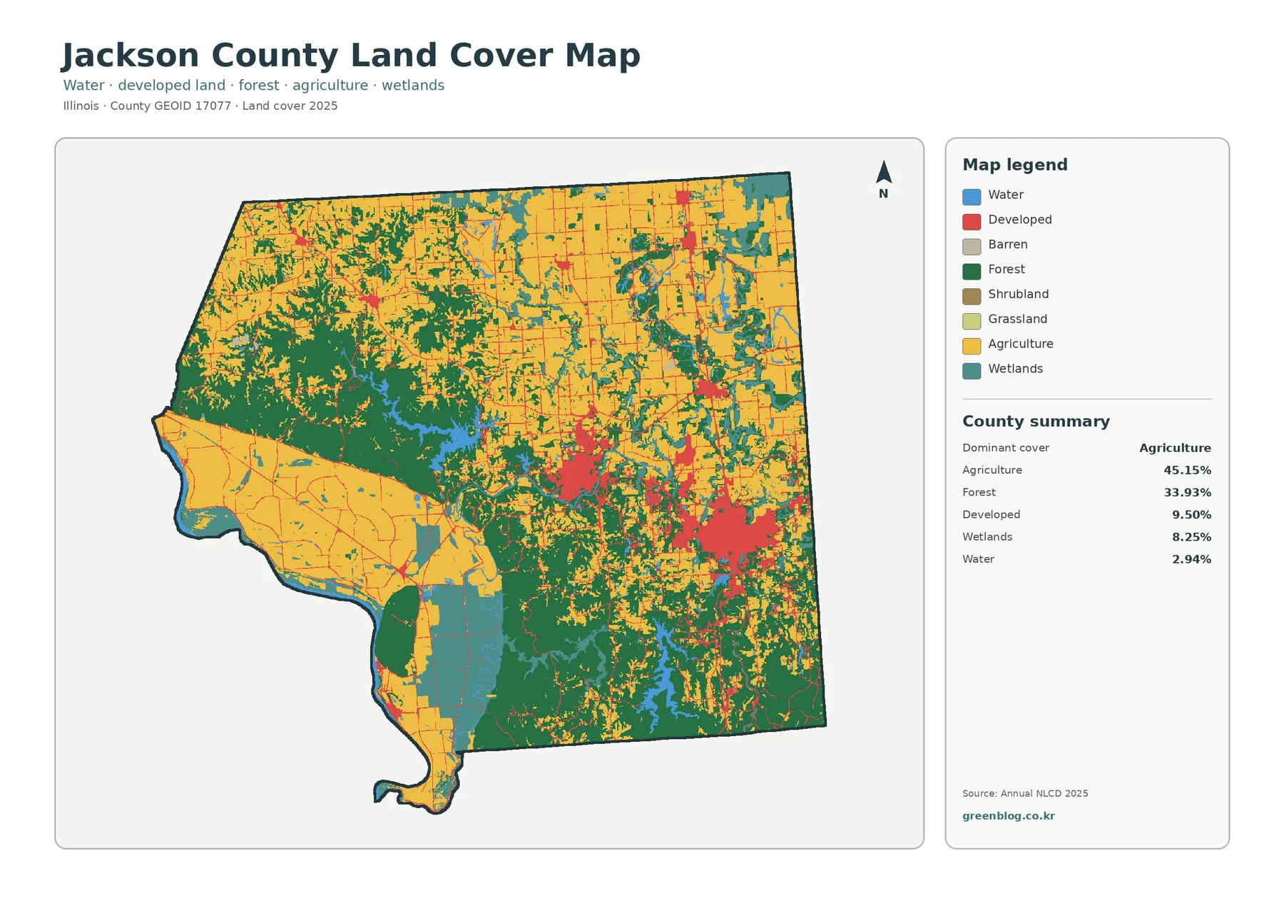
Jackson County, Illinois stands out because agriculture and forest both occupy large shares of the county rather than one class