Looking for a clear way to understand how Mexico’s regions relate to each other can be harder than expected. Many available maps are small, unclear, or missing reliable sources. This Mexico maps download collection was created to offer a large, readable reference that focuses on regional layout rather than extra decoration, making it easier to follow areas, names, and boundaries while reading or preparing materials.
Table of Contents
Why This Map Was Compiled
While searching for Mexico-related materials, it became clear that well-organized maps in Korean or high resolution were surprisingly limited. Many files lacked clarity when zoomed in, or their sources were unclear. This led to the decision to build a set of maps directly, keeping the focus on size, clarity, and everyday usability rather than visual effects.
The goal was not to create a decorative image, but a practical reference that feels comfortable to use while writing, organizing notes, or preparing visual materials.
Basic Country Context for Reading the Map
Mexico, officially known as the United Mexican States, is located in the southern part of North America. It borders the United States to the north, Guatemala and Belize to the southeast, the Pacific Ocean to the west, and the Gulf of Mexico and Caribbean Sea to the east.
With a land area of about 1,964,375 square kilometers and a population of roughly 129 million, Mexico’s regions vary greatly in size and shape. Keeping this context in mind helps when reading regional spacing, boundary lines, and naming placement on the map.
How the Map Is Structured
To keep the map easy to read, unnecessary visual elements were reduced. Regional boundaries are marked clearly, and surrounding countries are shown in muted tones so Mexico remains visually central. Region names vary in length, so text sizes were adjusted by area to avoid overlap and improve readability.
All maps were created in a large A3-friendly resolution, allowing zooming or printing without blurred lines or unreadable labels. Region names appear in Korean alongside Spanish names used locally in Mexico, helping readers connect locations with real-world naming.
1️⃣ Mexico Map(Color Version)
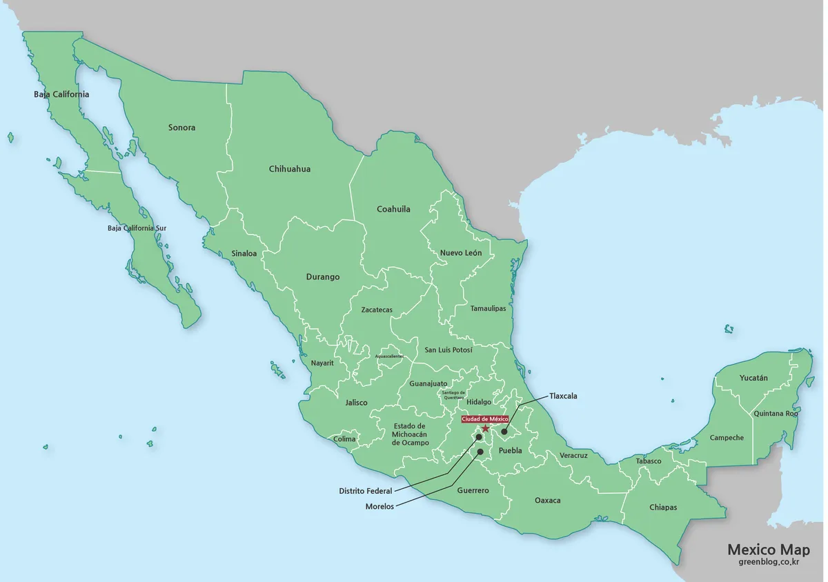
This version focuses on making regional divisions easy to follow at a glance. White boundary lines separate regions clearly, while nearby countries are shown in gray to give spatial context without distraction. The balance between color and restraint helps the overall shape of Mexico feel natural rather than crowded.
Even smaller regions remain readable when viewed at full size. When zoomed in after download, text and lines remain sharp, making this version useful for reference while writing or organizing content.
Section Summary
- Clear boundary lines help follow regional separation without visual overload
- Neighboring countries remain visible while keeping Mexico visually dominant
- Mixed Korean and Spanish labels support location recognition during reading
2️⃣ Black and White Version
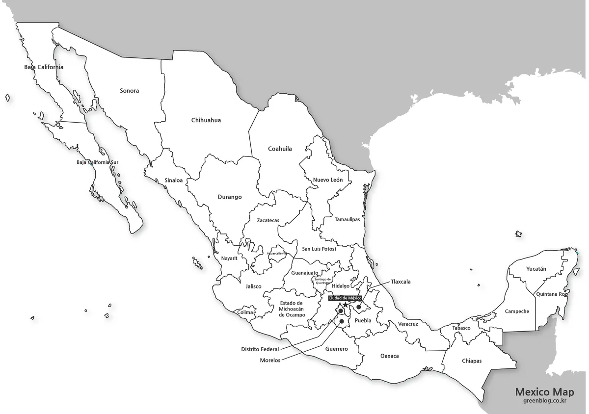
Some users prefer a simpler look, especially when printing or adding notes. This version removes color entirely, leaving only text and boundary lines. As a result, regions stand out more clearly on paper, and ink usage stays low when printing multiple pages.
Because the structure is simple, this version works well for adding custom marks, colors, or numbers in image editors. It also suits situations where the map acts as a base layer rather than a finished visual.
Section Summary
- Simple tones improve legibility when printed or photocopied
- Low ink usage supports repeated printing for meetings or classes
- Clean base layout allows easy addition of custom markings
3️⃣ Outline Version for Editing
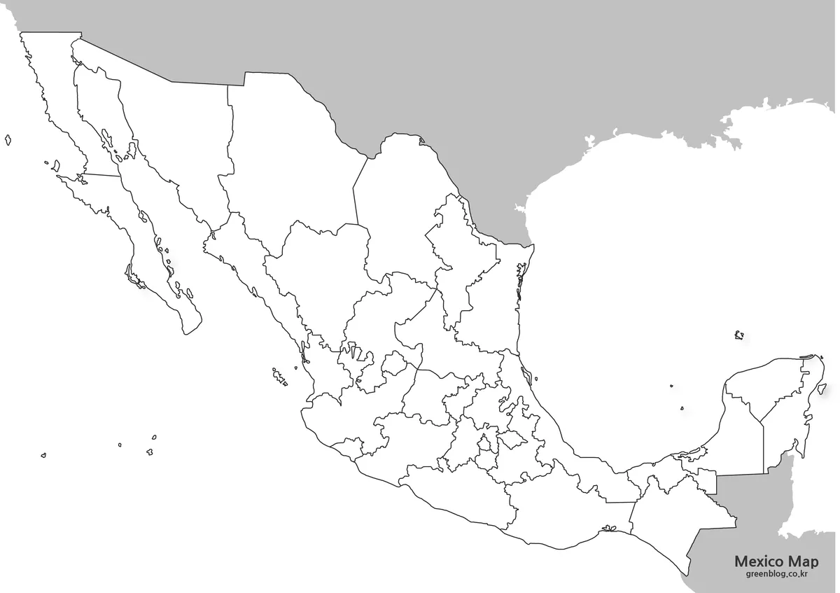
This version removes all text, color, and background elements, leaving only the outer and internal boundary lines. It was prepared for people who need full control over labels, colors, or emphasis when building custom visuals.
Because only outlines remain, it is easy to adapt this map for statistics, language changes, or selective highlighting. The clean structure helps users focus on adding information without working around existing design elements.
Section Summary
- Outline-only layout supports flexible graphic editing workflows
- Region names can be replaced or added in any language
- Works well as a base for charts, visuals, or custom layouts
Practical Contexts for Using the Map
- A student viewing Mexico’s regional layout for the first time
- A teacher explaining North American geography during class
- A planner preparing comparison materials between countries
- A blogger organizing regional references inside written content
- A presenter printing copies to add handwritten notes
Frequently Asked Questions
Can I print the maps without losing quality?
Yes. All maps were created in a large A3-friendly size, so lines and text remain clear when printed. The color version uses print-friendly settings, and the black and white version works especially well for paper use.
Can I edit the maps in design software?
The files are provided as high-resolution image formats. You can open and modify them in tools like Photoshop or Illustrator to add colors, labels, or notes as needed.
Are these maps free to use?
The maps were created directly for general use. They can be used in personal projects, blog posts, study materials, and printed documents. Redistribution of the original files as-is is not recommended.
Download Information
The Mexico map set includes three versions bundled into a single compressed file. The total file size is approximately 3.7 MB, making it easy to download while keeping full resolution intact.
All files are provided in their original size so you can zoom in, print, or edit without quality loss. Use the download button below to access the complete set at once, rather than downloading each map separately.
This map is also available in Korean. You can view the original version through the link below.

▶ Germany Maps Download Collection (4 Map Types)
▶ France Maps Collection Download – 3 Practical Formats
▶ China Maps Download Collection – 4 Regional Map Types