As the map collection gradually expanded into Europe, work continued after Italy with a new focus on the United Kingdom. Rather than creating highly detailed reference maps, the goal remained consistent: to provide maps that clearly show overall geography and regional names without visual clutter.
With detailed navigation and place-level information readily available through online map services, these maps were designed to support explanation, comparison, and visual organization. This United Kingdom maps download was prepared with that practical use in mind, making it suitable for reference materials and visual layouts.
For users looking for a clear United Kingdom map that focuses on regional structure rather than navigation details, this collection was designed as a practical starting point.
Table of Contents
Production Process and Design Direction
All maps were created using Adobe Illustrator. During the early stages, an error was found in the initial terrain reference, which required rebuilding the maps from the beginning. Although this extended the production time, it allowed for a more careful review of regional structure and proportions.
Multiple reference sources were compared to ensure consistency, and four distinct map types were prepared so users can choose the most appropriate version for their needs. An A3 format was selected as the standard size, and the resolution was set high enough to support both digital viewing and printed output without loss of clarity.
United Kingdom Basic Information
United Kingdom basic facts are summarized below for general reference.
- Official name: United Kingdom of Great Britain and Northern Ireland
- Capital city: London
- Population: approximately 68 million (2023–2024 estimate)
- Total area: about 243,610 km²
- Political system: constitutional monarchy with parliamentary democracy
- Major industries: finance, services, advanced technology, energy, manufacturing
United Kingdom Map Collection Overview
This United Kingdom maps download consists of four map types, each prepared with different usage scenarios in mind.
Each United Kingdom map in the collection serves a different purpose, making it easier to choose the right format for print, education, or design work.
- Output size: A3 standard
- Maximum resolution: 13193 × 9320
- Software used: Adobe Illustrator, Photoshop
- Total maps included: 4
The collection includes the following map variations:
- General regional map
- Detailed regional map
- Outline map
- United Kingdom flag image
1️⃣ General Regional Map
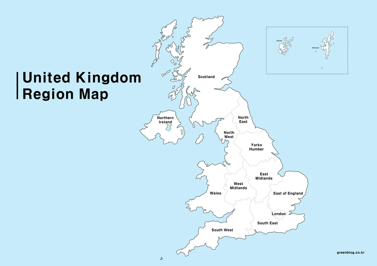
The first map presents the United Kingdom using broad regional divisions. Ireland is intentionally excluded to keep the focus on the structure of the UK mainland.
This version works well as a base map for graphic layouts or explanatory materials. Color usage was kept minimal to ensure clarity in both digital displays and printed formats, while the high resolution allows text to remain sharp on large screens.
Summary:
- Simplified structure with major regions
- Suitable as a base for design work
- Clear for both print and screen use
2️⃣ Detailed Regional Map
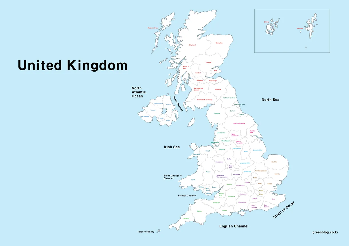
The second map adds more regional detail and includes surrounding straits to better illustrate geographic flow. Several methods for regional distinction were tested during development.
Ultimately, text color was chosen as the primary method for separating regions rather than background shading. This approach provides better readability across screens and printed documents, especially at larger sizes.
Summary:
- Includes finer regional divisions and surrounding waters
- Regions distinguished by text color
- Well suited for reference and explanatory materials
3️⃣ Outline Map
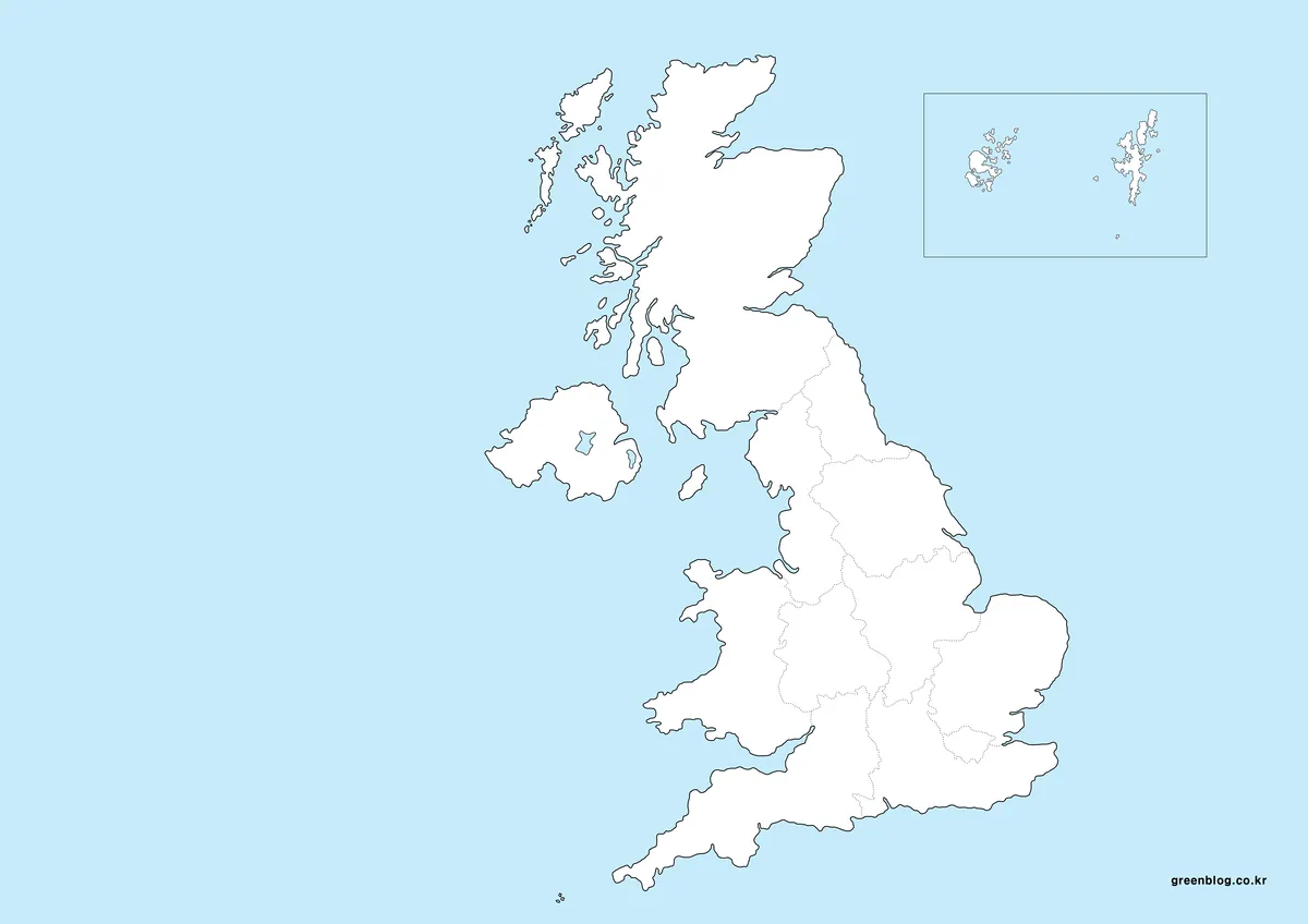
The outline map removes all colors and labels, leaving only the outer boundaries and internal divisions. This version was designed as a flexible template for users who want to add their own data or annotations.
It works especially well for infographic creation, statistical visualization, and custom educational materials using image editing software.
Summary:
- Minimal structure with boundaries only
- Ideal for infographics and data overlays
- Easy to customize for specific projects
4️⃣ United Kingdom Flag Image
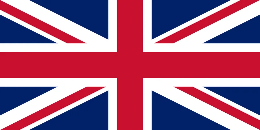
A high-resolution United Kingdom flag image is included for use alongside the maps. During research, large-format UK map resources were difficult to find, which led to preparing a matching flag image for consistency in presentations and documents.
This image can be paired with the maps in travel articles, educational content, or country overview materials.
Common Use Cases
These examples highlight how a well-structured United Kingdom map can support different types of content without requiring additional editing.
- Educational materials and classroom handouts
- Presentation slides and reports
- Travel and country overview articles
- Design layouts and infographics
- General geographic reference content
Frequently Asked Questions
Is this United Kingdom maps download free to use?
Yes. The maps can be used freely for personal blogs, educational materials, and non-commercial reference content.
Can the maps be used for commercial projects?
Limited use within explanatory or supporting materials is acceptable. Redistribution or resale of the map files themselves is not permitted.
Are these maps suitable for printing?
Yes. All maps were created at A3 size with high resolution. The outline and simplified maps are particularly suitable for print use.
What software was used to create the maps?
All maps were produced in Adobe Illustrator, ensuring consistent quality when scaled or edited.
Download Information
The complete United Kingdom maps download is provided as a single ZIP file. After extraction, all four map files are available in JPG format.
These files can be used directly in blog posts, educational documents, presentations, and design projects without additional processing.

▶ 4 Japan Maps Download Collection for Print and Design
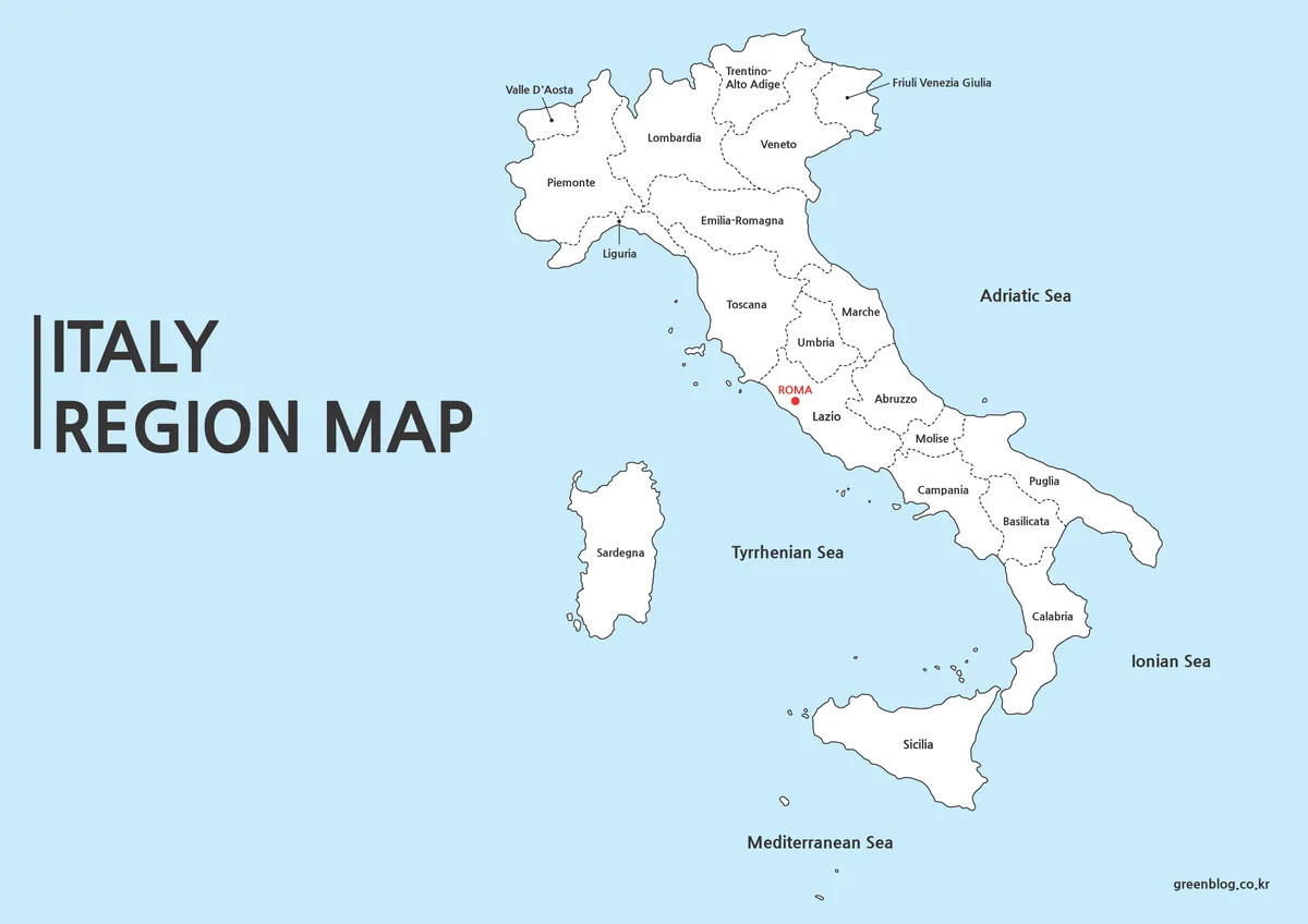
▶ Italy Maps Download Collection (3 Printable Map Files)
▶ 5 United States Maps for Download (Color, Black & White, Outline)