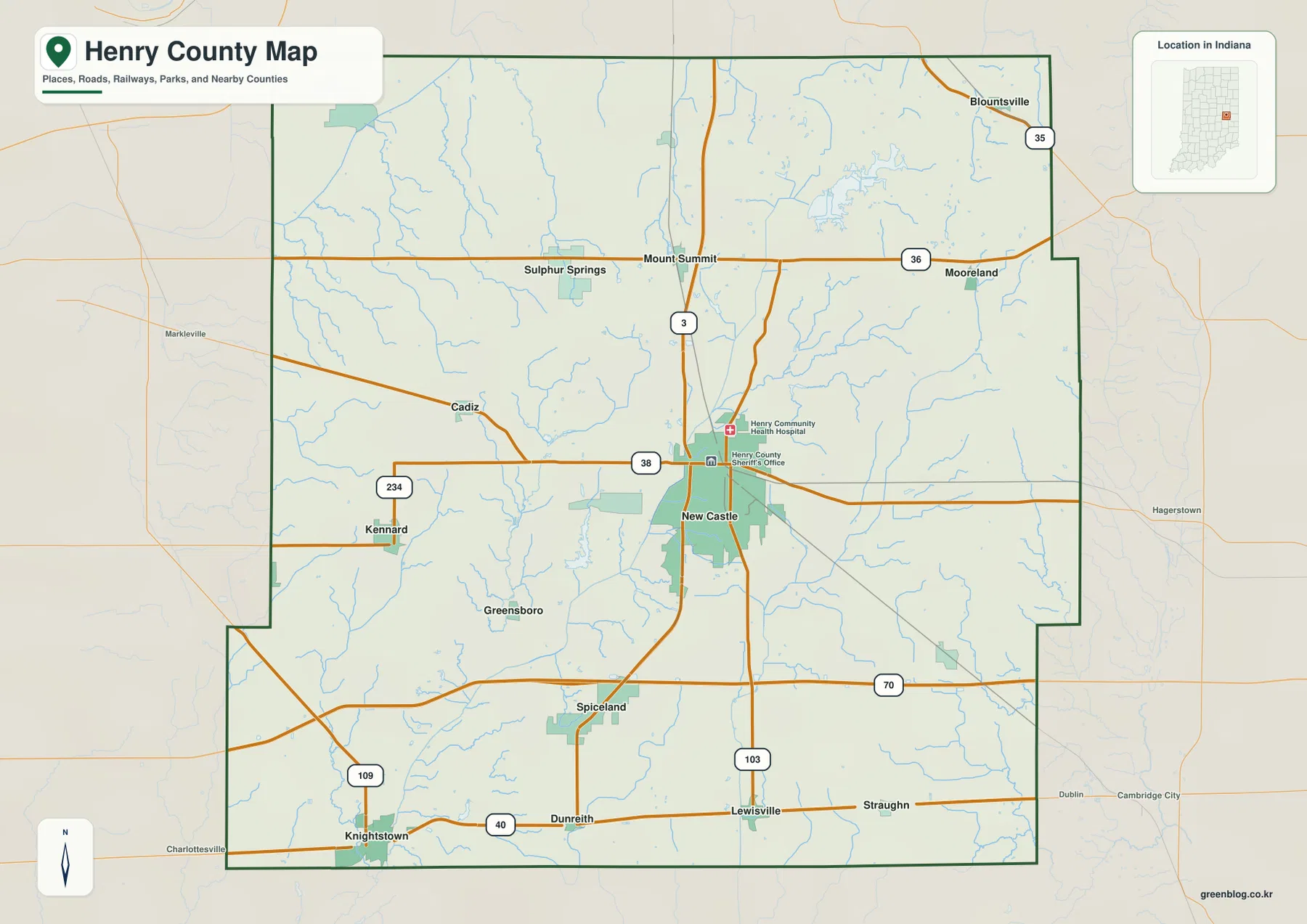
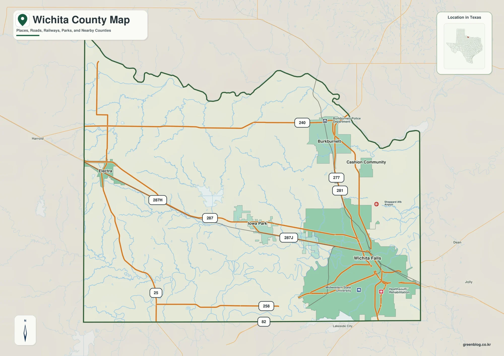
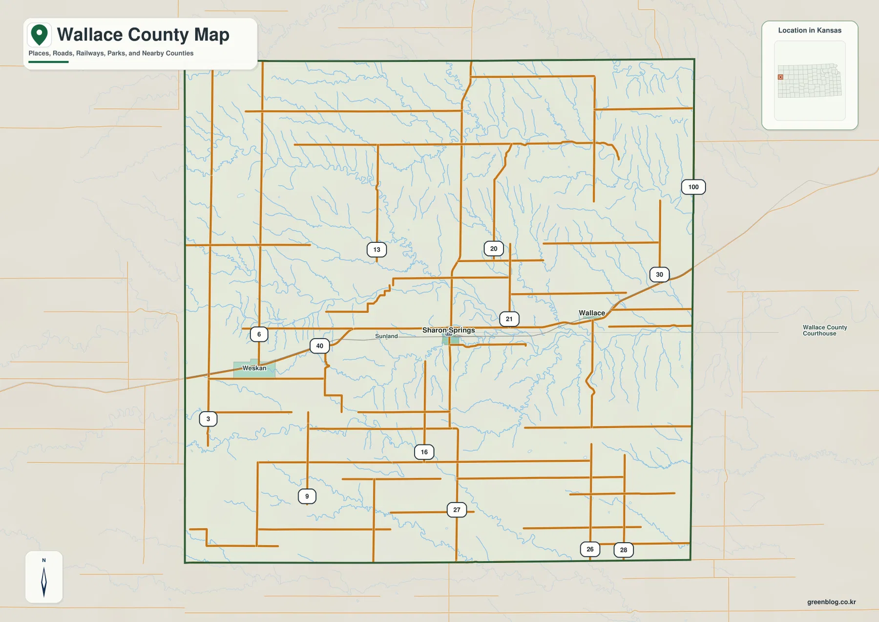
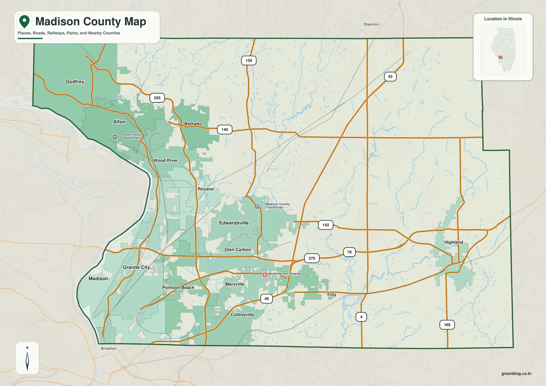
Shelby County sits in north-central Kentucky between the Louisville area and the state capital region, with Shelbyville near the middle of the county and Simpsonville to the west. This Shelby County Kentucky Map page brings together the county boundary and road network, the two major city locations, the Bullskin–Guist Creek drainage, and an elevation surface spanning about 169 to 362 meters. The reduced maps can be reviewed online, and a ZIP containing all four original high-resolution JPG files is available for download near the end of the article.
The county map shows a road system centered on Shelbyville, while the water and elevation layers reveal a landscape cut by many small valleys rather than one broad flat plain. Guist Creek, Clear Creek, Bullskin Creek, Jeptha Creek, and Beech Creek divide the rolling countryside into ridges and low corridors. The eastern and northern parts of the county generally show more high ground, while lower colors follow the western and south-central creek valleys. Reading the maps together makes it easier to connect towns, roads, drainage, and relief.
Table of Contents
Roads spreading from Shelbyville toward Simpsonville and the county edges
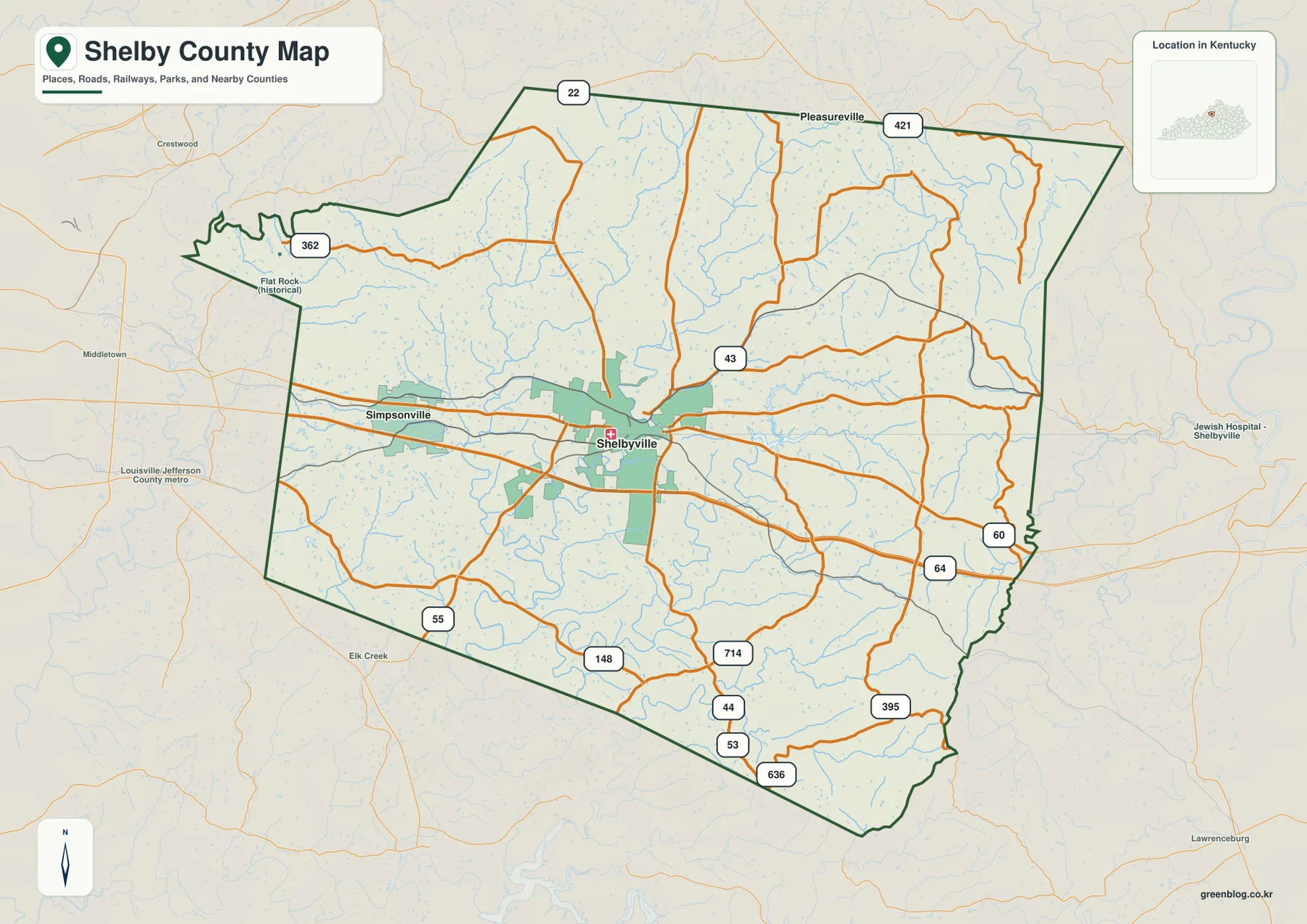
Shelbyville is the strongest visual anchor on the general county map. A broad developed area sits near the center, and numbered roads radiate in several directions from it. U.S. 60 runs across the county toward Simpsonville on the west and continues eastward, while I-64 forms the major east–west interstate corridor just south of the main urban strip. KY 55, 148, 43, 395, 53, 44, 636, and other state routes fill in the rural connections that the interstate and U.S. highway do not show.
Simpsonville lies much closer to the western boundary and the Jefferson County side of the region. Shelbyville is farther east and functions as the central reference point for routes heading north, south, east, or west. On the eastern side, U.S. 60 and I-64 continue toward Franklin County. North of Shelbyville, KY 421 and KY 22 help orient the map toward Henry County, while smaller routes reach the countryside between the major corridors.
The northwest section includes KY 362 and a Flat Rock historical label, and Pleasureville appears near the northern side as a useful regional reference. These edge labels are best treated as orientation points rather than as a list of major Shelby County communities. South of Shelbyville, KY 148, 714, 44, 53, and 636 branch through a more irregular road pattern, and KY 395 follows the rolling terrain in the southeast. The changing direction of local roads reflects the creek valleys and ridges that become clearer on the terrain maps.
The county boundary is also worth noticing. The western side has a narrow projecting section, the broad north contrasts with the angled southern line, and the eastern edge contains several bends. When the boundary is read together with the road network, it becomes easier to judge whether a location is oriented toward Shelbyville, the Simpsonville–Jefferson County side, or the Franklin and Henry County edges. This is a reference map rather than a live navigation product, so current closures, traffic conditions, and turn-by-turn routing should be checked separately.
Shelbyville and Simpsonville in a simplified city view
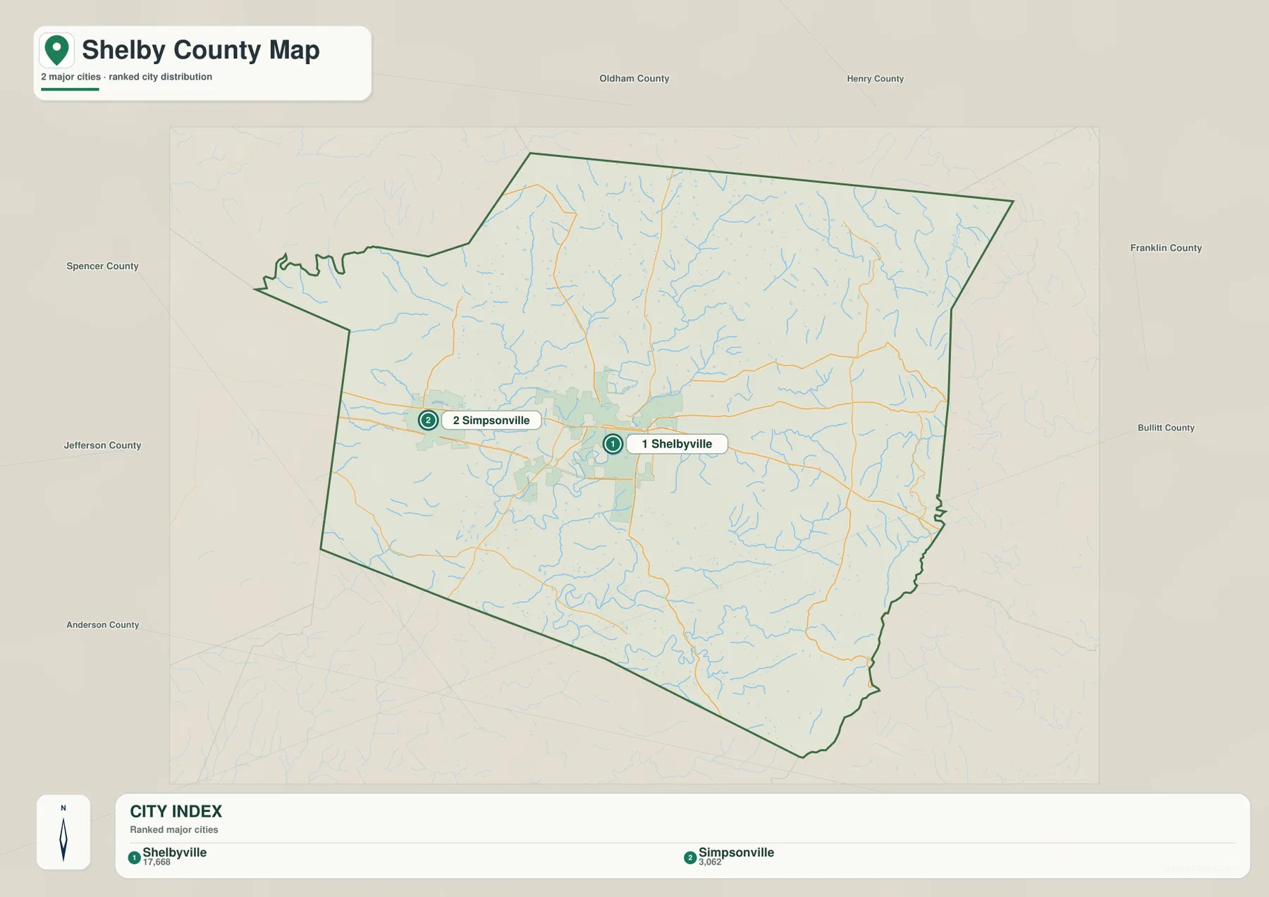
The city map removes most minor route labels so the two main city locations stand out clearly. Shelbyville is marked as number 1 near the center, while Simpsonville is number 2 to the west. The index printed along the bottom shows values of 17,668 for Shelbyville and 3,062 for Simpsonville. Those figures belong to the map’s city index and should not be treated as a substitute for a current official population estimate. The more durable information here is the relative position of the two communities.
Shelbyville occupies the larger central developed area, and Simpsonville sits closer to the Jefferson County side. The general map adds U.S. 60 and I-64, which helps explain why the two cities belong to the same east–west travel corridor even though their local road patterns differ. Using the city and general maps together separates two questions cleanly: where the major settlements are, and which numbered roads connect them.
Neighboring county labels make the city map useful even without many road numbers. Oldham County is to the northwest, Henry County to the north, Franklin County to the east, Anderson County to the southeast, Spencer and Bullitt counties to the southwest and south, and Jefferson County to the west. These labels are especially helpful when describing a trip that leaves Shelby County or when placing Shelbyville and Simpsonville within the wider Louisville–Frankfort region.
For a presentation, worksheet, or simple regional reference, this file is cleaner than the full road map. It is not intended to show every community, every route, or the exact limits of an urban service area. Pair it with the county map when road detail matters, or use it by itself when the goal is simply to show the two major city locations and the county’s surrounding geography.
Bullskin, Clear, Guist, and Beech creek valleys across the county
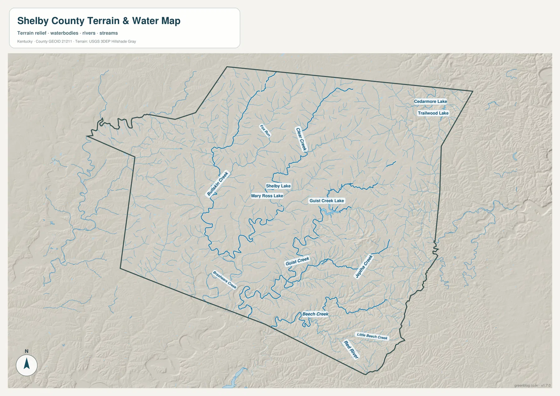
Water in Shelby County is organized around a dense network of creeks rather than one dominant river. Bullskin Creek is one of the most prominent lines in the northwestern and central part of the map, while Clear Creek descends through the north-central area. Smaller tributaries join both systems from the surrounding ridges. The pattern makes the county look finely divided, with many short valleys cutting into rolling uplands.
Farther south, Guist Creek follows a broad, winding valley and connects visually with Guist Creek Lake. Shelby Lake and Mary Ross Lake are also labeled nearby. These water bodies are small compared with the county as a whole, but they are useful reference points because they sit within the same network of branching tributaries. Guist Creek is especially helpful for understanding the south-central terrain, where the channel bends repeatedly between low ridges.
Jeptha Creek appears in the southeast, while Beech Creek and Little Beech Creek occupy the southern part of the county and continue toward the Red River side of the map. Brashears Creek is labeled farther southwest. Near the northeastern boundary, Cedarmore Lake and Trailwood Lake add two smaller water features. Together, these names show that the drainage is distributed across the county rather than concentrated in a single basin visible from every location.
Comparing the water map with the elevation layer shows why the channels follow those paths. Blue stream lines commonly occupy lower green corridors, with higher ridges on either side. Guist Creek and Beech Creek provide especially clear examples. This map is meant for county-scale geographic reference; it does not define flood zones, water depth, legal water boundaries, parcel limits, water quality, or navigability. Those questions require current specialist or regulatory sources.
A 169–362 m relief range from creek bottoms to eastern uplands
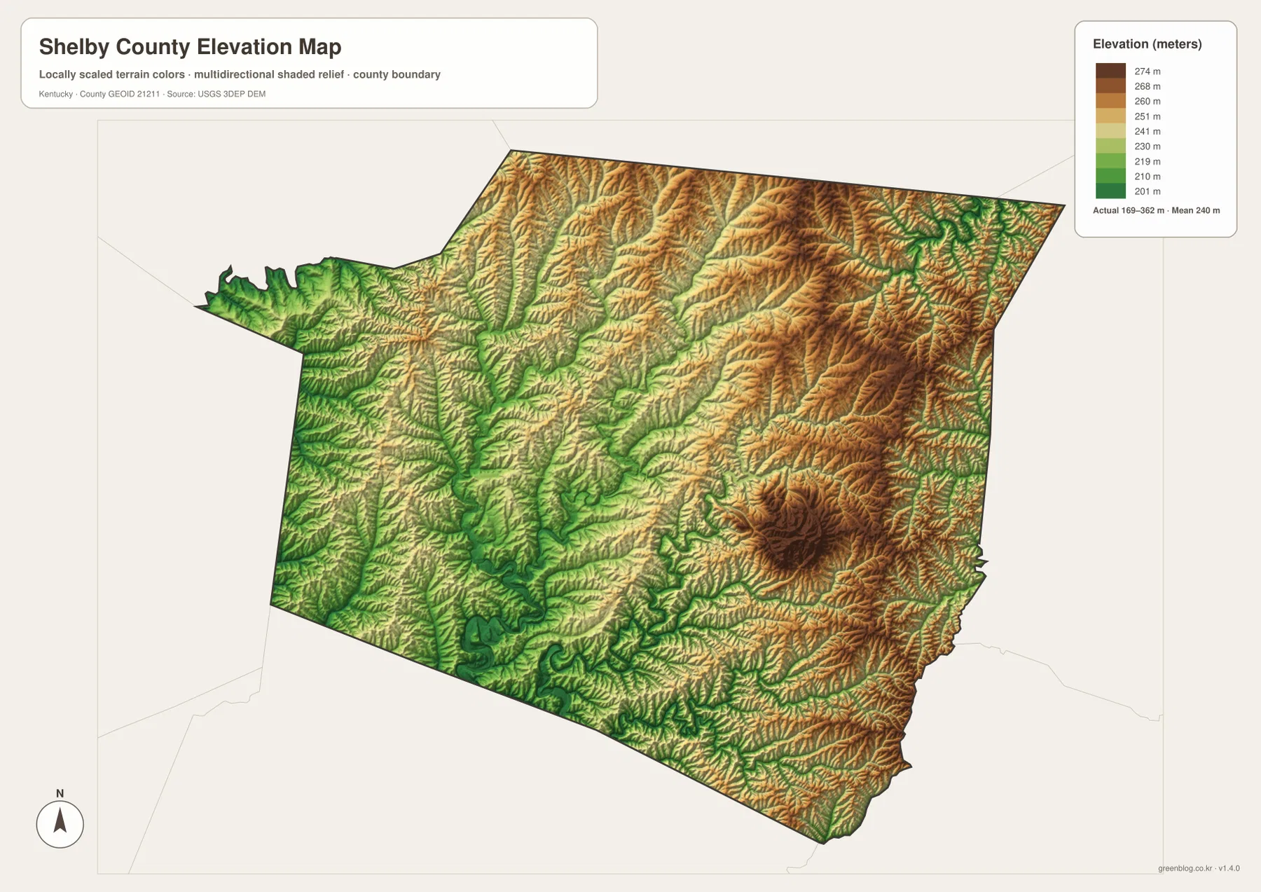
The elevation map reports an actual county range of about 169 to 362 meters, with a mean near 240 meters. Green tones mark the relatively lower parts of Shelby County, while yellow-brown and brown areas represent higher ridges and uplands. The western projecting section and several central creek valleys contain broad areas of lower color. Higher ground becomes more common across the east and north, where long ridges separate the drainage lines.
Shelbyville itself is not shown as a perfectly flat surface. Low corridors and gently higher ground alternate around the central developed area, and the Guist Creek and Jeptha Creek valleys become more obvious south and east of town. The eastern half contains larger areas of brown terrain, including several locally prominent high ridges. This contrast helps explain why minor roads do not follow a simple grid even though the main U.S. and interstate routes create strong east–west connections.
The northern part of the county also consists of repeating ridges and valleys rather than uninterrupted level land. Clear Creek and Bullskin Creek occupy lower bands that run through higher terrain, creating a pattern similar to the southern drainage but without one large lake or river dominating the view. The county is therefore best understood as rolling country dissected by many small streams, not as a mountain region with one continuous high range.
This generalized elevation surface is useful for county-wide comparison, not for survey or engineering work. It should not be used to determine the exact elevation of a building site, calculate construction grades, design drainage, or settle property questions. Those tasks require higher-resolution source data and professional measurement. For regional explanation, however, the 169–362 meter range clearly shows the relationship between low creek valleys and higher uplands.
Choose the file that matches roads, cities, water, or terrain
The four files emphasize different parts of Shelby County. Use the general county map when Shelbyville, Simpsonville, U.S. 60, I-64, state routes, and the full boundary need to appear together. The city map is cleaner when the main purpose is to compare the two city locations and neighboring county directions. The terrain and water map is the strongest option for Bullskin Creek, Clear Creek, Guist Creek, Jeptha Creek, Beech Creek, and the small lakes. The elevation file works best when the contrast between lower valleys and higher eastern and northern ridges is the subject.
- County map: best for Shelbyville, Simpsonville, U.S. 60, I-64, KY 55, KY 148, KY 43, KY 395, and the overall boundary.
- City map: best for a simple view of the two main city locations and the directions of Jefferson, Henry, Franklin, Anderson, Spencer, Bullitt, and Oldham counties.
- Terrain and water map: best for Bullskin Creek, Clear Creek, Guist Creek, Jeptha Creek, Beech Creek, Guist Creek Lake, Shelby Lake, and related valleys.
- Elevation map: best for comparing lower drainage corridors with higher uplands across the county’s approximately 169–362 m actual elevation range.
A useful reading sequence is to locate Shelbyville and Simpsonville first, then follow U.S. 60 and I-64 across the county. Move to the water map to identify Guist Creek, Clear Creek, and the smaller tributaries, and finish with the elevation surface to see why those streams occupy low corridors between ridges. This order links transportation, settlement, drainage, and relief without forcing every detail into one crowded image.
Each original JPG is 2572 × 3638 pixels, providing more room to inspect small route numbers, creek labels, and relief shading than the reduced web previews. For a printed handout, the county and city maps work well as a pair for settlement and transportation, while the terrain-and-water and elevation files make a natural pair for physical geography. Selecting the two files that match the subject usually produces a clearer page than shrinking all four onto a single sheet.
Frequently Asked Questions
Which map is best for comparing Shelbyville and Simpsonville?
Use the city map for the cleanest comparison. It places Shelbyville near the center and Simpsonville to the west while keeping neighboring county directions visible. Use the general county map alongside it when you also need U.S. 60, I-64, and the state-route network that connects the two communities.
Which file shows Guist Creek, Bullskin Creek, Beech Creek, and the small lakes?
The terrain and water map is the best choice. It combines Bullskin Creek, Clear Creek, Guist Creek, Jeptha Creek, Beech Creek, Little Beech Creek, Guist Creek Lake, Shelby Lake, Mary Ross Lake, and other smaller features so the drainage pattern can be viewed as one system.
Can the 169–362 meter elevation map be used for surveying or construction?
No. It is a generalized county-scale surface for comparing lower creek valleys with higher ridges. The approximate 169–362 meter actual range and mean near 240 meters are useful for regional interpretation, but exact site elevations, grades, drainage design, and construction decisions require higher-resolution source data and professional surveying.
Sources and reference information
Road, settlement, water, and elevation descriptions are based primarily on the supplied Shelby County map assets. County context and geographic data background were cross-checked against official county, tourism, Census Bureau, and USGS resources.
- Shelby County, Kentucky — Official county website with local information about Shelbyville, Simpsonville, and Shelby County.
- ShelbyKY Tourism — Official destination resource for Shelbyville, Simpsonville, and Shelby County.
- U.S. Census Bureau TIGER/Line Shapefiles — Official U.S. geographic resources for county boundaries, roads, and related map layers.
- USGS National Hydrography — Official reference data for rivers, streams, lakes, and related hydrographic features.
- USGS 3D Elevation Program — Official U.S. elevation data and terrain-model information.
Map File Information
The ZIP contains the original high-resolution JPG versions of the Shelby County road and boundary map, city map, terrain and water map, and elevation map. Review Shelbyville, Simpsonville, the main roads, the Guist Creek drainage, and the 169–362 m relief on the page, then choose the file that fits your printing or reference needs.
- File Type: ZIP containing 4 JPG files
Related Maps
Green Map creates custom-edited map images using open geographic data sources such as geoBoundaries, Natural Earth, OpenStreetMap, and government open data. These maps are edited visual materials, not raw data files, and are provided for education, documents, presentations, and graphic reference.