
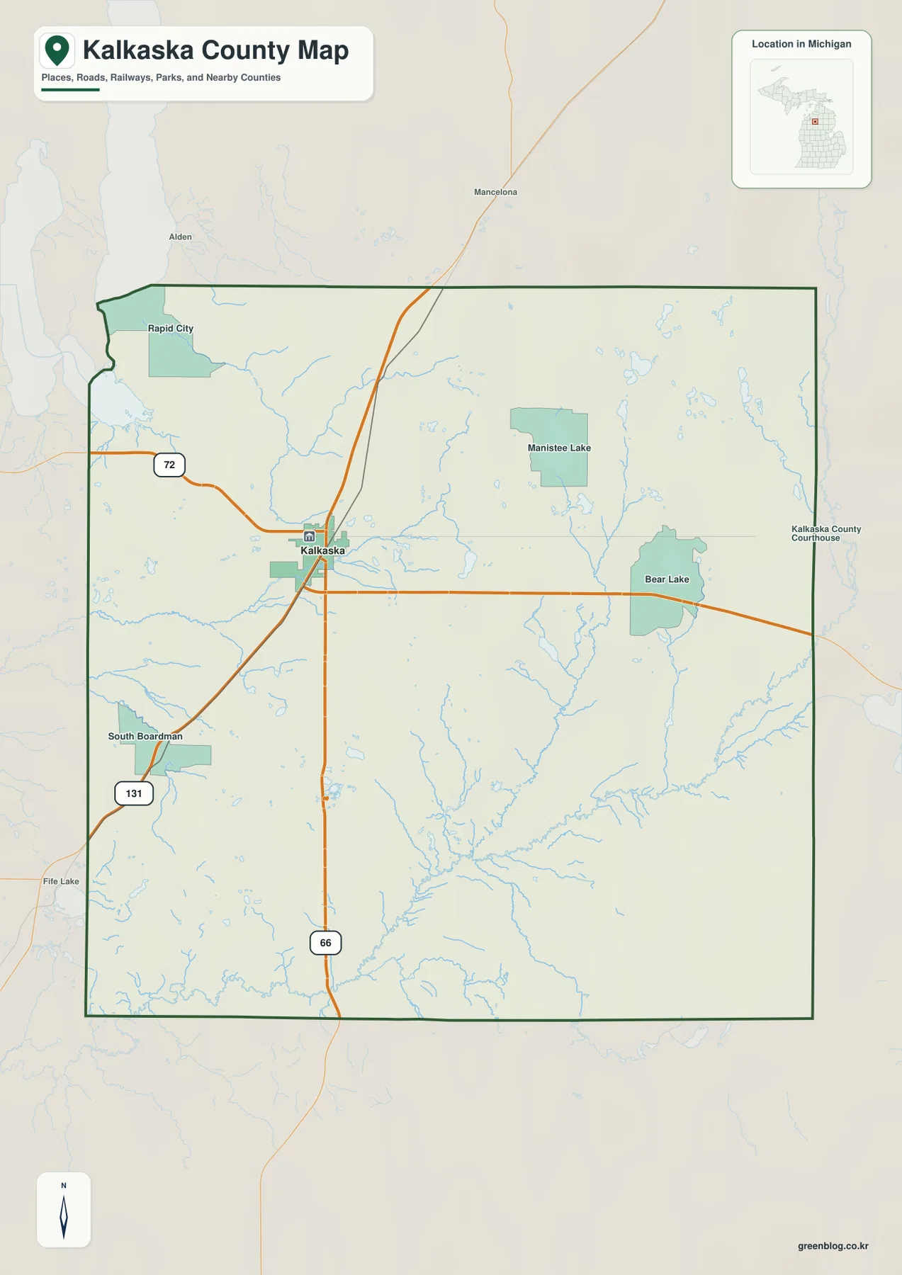
Kalkaska County Map at the US-131 and M-72 Junction: Rivers, Lakes, and Northeast Highlands
Kalkaska County in northern Michigan is easy to orient around the community of Kalkaska, where M-72, US-131, and M-66 converge
Kalkaska County in northern Michigan is easy to orient around the community of Kalkaska, where M-72, US-131, and M-66 converge
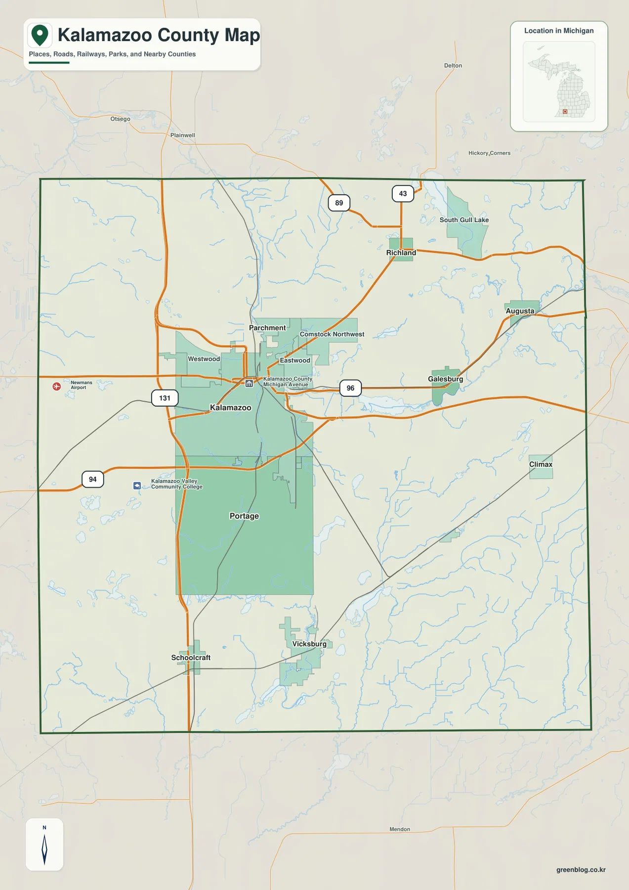
Kalamazoo County in southwest Michigan is easiest to understand by starting with the paired urban centers of Kalamazoo and Portage.
Kalamazoo County Map with I-94, US-131, Gull Lake, and the Kalamazoo River Read More »
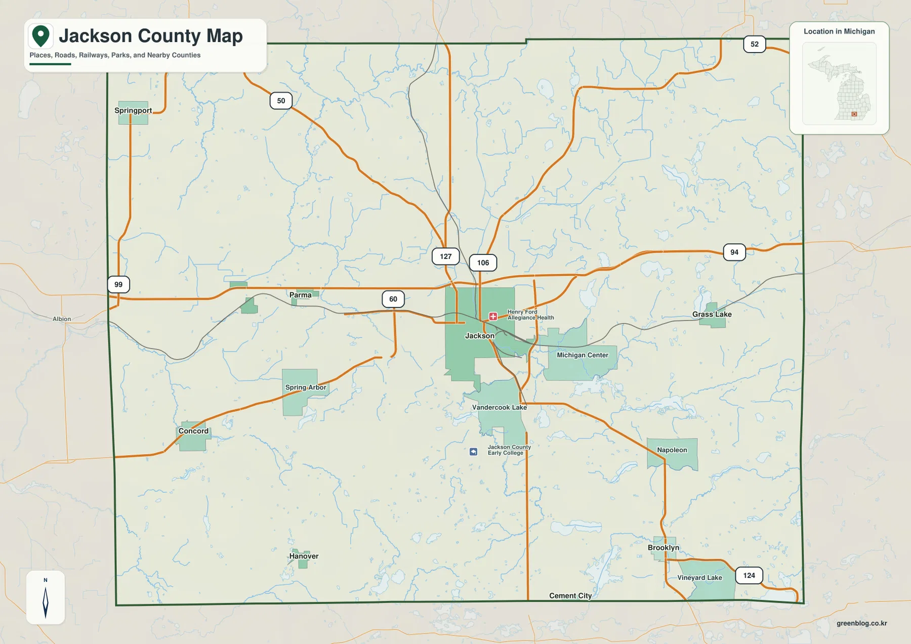
Jackson County sits in southern Michigan, with the city of Jackson forming the clearest geographic anchor where the I-94 east-west
Jackson County Michigan Map along I-94, Grand River, and the Southern Lakes Read More »
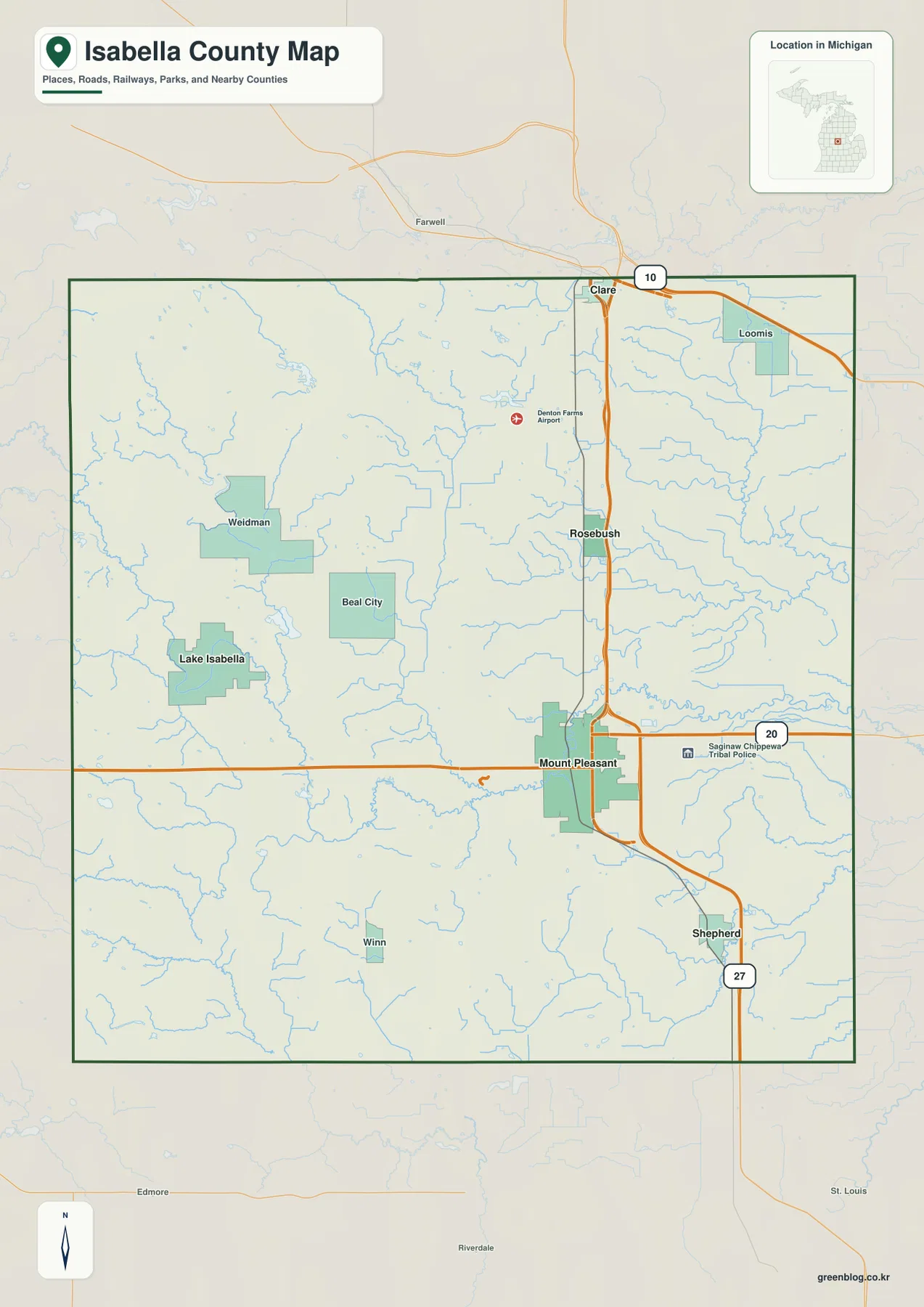
Isabella County sits in central Michigan’s Lower Peninsula, but the county is easier to understand when Mount Pleasant is treated
Isabella County Map from Mount Pleasant to Lake Isabella: Roads, Rivers, and Relief Read More »
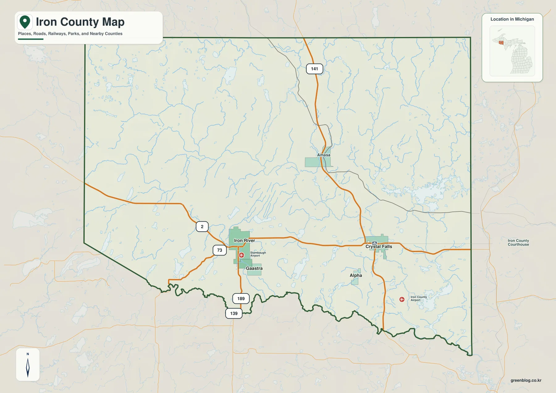
Iron County occupies a broad part of the western Upper Peninsula of Michigan along the Wisconsin border. Iron River and
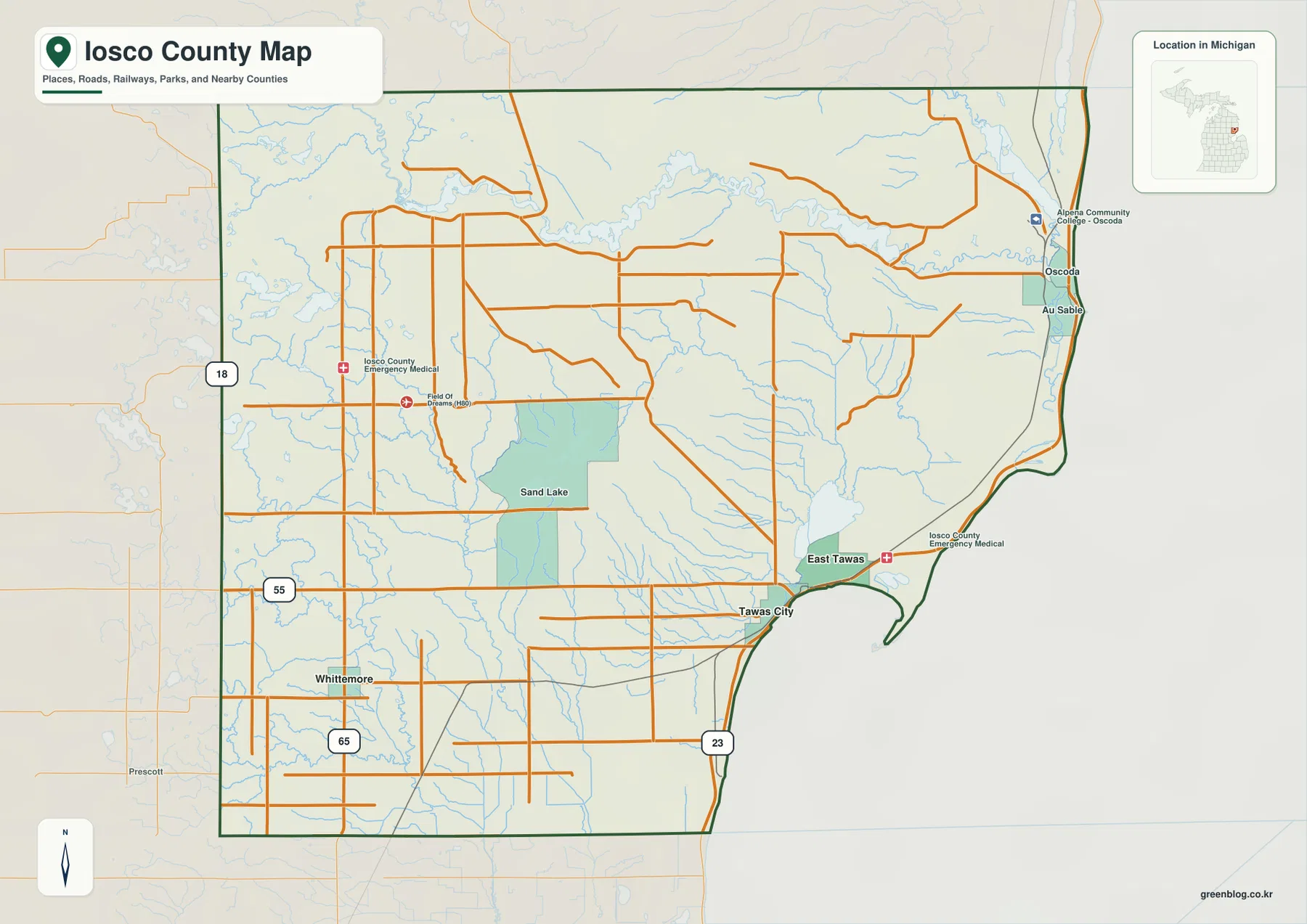
Iosco County sits on Michigan’s northeastern Lower Peninsula, where the Lake Huron shoreline gives the county a very different shape
Iosco County Map: Tawas Bay, Au Sable River, and the Higher Western Interior Read More »
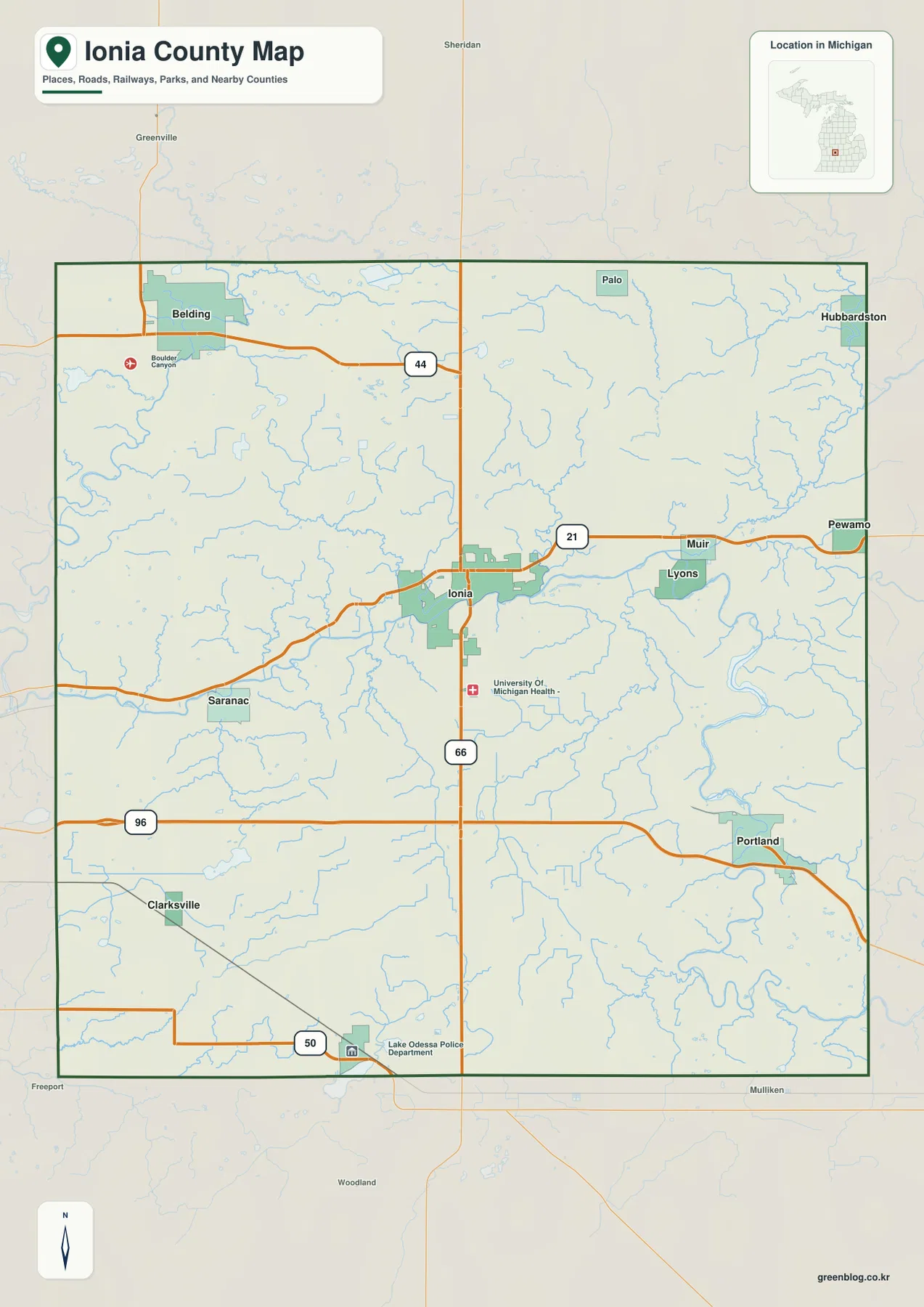
Ionia County sits in west-central Lower Michigan between the Grand Rapids and Lansing sides of the state, and its maps
Ionia County Map around Ionia, Belding, Portland, and the Grand River Corridor Read More »
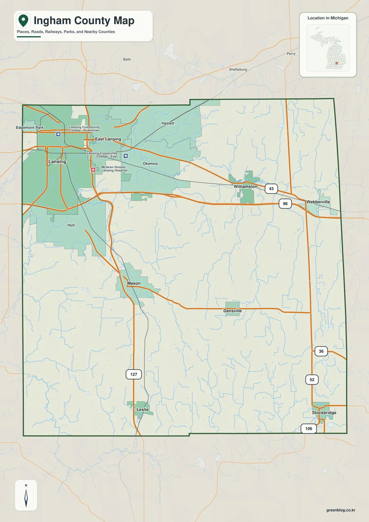
Ingham County lies in south-central Michigan, combining the Lansing–East Lansing urban area in the northwest with a much broader rural
Lansing, Red Cedar River, and Southern Hills — Ingham County Map Read More »
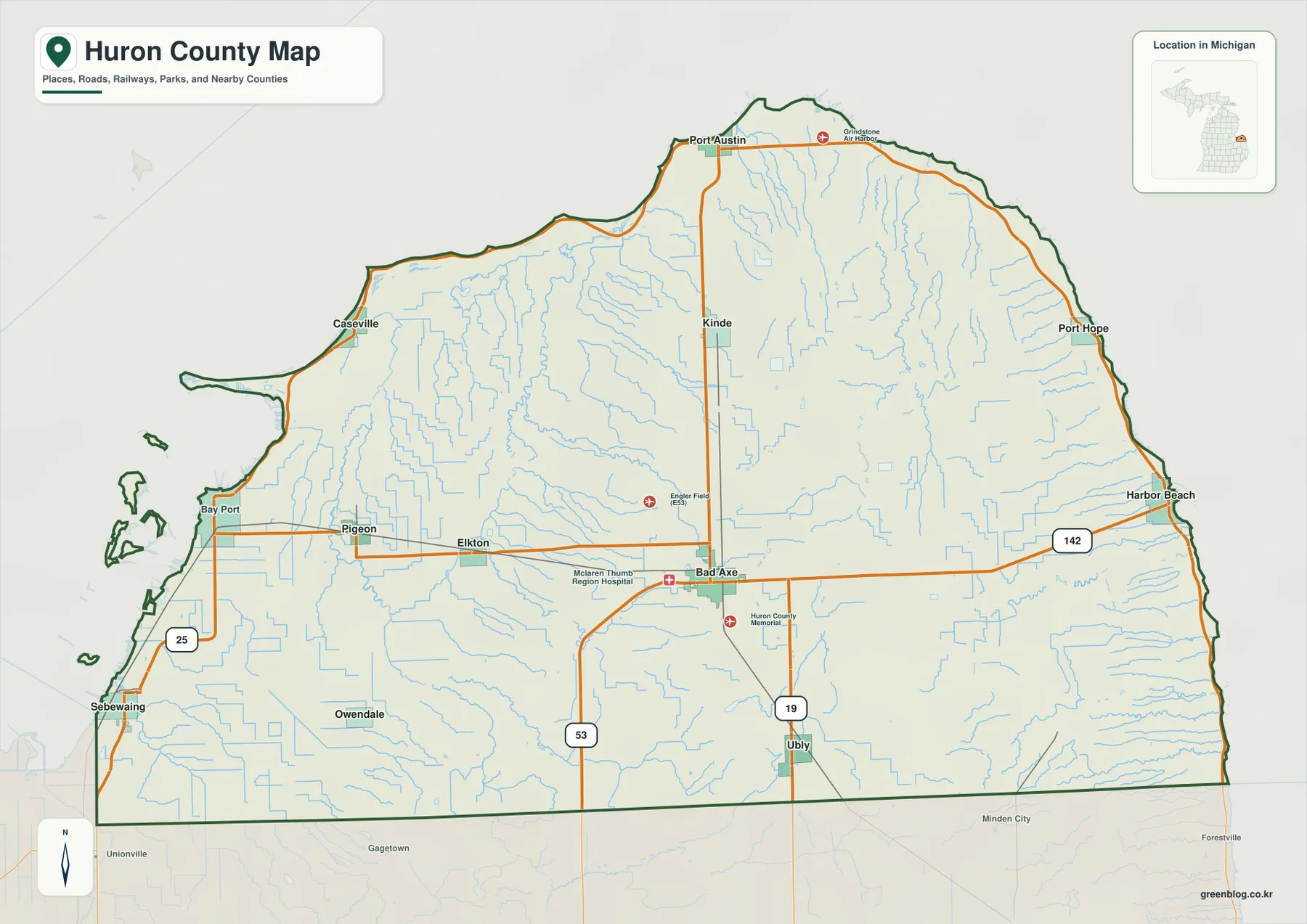
Huron County occupies the outer part of Michigan’s Thumb, where Bad Axe sits inland while Caseville, Port Austin, Port Hope,
Huron County Michigan Map across the Thumb: Bad Axe, Lake Huron Shore, and Inland Ridges Read More »