
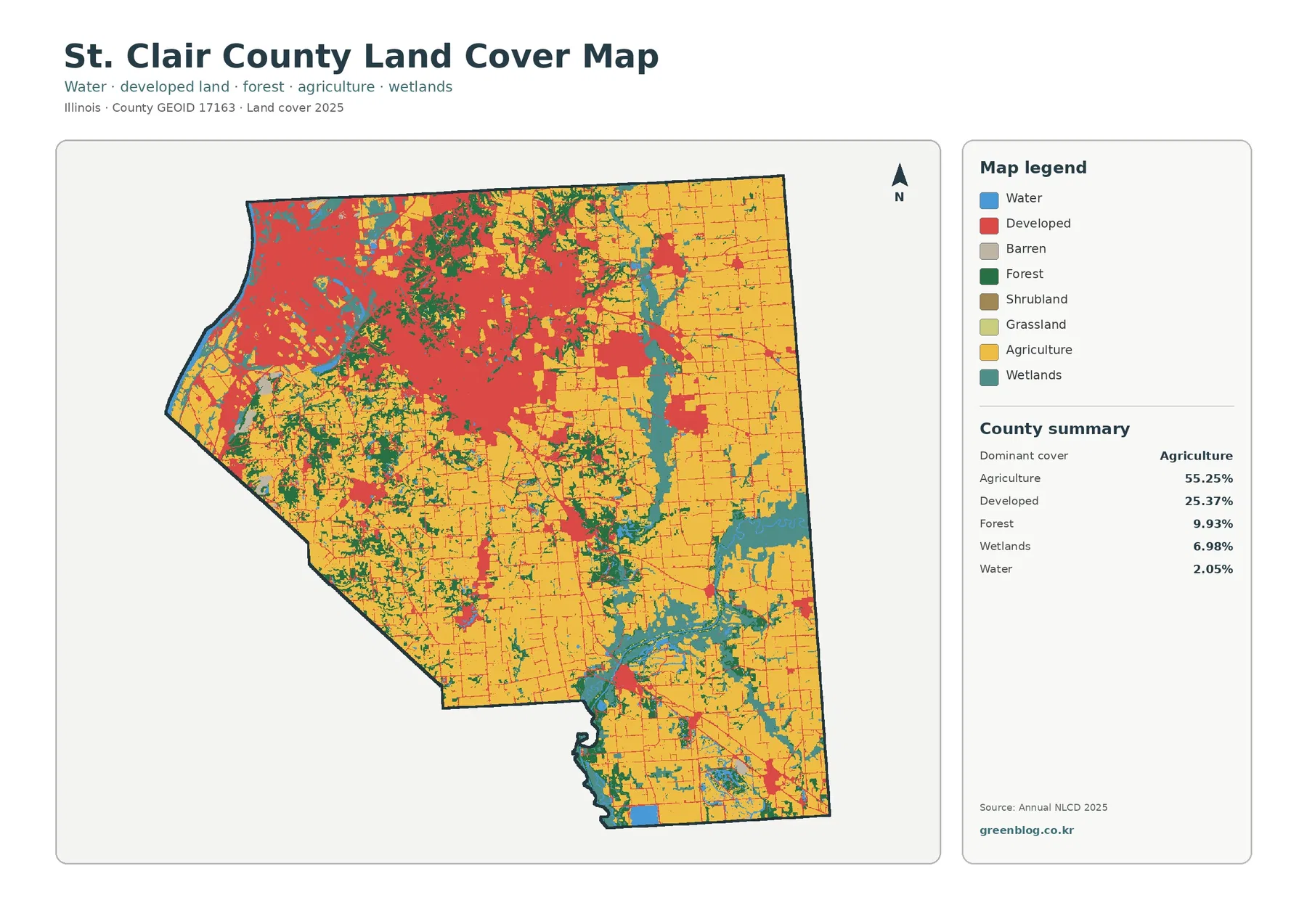
St. Clair County Illinois Land Cover Map | Metro Edge, Farm Belt, Wetlands & JPG Download
St. Clair County sits on the Illinois side of the St. Louis metropolitan area, and its land-cover pattern changes sharply
St. Clair County sits on the Illinois side of the St. Louis metropolitan area, and its land-cover pattern changes sharply
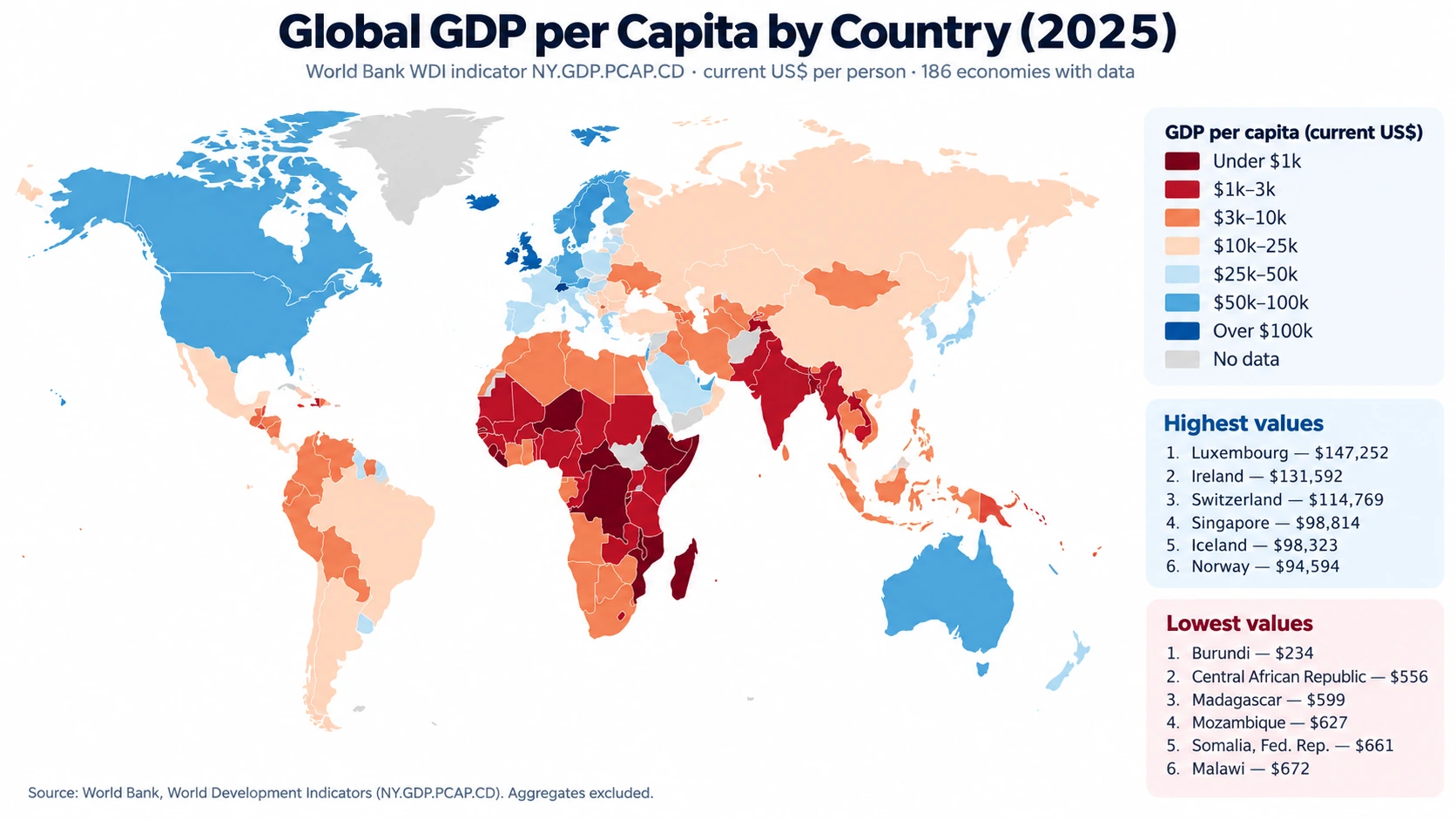
A 2025 global GDP per capita map reveals an unusually wide gap between countries and economies even when every observation
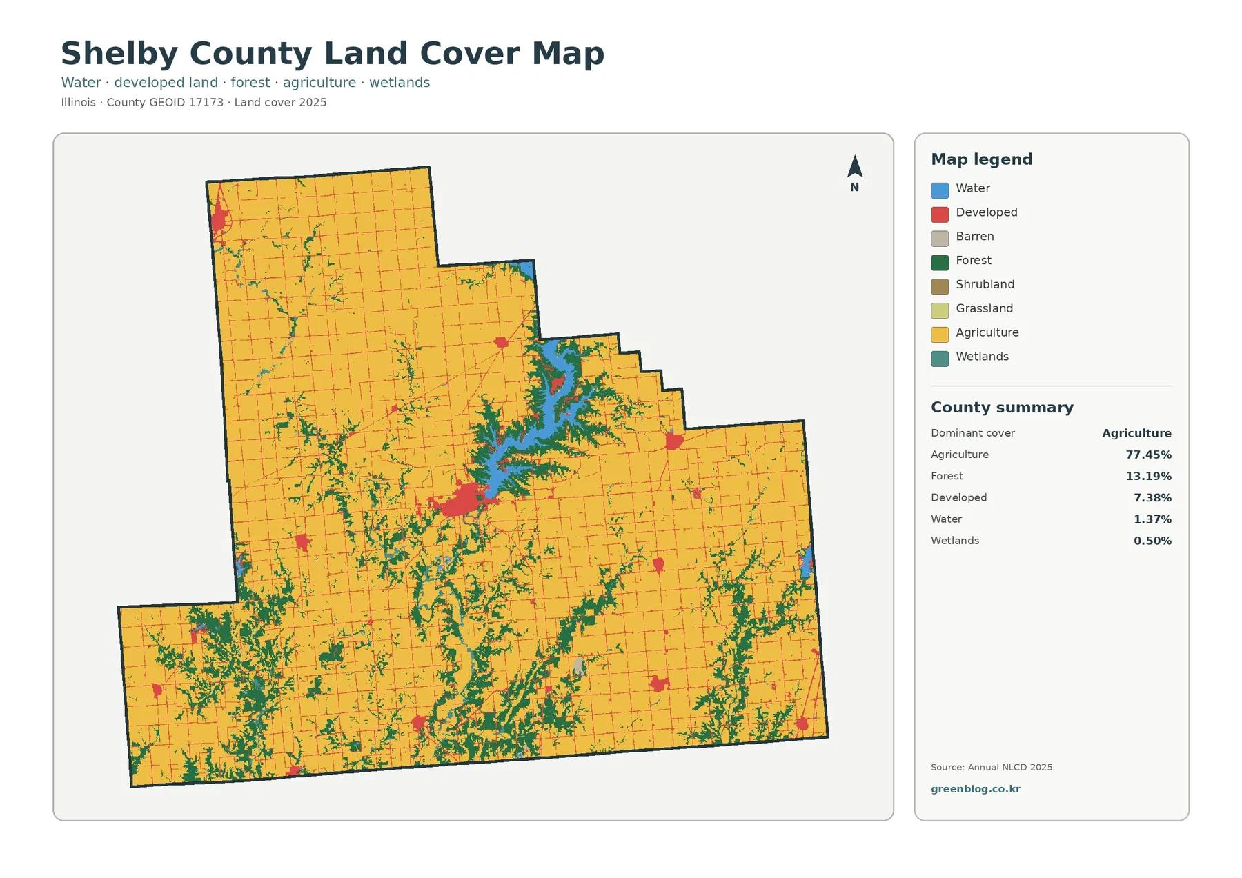
Shelby County, Illinois is mostly agricultural, yet its land-cover pattern is defined by a feature that breaks the farm landscape
Shelby County Illinois Land Cover Map – Lake Shelbyville and Farm Landscape Read More »
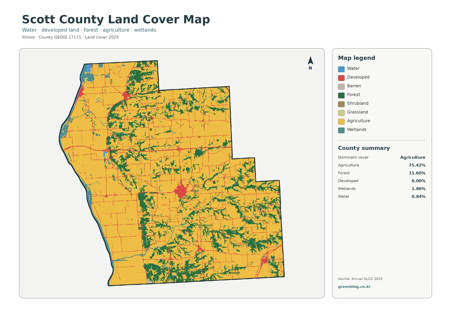
Scott County, Illinois is dominated by agriculture, but the supplied maps show more variety than the 75.42% farm share suggests.
Scott County Illinois Land Cover Map — Farmland, Winchester and River Wetlands Read More »
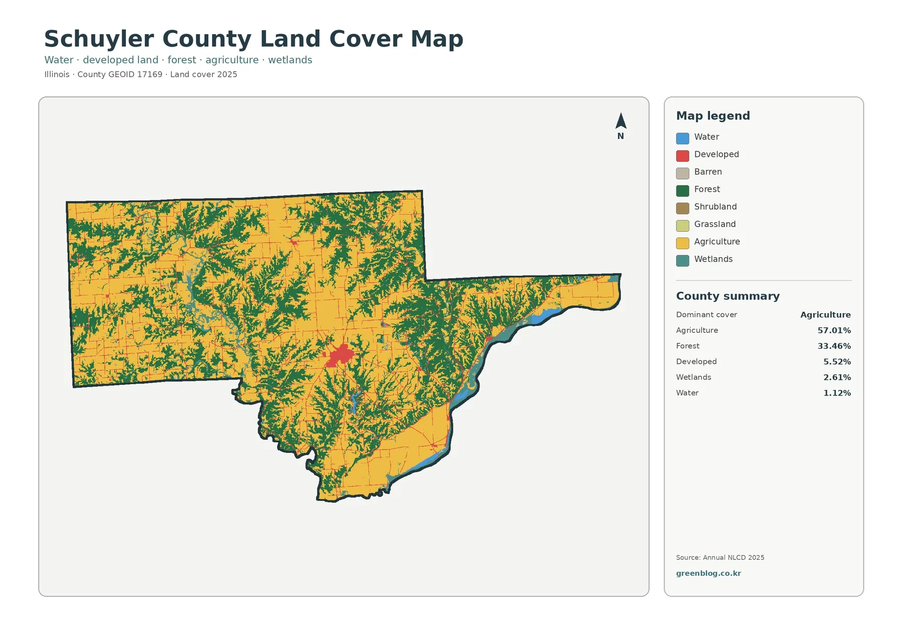
Schuyler County in west-central Illinois has a land-cover pattern that is easy to recognize once agriculture and forest are viewed
Schuyler County Illinois Land Cover Map | Rushville, Woods & Farms Read More »
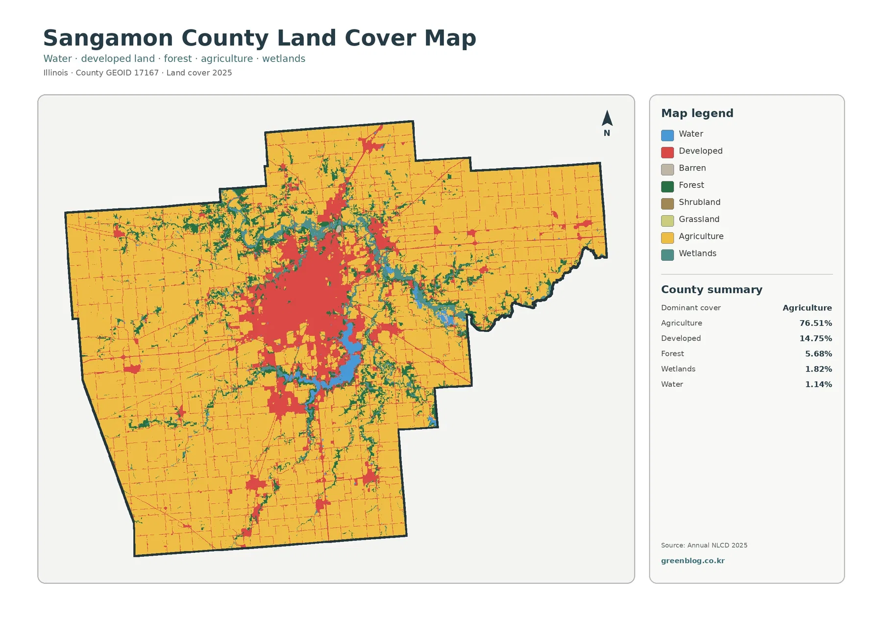
Sangamon County has one of the clearest urban-to-rural contrasts in central Illinois. Springfield forms a broad developed core near the
Sangamon County Illinois Land Cover Map | Springfield, Farms & Lake Corridors Read More »
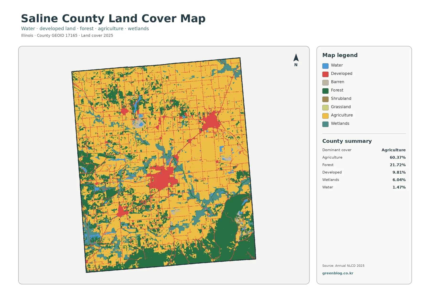
Saline County has a land-cover pattern that changes noticeably from one part of the county to another. Agriculture is the
Saline County Illinois Land Cover Map — Farmland, Forest & Wetlands Read More »
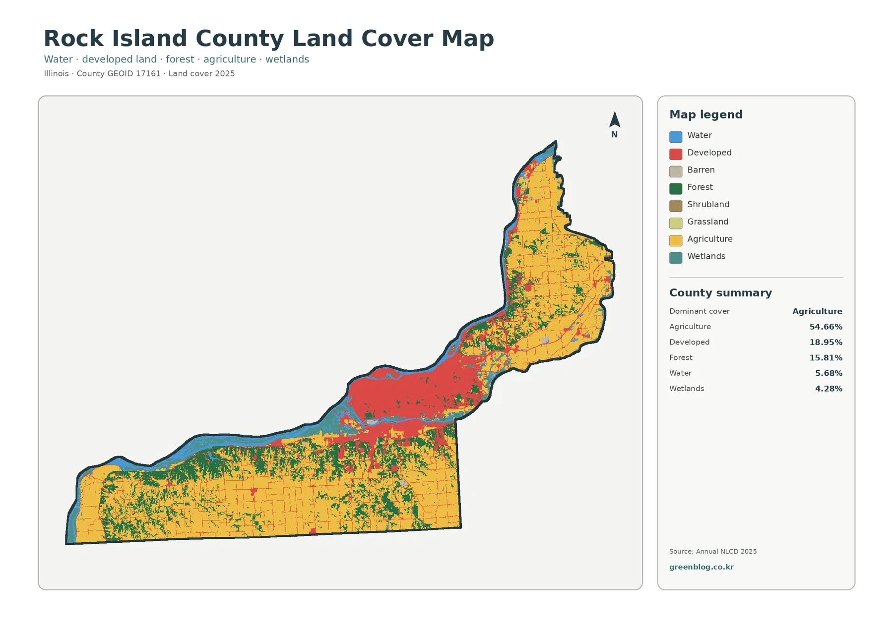
The Rock Island County Illinois Land Cover Map set captures one of the clearest urban-to-rural contrasts in western Illinois. A
Rock Island County Illinois Land Cover Map | Quad Cities, Farms & River Edges Read More »
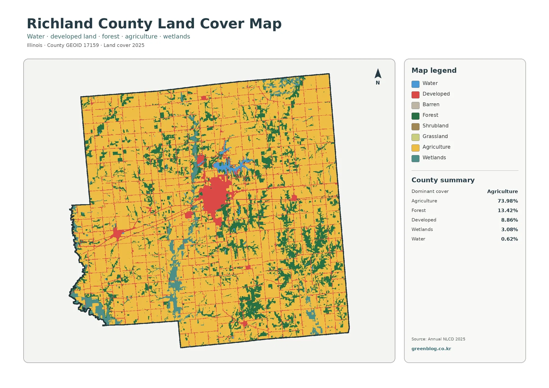
Richland County, Illinois is mostly agricultural in the 2025 land-cover data, but the county is not a single uninterrupted farm
Richland County Illinois Land Cover Map | Agriculture, East Fork Lake & Olney Read More »