
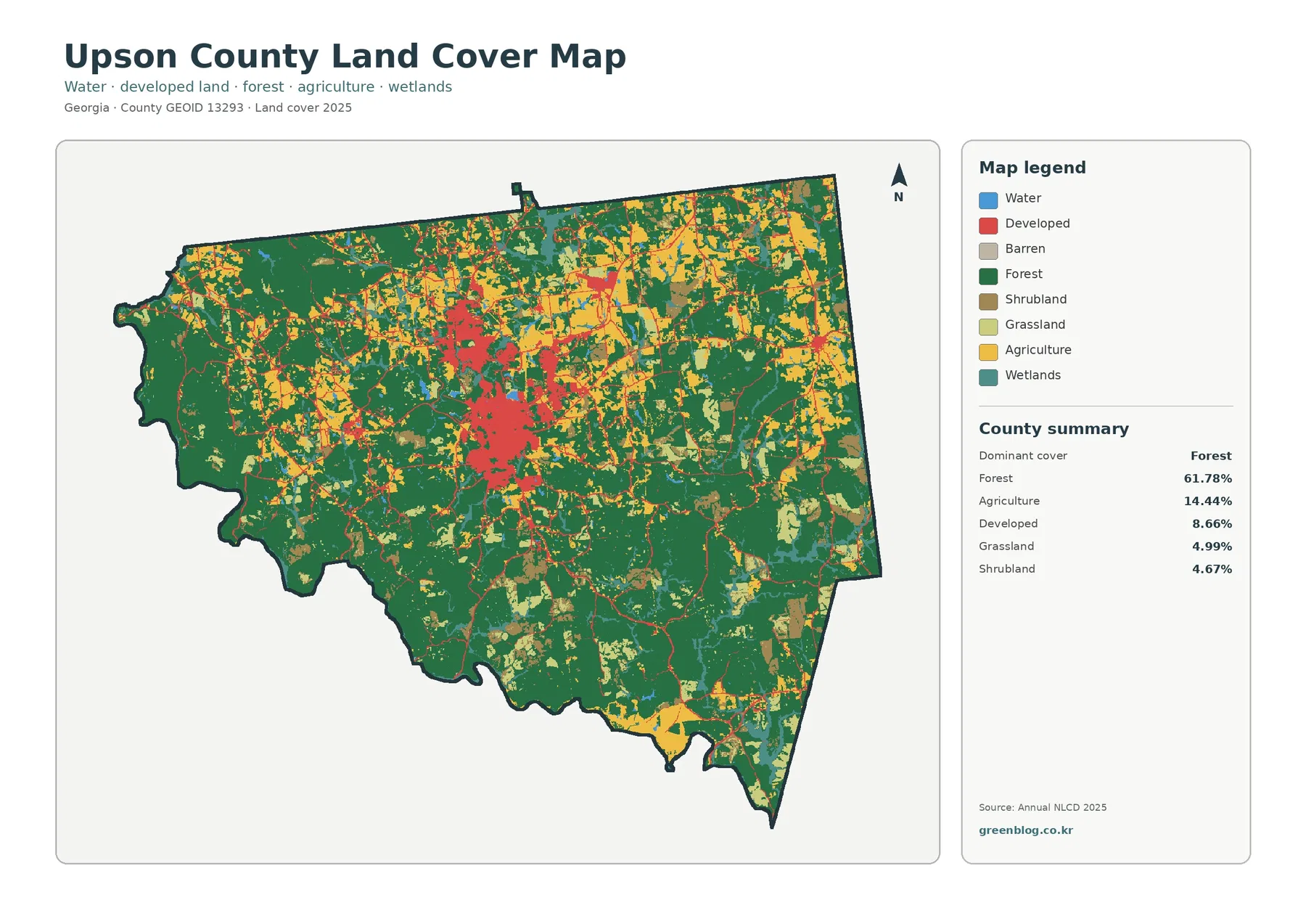
Upson County Georgia Land Cover Map: Thomaston in a Forest Patchwork and 31.37% Two-Date Difference
Forest covers most of Upson County in the supplied 2025 data, but the county does not read as one continuous […]
Forest covers most of Upson County in the supplied 2025 data, but the county does not read as one continuous […]
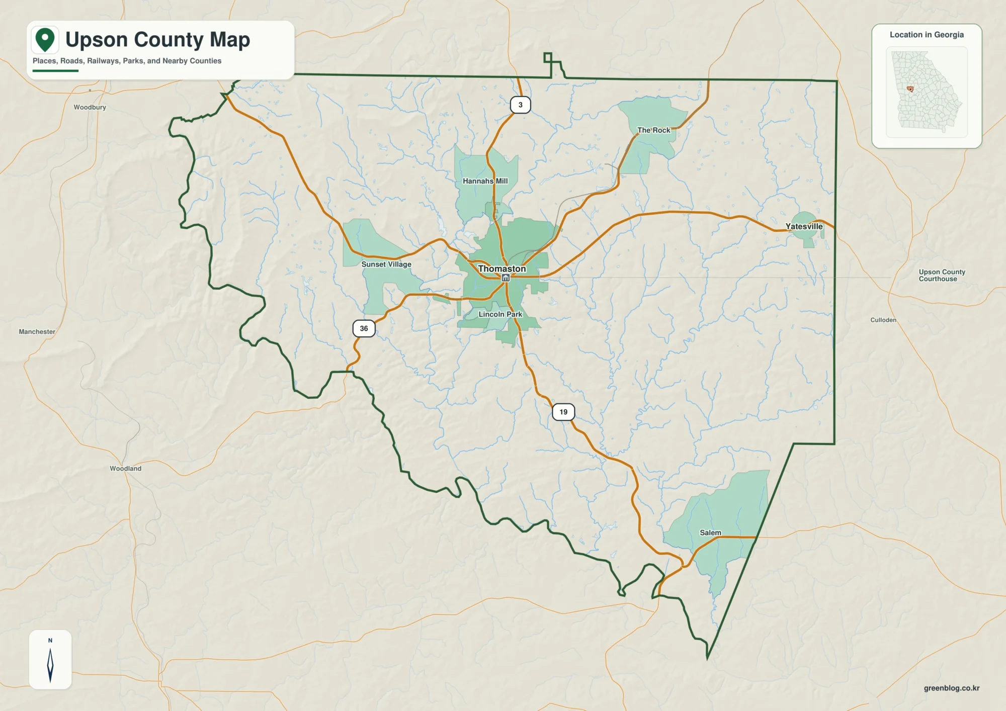
Upson County sits in west-central Georgia, where Thomaston forms the clearest road and settlement hub while the Flint River traces
Upson County Map – Flint River, Thomaston, and Rolling Georgia Terrain Read More »