
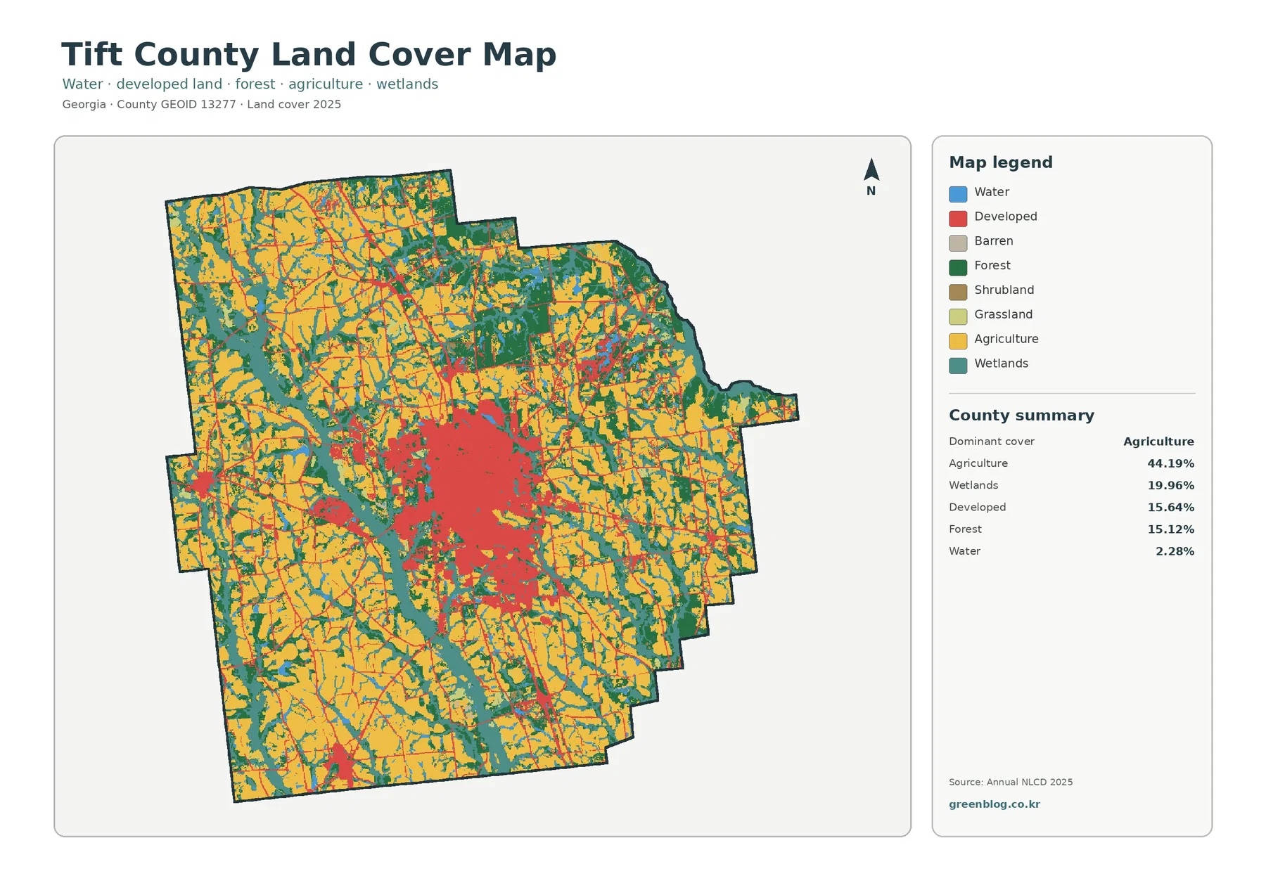
Tift County Georgia Land Cover Map — 2025 Agriculture, Wetland Strips, and Central Impervious Concentration
Tift County’s 2025 map has a clear rural–urban contrast. Agriculture is the largest mapped cover at 44.19%, spreading across much […]
Tift County’s 2025 map has a clear rural–urban contrast. Agriculture is the largest mapped cover at 44.19%, spreading across much […]
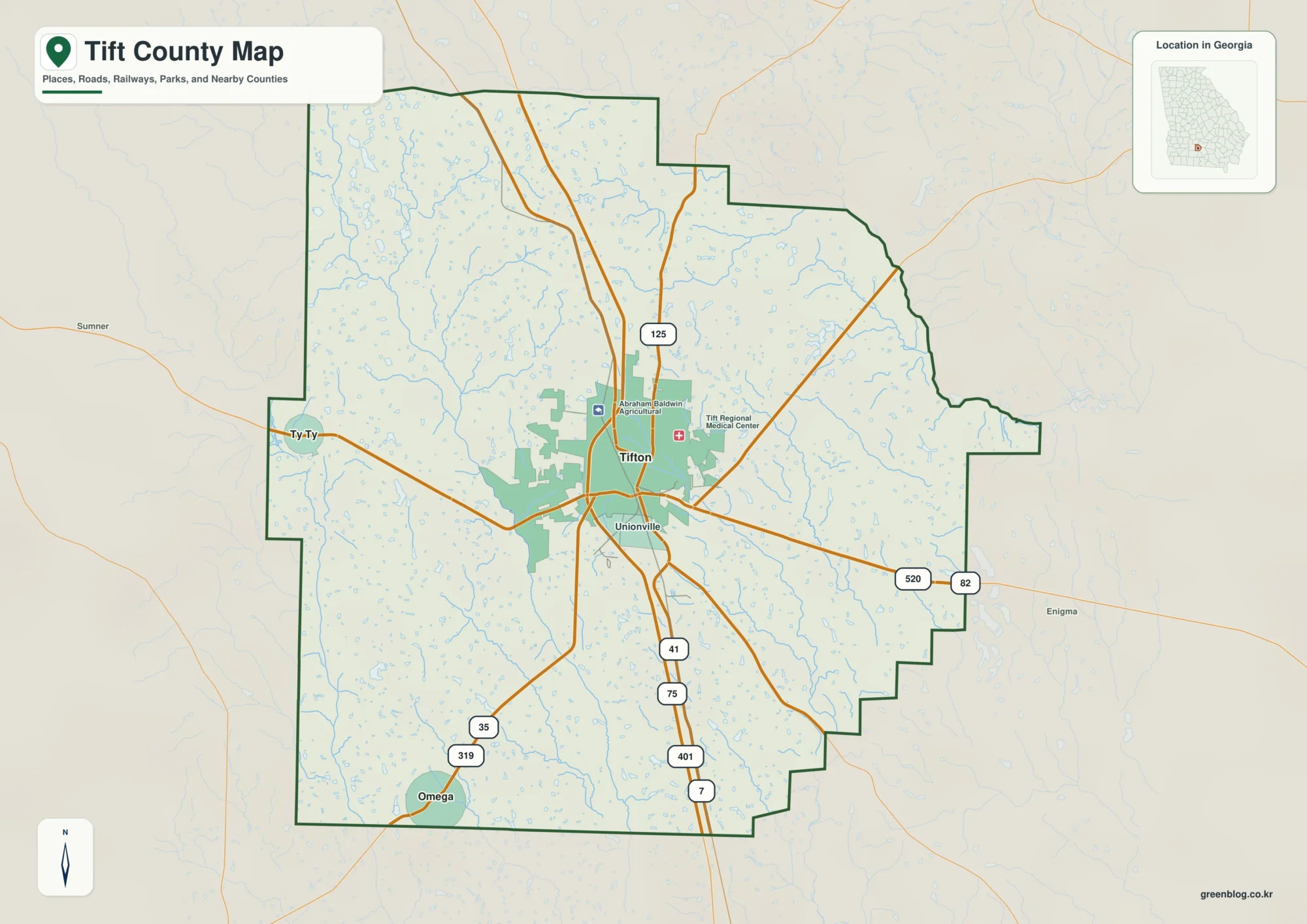
Tift County sits in south-central Georgia, where Tifton forms the clear center of the county’s road and settlement pattern. The
Tift County Map: Tifton Roads, Little River Waterways, and 69–125 m Relief Read More »