
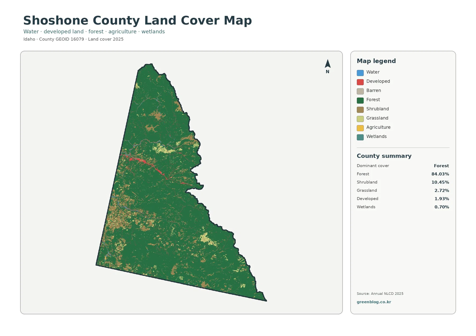
Shoshone County Idaho Land Cover Map — Forested Mountains and a Narrow Silver Valley Corridor
Forest is the defining surface on the supplied 2025 map of Shoshone County. It covers 84.03% of the county, while […]
Forest is the defining surface on the supplied 2025 map of Shoshone County. It covers 84.03% of the county, while […]