
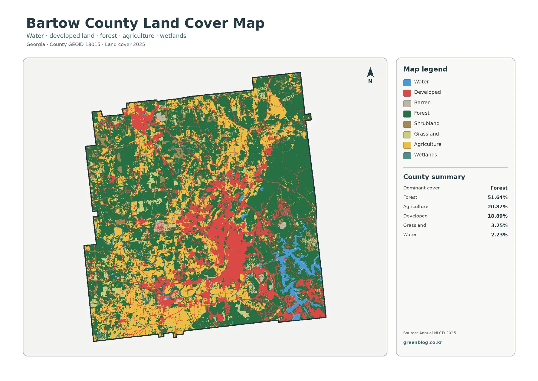
Bartow County Georgia Land Cover Map: Forested East, Cartersville Development, and Allatoona Lake
The Bartow County Georgia Land Cover Map is dominated by forest, but the county also contains two conspicuous developed concentrations […]
The Bartow County Georgia Land Cover Map is dominated by forest, but the county also contains two conspicuous developed concentrations […]
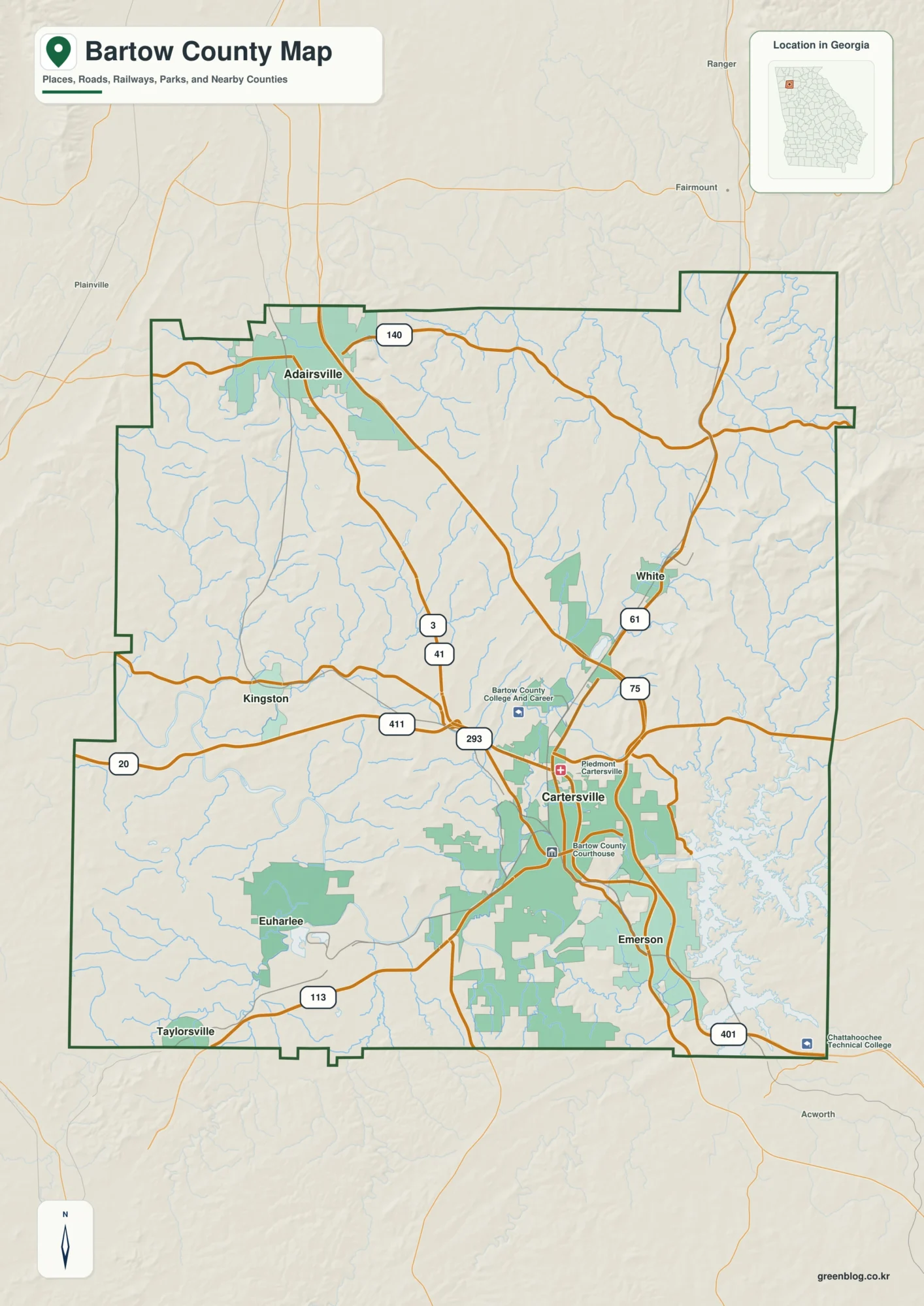
Bartow County sits northwest of Atlanta where the Cartersville area, the Interstate 75 corridor, the Etowah River, Lake Allatoona, and
Bartow County Map – Cartersville Roads, Etowah Waterways and Eastern Ridges Read More »