
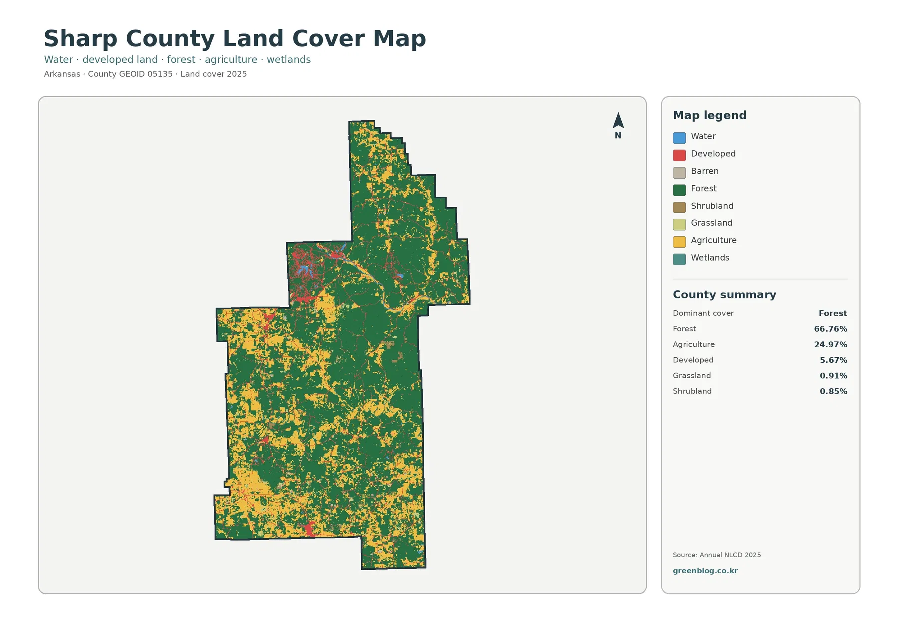
Sharp County Arkansas Land Cover Map | Ash Flat–Cherokee Village Development in a 66.76% Forest County
Sharp County’s 2025 map combines a strong forest majority with a substantial open-rural component. Forest covers 66.76%, agriculture 24.97%, and […]