
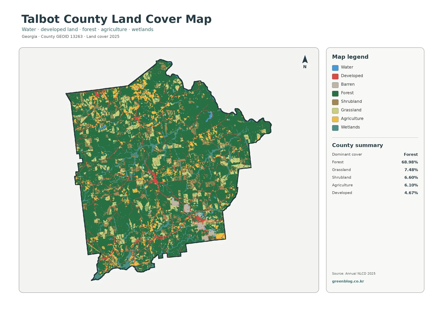
Talbot County Georgia Land Cover Map — 68.98% Forest with Only 0.82% Mean Impervious Surface
Forest is the defining 2025 surface pattern in Talbot County, covering 68.98% of the mapped area. Grassland accounts for 7.48%, […]
Forest is the defining 2025 surface pattern in Talbot County, covering 68.98% of the mapped area. Grassland accounts for 7.48%, […]
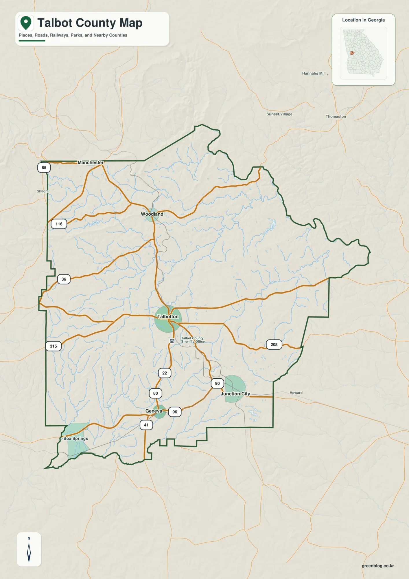
You can download four high-resolution A3 JPG maps of Talbot County in one ZIP from this page. The set covers
Talbotton Roads, Creek Valleys, and High Ground | Talbot County Georgia Map Read More »