
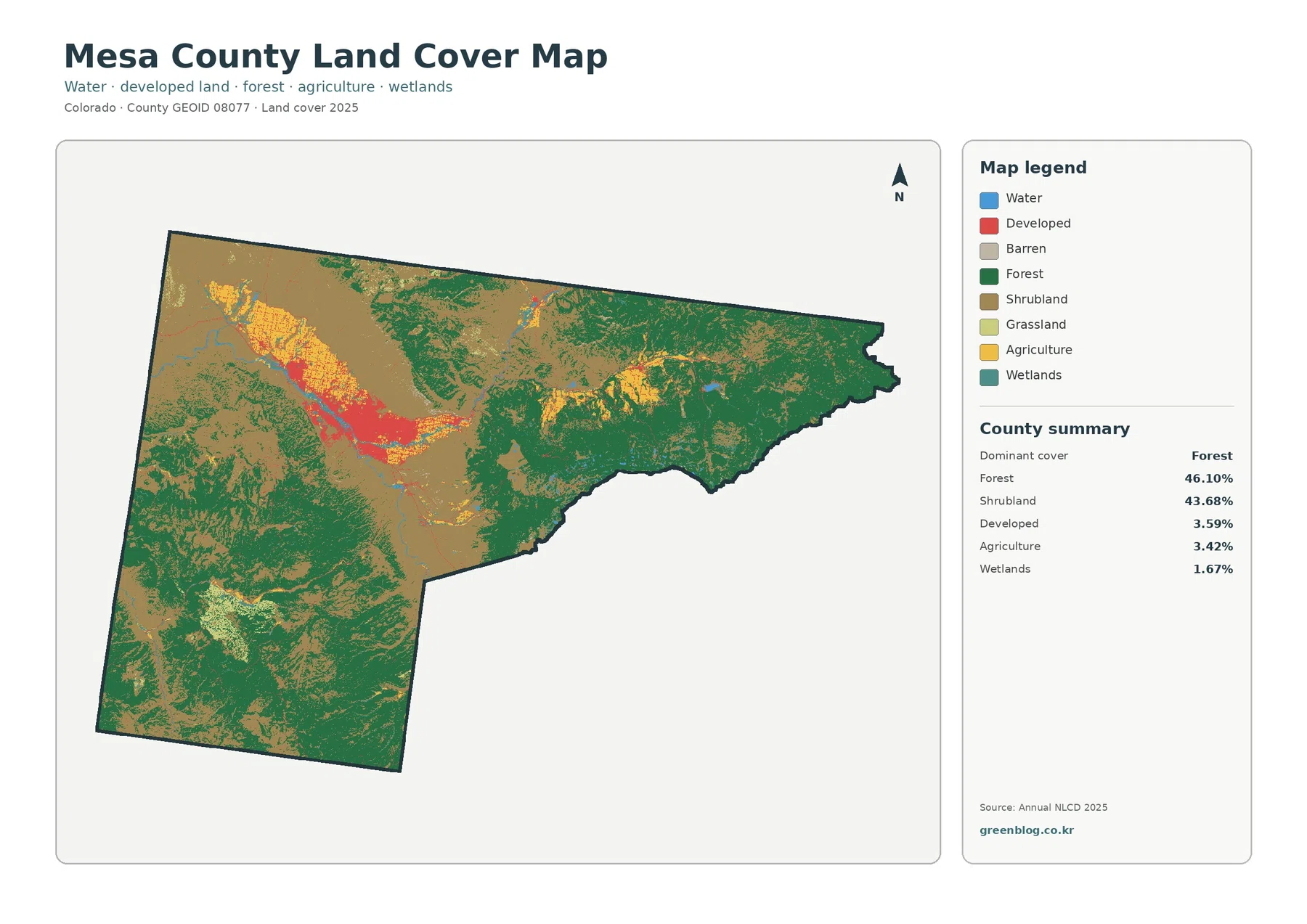
Mesa County Colorado Land Cover Map — Grand Valley Farms Between Shrublands and Forested Uplands
Mesa County has one of the more varied land-cover patterns in western Colorado. Forest accounts for 46.10 percent of the […]
Mesa County has one of the more varied land-cover patterns in western Colorado. Forest accounts for 46.10 percent of the […]