
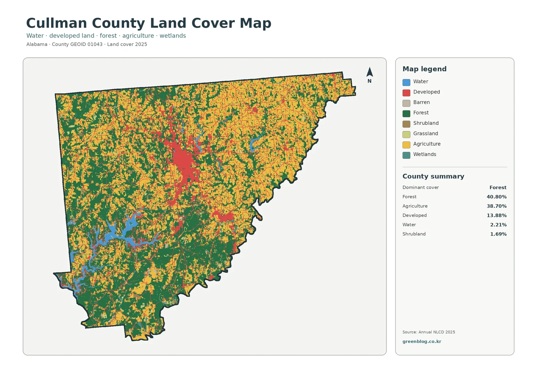
Cullman County Alabama Land Cover Map — Forest-Farm Balance, Smith Lake and Central Development
Cullman County’s 2025 land-cover pattern is unusual in one important way: forest and agriculture are almost evenly matched. Forest accounts […]
Cullman County’s 2025 land-cover pattern is unusual in one important way: forest and agriculture are almost evenly matched. Forest accounts […]
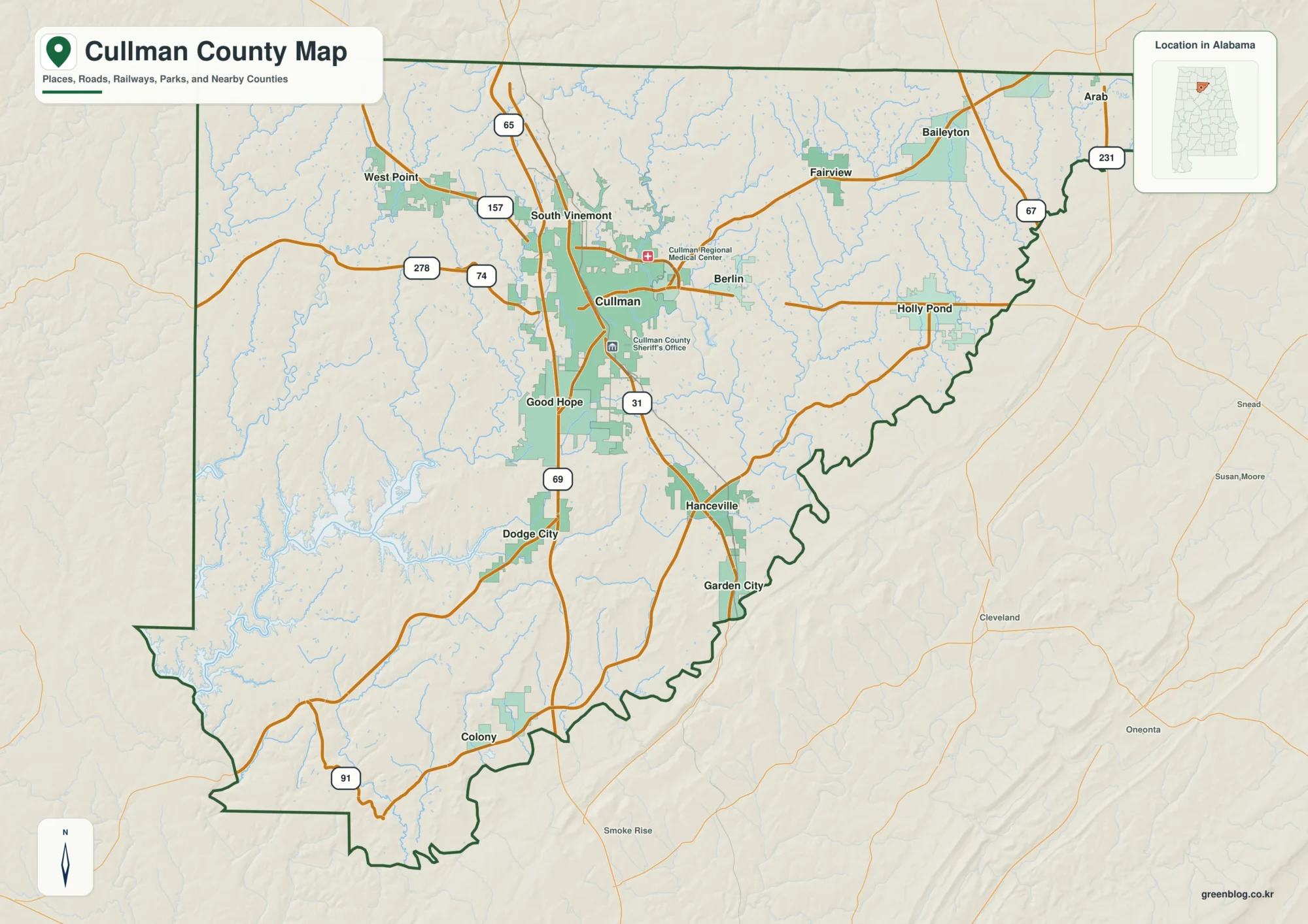
Cullman County sits in north-central Alabama, where the I-65 corridor around Cullman, Good Hope, and Hanceville contrasts with the winding
Cullman County Map – I-65 Corridor, Lewis Smith Lake, Waterways and Elevation Read More »